Tercero River
The Tercero River (Spanish, Río Tercero,[1] "third river"), also known as Ctalamochita, is the river of the Córdoba Province in Argentina with the most important water flow, 27.17 cubic metres per second (959 cu ft/s). It starts near the Calamuchita Valley, becomes navigable for boats of small to medium sizes as it flows through the plains, and flows 307 kilometres (191 mi) before reaching the Carcarañá River.
It has its origin near the Champaquí hill, in an area of annual precipitation of between 600 and 1,000 millimetres (24 and 39 in), near the Calamuchita Valley. Leaving the valley, it reaches the plains where four dams there have been constructed, called Cerro Pelado Dam, Arroyo Corto Dam, Embalse Río Tercero—with 54.3 square kilometres (21.0 sq mi) built in 1936—and Piedras Moras, which serve as flow regulators, and hydroelectricity production. But the lakes of the dams are also used for tourism and recreation; water sports and fishing.
The river the incursions into the wet Pampas area, which has an average rainfall of 730 millimetres (29 in) per year. It joins the Saladillo River (also called the Cuarto River) to form the Carcarañá River, a tributary of the Paraná River.
Among the most important cities on the path of the Tercero are Río Tercero, Villa María, Villa Nueva, Bell Ville and Leones.
The word Ctalamochita (from which the term Calamuchita derives) seems to be a mixture of the Native American term ctala or tala, meaning "important tree", and a deformation of the Spanish mucho or muchito, finally meaning "area of many trees". The name Tercero became more common since the 18th century, being the third of five rivers counting from Córdoba city. Of them, the Tercero and the Cuarto (fourth) are the only ones to reach, indirectly, the Paraná River, being therefore tributaries to the Río de la Plata Basin.
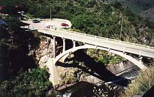
Bridges
The river has the following bridges from Piedras Moras dum to the Carcarañá River:
- Piedras Moras Dum Bridge (in Almafuerte).
- 6th State Road Bridge (in Rio Tercero).
- East Bridge (in Rio Tercero).
- Los Potreros Bridge (in the countryside 32° 9'3.98"S 64° 1'38.86"O).
- West Bridge (in Villa Ascasubi).
- East Bridge (in Villa Asasubi).
- 10th State Road Bridge (in Pampayasta).
- Andinian Bridge (in Villa Maria).
- Velez Sarsfield Bridge (in Villa Maria - Villa Nueva).
- 4th State Road Bridge (in Villa Maria - Villa Nueva).
- Black Bridge (in Villa Maria - Villa Nueva).
- 2nd State Road Bridge (in Villa Nueva).
- Carcano Bridge (in Ramon J. Carcano).
- Ballesteros Bridge (in Ballesteros).
- Morrison Bridge (in Morrison).
- Paso de la Arena Pedestrian Bridge (in Bell Ville).
- Colon Bridge (in Bell Ville).
- Bus Station Pedestrian Bridge (in Bell Ville).
- Italia Bridge (in Bell Ville).
- Colombia Pedestrian Bridge (in Bell Ville).
- Falcato Pedestrian Bridge (in Bell Ville).
- Bridge of he History (in Bell Ville).
- Monte Leña Bridge (in Monte Leña).
- San Marcos West Bridge (in the countryside 32°39'32.94"S 62°31'31.22"O).
- San Marcos East Bridge (in the countryside 32°41'51.42"S 62°28'54.82"O).
See also
Coordinates: 32°54′54″S 62°19′29″W / 32.91500°S 62.32472°W[2]
References
- ↑ Río Tercero at GEOnet Names Server
- ↑ GNS coordinates adjusted using Google Maps, and GeoLocator