Temple, Oklahoma
| Temple, Oklahoma | |
|---|---|
| Town | |
 Location of Temple, Oklahoma | |
| Coordinates: 34°16′16″N 98°14′5″W / 34.27111°N 98.23472°WCoordinates: 34°16′16″N 98°14′5″W / 34.27111°N 98.23472°W | |
| Country | United States |
| State | Oklahoma |
| County | Cotton |
| Area | |
| • Total | 1.3 sq mi (3.4 km2) |
| • Land | 1.3 sq mi (3.4 km2) |
| • Water | 0.0 sq mi (0.0 km2) |
| Elevation | 1,007 ft (307 m) |
| Population (2010) | |
| • Total | 1,102 |
| • Density | 876.8/sq mi (338.5/km2) |
| Time zone | Central (CST) (UTC-6) |
| • Summer (DST) | CDT (UTC-5) |
| ZIP code | 73568 |
| Area code(s) | 580 |
| FIPS code | 40-72750[1] |
| GNIS feature ID | 1098797[2] |
Temple is a town in Cotton County, Oklahoma, United States. It is 5 miles (8.0 km) south and 5 miles (8.0 km) east of Walters, the county seat. The population was 1,102 at the 2010 census, a decline of 12.6 percent from 1,146 at the 2000 census.[3] The town is named for the celebrated trial lawyer of Texas and Oklahoma Territory, Temple Lea Houston (1860–1905), the youngest son of General Sam Houston.[4]
Geography
Temple is located at 34°16′16″N 98°14′5″W / 34.27111°N 98.23472°W (34.271175, -98.234785).[5]
According to the United States Census Bureau, the town has a total area of 1.3 square miles (3.4 km2), all of it land.
Demographics
| Historical population | |||
|---|---|---|---|
| Census | Pop. | %± | |
| 1910 | 852 | — | |
| 1920 | 906 | 6.3% | |
| 1930 | 1,182 | 30.5% | |
| 1940 | 1,313 | 11.1% | |
| 1950 | 1,442 | 9.8% | |
| 1960 | 1,282 | −11.1% | |
| 1970 | 1,354 | 5.6% | |
| 1980 | 1,339 | −1.1% | |
| 1990 | 1,223 | −8.7% | |
| 2000 | 1,146 | −6.3% | |
| 2010 | 1,002 | −12.6% | |
| Est. 2015 | 969 | [6] | −3.3% |
As of the census[1] of 2000, there were 1,146 people, 488 households, and 301 families residing in the town. The population density was 876.8 people per square mile (337.8/km²). There were 604 housing units at an average density of 462.1 per square mile (178.0/km²). The racial makeup of the town was 75.65% White, 11.34% African American, 4.89% Native American, 0.17% Asian, 4.71% from other races, and 3.23% from two or more races. Hispanic or Latino of any race were 7.24% of the population.
There were 488 households out of which 27.3% had children under the age of 18 living with them, 46.1% were married couples living together, 12.9% had a female householder with no husband present, and 38.3% were non-families. 34.4% of all households were made up of individuals and 18.2% had someone living alone who was 65 years of age or older. The average household size was 2.27 and the average family size was 2.93.
In the town the population was spread out with 24.3% under the age of 18, 7.9% from 18 to 24, 24.2% from 25 to 44, 21.2% from 45 to 64, and 22.5% who were 65 years of age or older. The median age was 40 years. For every 100 females there were 91.0 males. For every 100 females age 18 and over, there were 84.7 males.
The median income for a household in the town was $18,864, and the median income for a family was $24,688. Males had a median income of $26,806 versus $17,708 for females. The per capita income for the town was $12,448. About 22.8% of families and 29.5% of the population were below the poverty line, including 43.3% of those under age 18 and 20.0% of those age 65 or over.
Notable residents
- LaDonna Harris (born 1931), Comanche political activist, birthplace
- Pepper Martin (1904—1965), Major League baseball player, birthplace[4]
References
- 1 2 "American FactFinder". United States Census Bureau. Retrieved 2008-01-31.
- ↑ "US Board on Geographic Names". United States Geological Survey. 2007-10-25. Retrieved 2008-01-31.
- ↑ CensusViewer:Temple, Oklahoma Population
- 1 2 Powell, Harold W. Encyclopedia of Oklahoma History and Culture. "Temple." Retrieved October 7, 2012.
- ↑ "US Gazetteer files: 2010, 2000, and 1990". United States Census Bureau. 2011-02-12. Retrieved 2011-04-23.
- ↑ "Annual Estimates of the Resident Population for Incorporated Places: April 1, 2010 to July 1, 2015". Retrieved July 2, 2016.
- ↑ "Census of Population and Housing". Census.gov. Retrieved June 4, 2015.
Municipalities and communities of Cotton County, Oklahoma, United States | ||
|---|---|---|
| City | 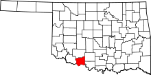 | |
| Towns | ||
| Unincorporated communities | ||