Tema
| Tema | ||
|---|---|---|
| City | ||
|
First-Left picture: Cargo ships with Intermodal containers being loaded in the Industrial Tema Harbour • First-Top right picture: Petroleum Processing and Refining Plant and Natural-Gas Processing Plant in Tema • Second-Bottom right picture: Valco Roundabout of State-owned Aluminium Corporation Valco (Volta Aluminum Company) in Tema. | ||
| ||
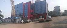
 Tema Location of Tema in Greater Accra Region, South Ghana | ||
| Coordinates: 5°40′N 0°0′W / 5.667°N -0.000°E | ||
| Country |
| |
| Admin. Region | Greater Accra Region | |
| District | Tema Metropolitan District | |
| Government | ||
| • Mayor | Isaac Ashai Odamtten | |
| Elevation | 1 m (3 ft) | |
| Population (2013) | ||
| • Total | 161,612[1] | |
| Time zone | GMT (UTC0) | |
| • Summer (DST) | GMT (UTC) | |
| Area code(s) | +233 (0) 30 3 plus 6 digit number | |

Tema is a city on the Bight of Benin and Atlantic coast of Ghana. It is located 25 kilometres (16 mi) east of the capital city; Accra, in the region of Greater Accra, and is the capital of the Tema Metropolitan District. As of 2013, Tema is the eleventh most populous settlement in Ghana, with a population of approximately 161,612 people – a marked decrease from its 2005 figure of 209,000.[2] The Greenwich Meridian (00 Longitude) passes directly through the city.[3] Tema is locally nicknamed the "Harbour Town" because of its status as Ghana's largest seaport.
Tema is a city constructed on the site of a small fishing village. Tema was commissioned by Ghana's first president, Kwame Nkrumah, and grew rapidly after the construction of a large harbour in 1961. It is now a major trading centre, home to an oil refinery and numerous factories, and is linked to Accra by a highway and railway. Tema is one of Ghana's two deep seaports, the other being Sekondi-Takoradi.[3] Tema became an Autonomous Council in 1974 and was elevated to the status of a Metropolitan Assembly in December 1990. Tema metropolitan forms part of the sixteen (16) Metropolis, Municipalities and Districts in the Greater Accra Region. The Metropolitan shares boundaries with Ashaiman Municipal, Adentan Municipal, and ledzokuku Krowor Municipal to the west respectively, to the east with Kpone Katamanso District, to the North with Dangme West District and to the South with the Gulf of Guinea.
History
Before the independence, the government identified a small fishing village called Torman as the site for an ultra modern seaport for the new Ghana. Torman residents also grew the calabash plant (gourd), known as Tor in the local language, hence the name of the village Tor-man (gourd-land) which was corrupted to TEMA.
In 1952, the government acquired 166 square kilometres (64 sq mi) of land north of the harbour, and entrusted it to the Tema Development Corporation. The "New Town" that was subsequently built on the site was planned as an industrial and residential complex. The villagers of Torman were ejected to make way for the project, and migrated to a new fishing ground around 3 kilometres (1.9 mi) away.[4]
The main Tema Township was constructed, and the Tema Harbour officially opened, in 1962. Over the following decades, Tema grew into the industrial hub of Ghana, with a carefully constructed road layout featuring landscaping and street lights. It boasted modern recreational centres and other social amenities rare among African cities at the time.[4] President Nkrumah appointed Mr. Theophilus Asiaw Mills as the first District Commissioner.
The chiefs and people of Tema Manhean have finally made a historical return to their ancestral home at the frontage of the dilapidated Meridian Hotel building for the first time in 55 years, after they were relocated to their present home at Tema Manhean.
Fifty-five years ago, the government of Osagyefo Dr. Kwame Nkrumah, Ghana's first President, in an attempt to develop the Tema into a modern port city, and also to create an industrial city, forcefully relocated the Tema people from their original place of abode to the present Tema Manhean.
A large population influx began in the 1960s owing to the town's employment opportunities; but the Tema Development Corporation was unable to construct housing and provide other services to meet the needs of the migrants.[5] The Tema Newtown district was overwhelmed by the sudden population growth, and became the poor cousin of Tema Township, receiving none of the latter's improved housing, geometrically laid roads, or social amenities. Moreover, royalties paid by Tema Newtown's companies to evicted villagers have not been used due to a chieftain dispute. The area's fishing potential was thus not fully exploited.[4]
The importance of Tema as a port and industrial hub is reflected by the fact that the Ghana Police Service maintains a special policing region devoted entirely to the city.[4]
Climate
Tema is characterised by a dry equatorial climate. It lies in the driest part of southern Ghana, experiencing average annual rainfall of about 750 millimetres (30 in). Average temperatures are high year-round, often exceeding 30° Celsius.[3]
| Climate data for Tema | |||||||||||||
|---|---|---|---|---|---|---|---|---|---|---|---|---|---|
| Month | Jan | Feb | Mar | Apr | May | Jun | Jul | Aug | Sep | Oct | Nov | Dec | Year |
| Average high °C (°F) | 32 (89) |
32 (90) |
32 (90) |
33 (91) |
32 (90) |
30 (86) |
28 (82) |
28 (83) |
29 (85) |
30 (86) |
32 (89) |
33 (91) |
33 (91) |
| Average low °C (°F) | 23 (73) |
24 (75) |
24 (76) |
26 (78) |
25 (77) |
24 (75) |
23 (73) |
23 (74) |
24 (75) |
23 (73) |
23 (73) |
24 (76) |
23 (73) |
| Average precipitation mm (inches) | 8 (0.3) |
25 (1.0) |
25 (1.0) |
127 (5.0) |
127 (5.0) |
152 (6.0) |
76 (3.0) |
25 (1.0) |
76 (3.0) |
76 (3.0) |
25 (1.0) |
8 (0.3) |
752 (29.6) |
| Source: Myweather2.com[6] | |||||||||||||
Economy
Industry
The town's chief industrial products include aluminium, steel, processed fish, refined petroleum, textile, chemicals, food products, and cement.[2] Major companies operating in Tema include Volta Aluminium (VALCO), Tema Oil Refinery (TOR), Nestlé Ghana Ltd., Wahome Steel Ltd, Tema Shipyard.[7] There is also a Free zone enclave in Tema.
Seaport

Tema Port, which was opened in 1962, is the biggest of the two seaports in Ghana. It has a water-enclosed area of 1.7 square kilometres (0.66 sq mi) and a total land area of 3.9 square kilometres (1.5 sq mi). Apart from handling Ghanaian imports and exports, it is also a traffic junction, dealing with transit cargo destined for the landlocked countries of Burkina Faso, Mali and Niger. The port of Tema handles 80% of Ghana's import and export cargo, including the country's chief export, cacao.
The port has 5 kilometres (3.1 mi) of breakwaters, 12 deepwater berths, an outsize oil tanker berth, a dockyard, warehouses, and transit sheds. The port has open and covered areas for the storage of cargo, including a 77,200-m² (7.72-hectare) paved area for the storage of containers, steel products and other conventional cargo. The port's container yard is capable of holding over 8,000 TEUs at any given time. The closed storage area, which is about 25,049 m² (2.51 hectares) in area, consists of six sheds with a total storage capacity of 50,000 tonnes of cargo. The port also includes a 100,000-dwt dry dock and slipway facility.[8] The harbour is operated by the Ghana Ports and Harbours Authority.
Fishing harbour
Ghana has a long history of fishing. The Tema fishing harbour is at the eastern end of the town's commercial harbour. It comprises the Inner Fishing Harbour, the Canoe Basin, the Outer Fishing Harbour, and a commercial area with marketing and cold storage facilities.[5]
The Inner Fishing Harbour was constructed along the Tema Main Port in 1962 to provide a handling facility for semi-industrial and industrial fishing vessels, and to encourage the development of the local fishing industry. In 1965, the Outer Fishing Harbour was constructed for bigger industrial vessels such as trawlers, tuna vessels, and deep-sea carriers.[5] The trawlers operating in the area are 30–45 m long and are able to land 55–65 tonnes of fish (usually redfish and club and scad mackerel) per fishing trip. The tuna vessels range from smaller boats around 45–50 m in length, able to land 200–250 tonnes of catch, to larger versions with a length of 50–65 m and the ability to land up to 650 tonnes per fishing trip.[5] The largest fishing vessels, the deep-sea carriers (with lengths of 90–105 m), are mostly chartered vessels.[5] Since 1984, the national catch has averaged about 200,000 to 300,000 metric tonnes per annum. Ghana's tuna catch has maintained a stable level of 30,000 tonnes per annum since 1981.[5]
The Canoe Basin caters for the artisanal fishermen. The basin is normally occupied by about 400 canoes. These are mainly two types: wooden vessels, locally called "Legelege", and metallic vessels. The wooden canoes have lengths over all (LOA) ranging between 30–70 m, mainly owned and operated by indigenous Ghanaians.[8] Their operations peak during the months of June–September. Main catches during this period are herrings and salmon. Artisanal canoe fishing is responsible for about 70% of the catch.[8]
Education
SOS Hermann Gmeiner International College (SOS-HGIC), a private mixed boarding school catering to the 10th to 13th grades, is located in Tema. It uses the International General Certificate of Secondary Education (IGCSE) for the 10th and 11th grades and the International Baccalaureate (IB) for the 12th and 13th grades. The school was headed by Margaret Nkrumah for over 15 years, and is now headed by Titi Ofei. Tema also has an international school, Tema International School (TIS), and a senior high school, Tema Secondary School (TSS), which was built in 22 September 1961. Tema has a number of public Secondary schools such as Chemu Senior High School in Community 4, Tema Methodist Day School, Mahean Senior High School, Our Lady of Mercy Senior High School,Tema Technical Institute and Tema Secondary School (Temasco). Private Preparatory Schools like Creator Schools, St Paul Methodist Primary and JHS, Marbs Preparatory School, Datus School Complex, Deks Educational Institute, Angel School Complex, Naylor SDA School, Tema Christian Centre, Tema Parents Association, First Baptist School, Tema Regular Baptist School, Queen Esther School, Dorsons School, Adwen Memorial, Creator Montessori, New Covenant School, St Alban's School, Lorenz Wolf School, Bexhill School Complex, Life International School, Mazon Grace Academy, Santabarbera School, First Star Academy, Pentecost School, Star School Complex, Tema Ridge, St John Bosco School and Rosharon School. Public primary and JHSs exist in Tema. Twedaase Primary School, Star School, Aggrey Road School, Republic Road School, Padmore School, Mantedii School among others.
Twin cities
| Country | City | County / District / Region / State | Date | |||
|---|---|---|---|---|---|---|
| |
United Kingdom | Greenwich | |
Greater London | 1990 | |
| |
United States | |
San Diego | |
California | 1976 |
| |
United States | Roanoke | |
Virginia | 2010 | |
| |
United States | |
Columbia | |
Maryland | 2013 |
Coordinates: 5°40′N 0°0′W / 5.667°N -0.000°E
References
- ↑ "Ghana: Die wichtigsten Orte mit Statistiken zu ihrer Bevölkerung" (in German). World Gazetteer. 2012. Retrieved 9 March 2013.
- 1 2 Tema. GhanaWeb.com. Retrieved 9 March 2013.
- 1 2 3 Greater Accra » Tema Metropolitan. GhanaDistricts.com. Retrieved 9 March 2013.
- 1 2 3 4 "Poverty In The Mist of Riches". GhanaWeb.com. Retrieved 9 March 2013.
- 1 2 3 4 5 6 Tema. OT Africa Line. Retrieved 9 March 2013.
- ↑ "Tema Weather Averages". Myweather2. 2013. Retrieved 20 June 2013.
- ↑ "P.S.C. Tema Shipyard Ltd.". ghanaweb.com. Retrieved 15 July 2013.
- 1 2 3 Tema. Ghana Ports and Harbours Authority. Retrieved 9 March 2013.
External links
| Wikimedia Commons has media related to Tema. |