Television Infrared Observation Satellite


TIROS, or Television Infrared Observation Satellite, is a series of early weather satellites launched by the United States, beginning with TIROS-1 in 1960. TIROS was the first satellite that was capable of remote sensing of the Earth, enabling scientists to view the Earth from a new perspective: space.[1] The program, promoted by Harry Wexler, proved the usefulness of satellite weather observation, at a time when military reconnaissance satellites were secretly in development or use. TIROS demonstrated at that time that "the key to genius is often simplicity".[2]
The 270 lb (122 Kg) satellite was launched into a nearly circular low earth orbit by a Thor Able rocket. Drum-shaped with a 42 inch (1.1 m) diameter, and height of 19 inches (48 cm), the TIROS satellite carried two six-inch (15 cm) long television cameras. One of the cameras had a wide-angle lens with an f /1.6 aperture that could view an 800-mile-wide area of the Earth. The other camera had a telephoto lens with an f /1.8 aperture and 10- to 12-power magnification compared to the wide angle camera.
The satellite itself was stabilized in its orbit by spinning like a gyroscope. When it first separated from the rocket's third stage, it was spinning at about 136 revolutions per minute (rpm). To take unblurred photographs, a de-spin mechanism slowed the satellite down to 12 rpm after the orbit was accomplished.
The camera shutters made possible the series of still pictures which were stored and transmitted back to earth via 2-watt FM transmitters as the satellite approached one of its ground command points. After transmission, the tape was erased or cleaned and readied for more recording.
Series
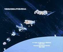
TIROS continued as the ESSA TIROS Operational System, and was eventually succeeded by the NOAA ITOS (Improved TIROS Operational System), or TIROS-M, and then by the TIROS-N and Advanced TIROS-N series of satellites. The naming of the satellite can become confusing because the satellites share the same name as the over-seeing organization, such as ESSA & ESSA 1 and NOAA & NOAA M. NOAA-N Prime is the last in the TIROS series of NOAA satellites that observe Earth’s weather and the environment.[3]
Participants in this satellite project included the US National Aeronautics and Space Administration, United States Army Signal Research and Development Lab, Radio Corporation of America, the United States Weather Bureau, and the United States Naval Photographic Interpretation Center.[4]
- TIROS-1 (A): launched April 1, 1960, suffered electrical system failure on June 15, 1960
- TIROS-2 (B): launched November 23, 1960, failed January 22, 1961
- TIROS-3 (C): launched July 12, 1961, deactivated February 28, 1962
- TIROS-4 (D): launched February 8, 1962, failed on June 30, 1962 (both cameras failed earlier)
- TIROS-5 (E): launched June 19, 1962, failed on May 13, 1963
- TIROS-6 (F): launched September 18, 1962, failed October 21, 1963
- TIROS-7 (G): launched June 19, 1963, deactivated June 3, 1968
- TIROS-8 (H): launched December 21, 1963, deactivated July 1, 1967
- TIROS-9 (I): launched January 22, 1965, failed February 15, 1967. First Tiros satellite in near-polar orbit
- TIROS-10 (OT-1): launched July 2, 1965, deactivated July 31, 1966
As of June 2009, all TIROS satellites launched between 1960 and 1965 (with the exception of TIROS-7) were still in orbit.[5]
TIROS Operational System
- ESSA-1 (OT-3)
- ESSA-2 (OT-2)
- ESSA-3 (TOS-A)
- ESSA-4 (TOS-B)
- ESSA-5 (TOS-C)
- ESSA-6 (TOS-D)
- ESSA-7 (TOS-E)
- ESSA-8 (TOS-F)
- ESSA-9 (TOS-G)
ITOS/TIROS-M
- TIROS-M (ITOS-1): January 23, 1970 launch
- NOAA-1 (ITOS-A): December 11, 1970 launch
- ITOS-B October 21, 1971 launch; unusable orbit
- ITOS-C
- NOAA-2 (ITOS-D): October 15, 1972 launch
- ITOS-E July 16, 1973 launch, failed to orbit
- NOAA-3 (ITOS-F): November 6, 1973 launch
- NOAA-4 (ITOS-G): November 15, 1974 launch
- NOAA-5 (ITOS-H): July 29, 1976 launch
TIROS-N

- TIROS-N (Proto-flight)
- Launched 13 October 1978 into a 470-nmi orbit; deactivated on 27 February 1981.[6]
- NOAA-6 (NOAA-A prior to launch)
- Launched 27 June 1979 into a 450-nmi orbit. The HIRS, a primary mission sensor, failed 19 September 1983. The satellite exceeded its two-year designed lifetime by almost six years when deactivated on 31 March 1987.[6][7]
- NOAA-B
- Launched 29 May 1980. It failed to achieve a usable orbit because of a booster engine anomaly.[3]
- NOAA-7 (C)
- Launched 23 June 1981 into a 470-nmi orbit; deactivated June 1986.[6]
- NOAA-12 (D)
- Launched 14 May 1991 into a 450-nmi AM orbit, out of sequence (see below). Placed in standby mode on 14 December 1998, when NOAA-15 became operational[6] and deactivated on 10 August 2007, setting an extended lifetime record of over sixteen years.[3]
Advanced TIROS-N
The Advanced TIROS-N (ATN) spacecraft were similar to the NOAA-A through -D satellites, apart from an enlarged Equipment Support Module to allow integration of additional payloads. A change from the TIROS-N through NOAA-D spacecraft was that spare word locations in the low bit rate data system TIROS Information Processor (TIP) was used for special instruments such as the Earth Radiation Budget Satellite (ERBE) and SBUV/2. The search and rescue (SAR) system became independent, utilizing a special frequency for transmission of data to the ground.[8]
- NOAA-8 (E)
- Launched 28 March 1983 into a 450-nautical-mile (830 km; 520 mi) orbit, out of sequence (before NOAA-D) to get the first SAR system on a US satellite operational.[3] Deactivated 29 December 1985, following a thermal runaway which destroyed a battery.[7]
- NOAA-9 (F)
- Launched 12 December 1984 into 470 nmi "afternoon" orbit and was the first satellite to carry an SBUV/2 instrument. It was deactivated on 1 August 1993 but was reactivated three weeks later, after the failure of NOAA-13. The SARR transmitter failed on 18 December 1997 and the satellite was permanently deactivated on 13 February 1998.[6][7]
- NOAA-10 (G)
- Launched 17 September 1986 into a 450 nmi "morning" orbit. Placed in standby mode on 17 September 1991 (when NOAA-12 became operational)[7] and deactivated on 30 August 2001.[6]
- NOAA-11 (H)
- Launched 24 September 1988 into a 470 nmi PM orbit. Placed in standby mode in March 1995 and was reactivated in May 1997 to provide soundings after an HIRS anomaly on NOAA-12.[7] Decommissioned 16 June 2004.[9]
- NOAA-13 (I)
- Launched 9 August 1993 into a 470 nmi PM orbit; two weeks after launch the spacecraft suffered a catastrophic power system anomaly. Attempts to contact or command the spacecraft were unsuccessful.[6]
- NOAA-14 (J)
- Launched 30 December 1994 into a 470 nmi PM orbit and decommissioned 23 May 2007 after more than twelve years of operation.[9]
- NOAA-15 (K)
- Launched 13 May 1998 into a 450 nmi morning orbit and replaced NOAA-12 on 14 December 1998, as the primary AM spacecraft. Now secondary, with MetOp-B as the AM primary.[10]
- NOAA-16 (L)
- Launched 21 September 2000 into a 470-nmi afternoon orbit; replaced NOAA-14 on 19 March 2001, as the primary AM spacecraft.[6] Decommissioned on 9 June 2014 due to major spacecraft anomaly.[11]
- NOAA-17 (M)
- Launched 24 June 2002 into a 450 nmi AM orbit and decommissioned 10 April 2013.[9]
- NOAA-18 (N)
- Launched 20 May 2005 into a 470 nmi afternoon orbit and replaced NOAA-16 as the PM primary spacecraft on 30 August 2005.[11][10]
- NOAA-19 (N Prime)
- Launched 6 February 2009 into a 470 nmi afternoon orbit[12] and replaced NOAA-18 as the PM primary spacecraft on 2 June 2009.[10][13]
References
- ↑ "Space-Based Remote Sensing of the Earth: A Report to the Congress". NASA. NASA Technical Reports Server. Retrieved 4 October 2011.
- ↑ Modern Mechanix: How Tiros Photographs the World
- 1 2 3 4 "NOAA-N Prime" (PDF). NP-2008-10-056-GSFC. NASA Goddard Space Flight Center. 16 December 2008. Retrieved 8 October 2010.
- ↑ EXPLORES! (EXPloring and Learning the Operations and Resources of Environmental Satellites!)
- ↑ "U.S. Space Objects Registry". Bureau of Oceans and International Environmental and Scientific Affairs. Retrieved 2009-06-25.
- 1 2 3 4 5 6 7 8 "History of NOAA's environmental satellites". Spaceflight Now. 22 June 2002. Retrieved 7 June 2015.
- 1 2 3 4 5 NOAA-K (PDF) (Booklet), Greenbelt, Maryland: NASA Goddard Space Flight Center, 1998, p. 20, NP-1997-12-052-GSFC, retrieved 12 June 2015
- ↑ Kidwell, Katherine B., ed. (November 1998). NOAA Polar Orbiter Data User’s Guide (PDF). National Climatic Data Center, Asheville, NC: National Oceanic and Atmospheric Administration. sec. 1.1. Retrieved 14 June 2015.
- 1 2 3 "POES Decommissioned Satellites". Office of Satellite and Product Operations. NOAA. 30 September 2014. Retrieved 5 June 2015.
- 1 2 3 "POES Operational Status". Office of Satellite and Product Operations. NOAA. Retrieved 5 June 2015.
- 1 2 "NOAA retires NOAA-16 polar satellite". NOAA News Archive. 9 June 2014. Retrieved 7 June 2015.
NOAA exclusively operates afternoon polar orbit spacecraft, while its key international partner, the European Organisation for the Exploitation of Meteorological Satellites (EUMETSAT), flies mid-morning orbit spacecraft.
- ↑ Justin Ray (February 6, 2009). "History Abounds in Launch of Crucial Weather Satellite". Spaceflight Now. Retrieved 25 October 2010.
A last-of-its-kind weather observatory...
- ↑ Harrod, Emily D. (28 May 2009). "PSB - All POES, All Instruments, Switch to NOAA-19 as Operational Afternoon Satellite, 2 June 2009". Office of Satellite and Product Operations. NOAA. Retrieved 7 June 2015.
External links
| Wikimedia Commons has media related to Television Infrared Observation Satellite. |
- NASA page on TIROS
- NASA page on ESSA
- NASA page on ITOS and NOAA
- NASA page on TIROS-N
- NASA Goddard GOES POES Program - POES Home
- NOAA Office of Satellite Operations - POES
- NASA's YouTube video of TIROS-1
TIROS satellites | ||
|---|---|---|
| TIROS |  | |
| TOS | ||
| ITOS |
| |
| TIROS-N | ||
| Adv. TIROS-N | ||