Lake Teletskoye
| Lake Teletskoye Altyn-Köl | |
|---|---|
 The southern bank | |
| Location | Altai Republic |
| Coordinates | 51°31′45″N 87°42′53″E / 51.52917°N 87.71472°ECoordinates: 51°31′45″N 87°42′53″E / 51.52917°N 87.71472°E |
| Primary inflows | Chulyshman River (70 rivers and 150 temporary streams) |
| Primary outflows | Biya River |
| Basin countries | Russia |
| Max. length | 78 km (48 mi) |
| Max. width | 5 km (3.1 mi) |
| Surface area | 233 km2 (90 sq mi) |
| Average depth | 174 m (571 ft) |
| Max. depth | 325 m (1,066 ft) |
| Water volume | 40 km3 (9.6 cu mi) |
| Surface elevation | 434 m (1,424 ft) |
Lake Teletskoye (Russian: Телецкое озеро, Altay: Алтын Кӧл, Altyn-Köl, literally: "Golden Lake") is the largest lake in the Altay Mountains and the Altai Republic, Russia, and has depth up to 325 meters.[1]
Situated at a height of 434 m (1,424 ft) above the sea level, the lake is 78 km (48 mi) long and 5 km (3.1 mi) wide and lies between the mountain ridges Korbu and Al-tyntu, on the junction of the Sailughem Mountains and the Western Sayans. Its surface area is 233 km2 (90 sq mi); however, due to its considerable depth (325 m; 1,066 ft), the lake contains no less than 40 km³ (9.6 cubic miles) of fresh water. Annual water level fluctuations are estimated at some 348 sm. The lake transparency is high, with the visibility of the lake water ranging from six to fourteen meters.
About 70 rivers and 150 temporary streams flow into the lake, the largest of them, Chulyshman River, supplying more than half of the lake's water. The lake is drained through a single outlet, the Biya River, which, after its confluence with the Katun River, forms one of Siberia's largest rivers, the Ob River.
The lake is surrounded by mountains of 600-1,300 m in the northern part and about 1,700–2,400 m (5,600–7,900 ft) in the southern part. Lake Teletskoe is included into Altaisky Nature Reserve. That reserve along with the Katun Nature Reserve and the Ukok Plateau Nature Refuge were listed as one of UNESCO World Natural Heritage Sites under the name "Golden Mountains of Altai".[2]
The Altay people have a legend about the name of the lake in their language, which means Golden Lake. According to this story, once, a rich man had an ingot of gold, which he wanted to use to buy food. He travelled around Altai, but could not find anyone who would sell him any food. Eventually, he threw the gold into the lake. This legend is the origin of the name.[3]
Research
There is a field base of Institute of Taxonomy and Ecology of Animals (Russian: Институт систематики и экологии животных СО РАН) by the Siberian Division of the Russian Academy of Sciences (Russian: Сибирское отделение Российской академии наук) at the northwest part of the lake, about 6 km from head water of Biya River. Therein studies are performed of the insect-eaters and rodents of Altai Republic, helminthofauna of vertebrates in biocenoses of taiga, ichthyocenose and animal plankton of Lake Teletskoye. Near the base there is located the research-and-production sport-and-sanitary base of Gorno-Altaisk State University. Tomsk State University carries out its investigation more than 50 years. Many years here work ecologists from the Institute of Water and Ecological Problems (Russian: Институт водных и экологических проблем СО РАН) by the Siberian Division of the Russian Academy of Sciences, and also geologists and archeologists from the Academy. Geomorphologists and geologists scrutinize geological structure of Lake Teletskoye, its paleogeography, age, and origin.
It has been known for a long time that there are gold in placers and bedrock deposits in the Altay. The Geomorphologists from Tomsk State University works in the Teletskoye geology-prospecting detachment searching for gold-placers. They managed to establish a new search criterion for a placer. The base for the discovery were the palaeoglaciological studies during the last few years and theoretical models of the diluvial morpholithogenesis. The content of the precious component is everywhere much higher than the lowest accepted industrial standard, sometimes it’s tremendous.
 Altay. August 2009 |
 Fairy tale. August 2010 |
 On the rocky coast. July 2010 |
 Waterfall. August 2010 | |||
 Bonfire on the beach. August 2008 |
 Gravel on the shore. Summer 2010 |
 For aero-visual recording. July 2010 |
 Strange evening light. July 2010 | |||
 Camp on shore. August 2010 |
 The young researcher. Juli 2010 |
 Last fire. 23 August 2010 |
 Last Camp. August 2010 | |||
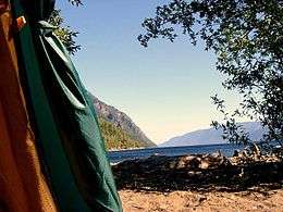 Morning. View from the tent. August 2009 |
 Taiga. August 2010 |
 Bath-house. August 2009 |
 Route across the lake. July 2008 | |||
The investigators carried out large-scale exploration routes on vast territories near watersheds of the upper reaches of all the rivers in the northern and western parts of the Teletskoye Lake basin. These explorations included studies of exposures, boring of prospect-holes, pits and hollow wells (up to 15 m deep). The results of these investigations let us speak about the regularity and reliability of the new criterion. The first 14C-method data for the layered clays on the flat watersheds showed the age of 15 thousand years and younger. This important fact leads to an unavoidable conclusion about the youth of the Teletskoje Lake depression – the post-glacial age of “the last cutting” during the pre-glacial (Late Quaternary) peneplain.
References
- Малолетко А. М. Телецкое озеро по исследованиям. 1973—1975 гг. / Изд. 2, перераб. — Томск, 2009. — 234 с.
- Николаева Н. А. Эхо песен Алтын-Кёля. Сказка. Барнаул:ООО «Принт-инфо», 2005.-128с.;1000 экз. ISBN 5-88449-130-1
- Дулькейт, Тигрий Георгиевич. Телецкое озеро в легендах и былях. 2-е изд. Бийск: НИЦ БиГПИ, 1999. — 160 с. ISBN 5-85127-167-1
- Будников А. Л., Рудой, Алексей Николаевич. Дилювий Северо-Восточного Алтая: Новые данные // «Научные чтения памяти. Селиверстов, Юрий Петрович (Селиверстовские чтения)». — СПб, 2009. — С. 399—405.
- Будников А. Л., Рудой А. Н. Новые находки ленточных глин на территории Северо-Восточного Алтая // Материалы Всероссийского совещания по изучению четвертичный период — Новосибирск, 2009. 19-23 окт. 2009. — С. 94-100.
- Будников А. Л., Рудой А. Н. Дилювиально-аккумулятивные образования Северо-Восточного Алтая: новые данные
Notes
- ↑ "Altai Reserve". altai-republic.ru. Retrieved 2007-07-31.
- ↑ "Altai - Pearl of Siberia". Retrieved 2006-11-30.
- ↑ "Altai Republic :: official portal". Retrieved 2010-01-14.
External links
![]() Media related to Lake Teletskoye at Wikimedia Commons
Media related to Lake Teletskoye at Wikimedia Commons