Tebet, South Jakarta
Tebet is a subdistrict of South Jakarta, one of the administrative cities which form the Capital Region of Jakarta, Indonesia. The boundaries of Tebet are Jend. Gatot Subroto-Letjen Haryono MT. tollway to the south, Ciliwung River to the east, Jalan Casablanca - Ciliwung River to the north, and Cideng River to the west. This subdistrict is home to SMA Negeri 8 Jakarta
Tebet is prone to flooding, especially the area around the Ciliwung River.
History
Before urban development, the area that is now Tebet were marshy land dotted with fish ponds and criss-crossing canals. The river Ciliwung present in the east side of the Subdistrict. The name Tebet itself was derived from tebat, Indonesian for "fish pond". Up until the early 1960s many fish ponds can still be found in Tebet.
In preparation for GANEFO and the 1962 Asian Games, the population residing in Senayan had to be relocated because of the compulsory land acquisition to build the Gelora Bung Karno sporting complex. Hence the planning of Tebet was started very early in the 1960s to house the dislocated people of Senayan. The administrative villages of Tebet Timur (Jakarta 12820) and Tebet Barat (Jakarta 12810) were the first area in Tebet Subdistrict to be developed.
Planning of Tebet Timur and Tebet area follows a more or less garden city principle similar with older Kebayoran residential district in southern Jakarta: hierarchical roads, parks, supporting facilities such as schools and clinics, and good water catchment area.[1] Some area in the Tebet residential area were designed as recreation park and water catchment area. One of this area was the park that is now known as Honda Park. Other parks, e.g. Rawa Bilal, has already been settled with housing that is now Jalan Tebet Mas.
By the early 1970s, Tebet residential area had already made considerable progress.[1] During the period, some streets were named to commemorate the era of Sukarno e.g. Ganefo Street, Nefo Street (after the GANEFO), Usdek Street, Berdikari Street, and Trikora Street.
Tebet Barat and Tebet Timur Administrative Villages present a well-planned urban design example which contrast the relatively unplanned kampung-like area of Kebon Baru (and Gudang Peluru, Jakarta 12830) to the east of Tebet Timur Administrative Village and Menteng Dalam (Jakarta 12870) to the west of Tebet Barat Administrative Village. Kebon Baru and Menteng Dalam Administrative VIllage grew in the 1970s with no proper planning and as a result the area was prone to flooding and filled with relatively underdeveloped slum.
Kelurahan (Administrative villages)
Tebet Subdistrict is divided into seven kelurahan or administrative villages:
- Tebet Barat - area code 12810
- Tebet Timur - area code 12820
- Kebon Baru - area code 12830
- Bukit Duri - area code 12840
- Manggarai - area code 12850
- Manggarai Selatan - area code 12860
- Menteng Dalam - area code 12870
List of important places
- Menteng Pulo Cemetery
- Cawang Railway Station (in Tebet Timur actually)
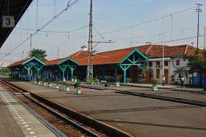
- Manggarai Railway Station, Railway Workshops and Depot
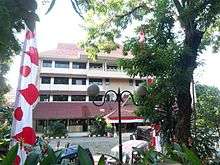
- Sahid University
- Taman Tebet or "Tebet Park"
- Tebet Railway Station
- SMPN 115 Jakarta.
References
- 1 2 Merrillees 2015, p. 23.
Cited works
| Wikimedia Commons has media related to Tebet. |
- Merrillees, Scott (2015). Jakarta: Portraits of a Capital 1950-1980. Jakarta: Equinox Publishing. ISBN 9786028397308.