Tauentzienstraße

Tauentzienstraße is a major shopping street in the western inner city of Berlin, Germany. With a length of about 500 m (1,600 ft) it runs between two important squares, Wittenbergplatz in the east and Breitscheidplatz in the west, where it is continued by the Kurfürstendamm boulevard. While the eastern half belongs to the Schöneberg district, the western part beyond Nürnberger Straße is in Charlottenburg.
History
The broad street was laid out during the 19th century Wilhelmine era in the manner of a Parisian boulevard, then part of a larger road link from Charlottenburg through Schöneberg to the Berlin district of Kreuzberg named after victorious Prussian generals (therefore colloquially called Generalszug in German). The projected section was named after Bogislav Friedrich Emanuel von Tauentzien (1760–1824) by order of King William I of Prussia, celebrating the 50th anniversary storming of the French garrison at Wittenberg under General Jean François Cornu de La Poype by the Prussian Army in 1814. Tauentzien had been in command and, although he did not personally take part in the battle, he had been vested with the title "von Wittenberg."
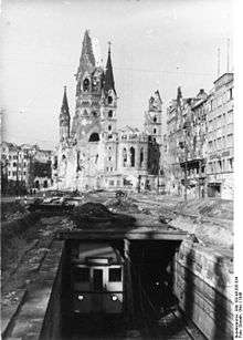
In 1902 the first Berlin U-Bahn line (Stammstrecke) was inaugurated, which ran under the Tauentzienstraße pavement (the present-day U2). Furthermore, a tramway line ran on the central strip. During the Cold War era, the street formed part of the commercial center of West Berlin, along with the nearby Kurfürstendamm. Tauentzienstraße is actually the busier of the two streets due to the concentration of shops along its length.[1]
Gallery
_Alice_Hirsch.jpg) 9 Stolpersteine at Tauentzienstraße 7, commemorating the Hirsch family and Edith Seelig
9 Stolpersteine at Tauentzienstraße 7, commemorating the Hirsch family and Edith Seelig_Fritz_Hahn.jpg) 3 Stolpersteine at Tauentzienstraße 13a, commemorating the Hahn family
3 Stolpersteine at Tauentzienstraße 13a, commemorating the Hahn family
Attractions
Midway along the street is a sculpture, entitled Berlin, that expresses the "broken" nature of the city during the Cold War.
Stores along its length include the famous Kaufhaus des Westens (KaDeWe), the largest department store in continental Europe, a Peek & Cloppenburg clothing store.
See also
References
| Wikimedia Commons has media related to Tauentzienstraße. |
- ↑ Ian Barwick (2007-10-05). "» Tauentzienstrasse - Berlin Guide in English". Germany: Berlin.barwick.de. Retrieved 2014-06-25.
Coordinates: 52°30′08″N 13°20′27″E / 52.50222°N 13.34083°E