Tanga, Tanzania
| Tanga | |
|---|---|
| City | |
|
Aerial view | |
_location_map.svg.png) Location in Tanzania (dark green) | |
| Country | Tanzania |
| Zone | Northern |
| Region | Tanga |
| Incorporated Town | 18911 |
| Incorporated City | 1 July 2005 |
| Government | |
| • Type | City Council |
| • Mayor | Omari Guledi |
| Area | |
| • Total | 536 km2 (207 sq mi) |
| Population (2012) | |
| • Total | 273,332 |
| • Density | 510/km2 (1,300/sq mi) |
| Time zone | EAT (UTC+3) |
| Postcode | 211xx |
| Area code(s) | 027 |
| Climate | Aw |
| Website |
tanga |
| 1The Germans designated Tanga into a township after taking control of the coastal area from the Sultan of Zanzibar in April 1891 | |

Tanga is both the name of the most northerly seaport city of Tanzania, and the surrounding Tanga Region. It is the Regional Headquarters of the region. With a population of 273,332 in 2012, Tanga is one of the largest cities in the country. It is a quiet city compared to, for example, Arusha or Moshi with a comparable number of inhabitants.
The city of Tanga sits on the Indian Ocean, near the border with Kenya. Major exports from the port of Tanga include sisal, coffee, tea, and cotton. Tanga is also an important railroad terminus, connecting much of the northern Tanzanian interior with the sea. Via the Tanzania Railways Corporation's Link Line and Central Line, Tanga is linked to the African Great Lakes region and the Tanzanian economic capital of Dar es Salaam. The city is served by Tanga Airport.
The harbour and surrounding is the centre of life in Tanga. It is stretched out several km² into the country. It has several markets in several neighborhoods.
History
Early History
The earliest documentation about Tanga roots from the Portuguese. A trading post was established by the Portuguese as part of their East African coastal territory and controlled the region for over 200 years between 1500-1700. The Sultanate of Oman battled the Portuguese and gained control of the settlement by mid 1700 along with Mombasa, Pemba Island and Kilwa Kisiwani.[1] The town continued to act as a Trading port for Ivory and Slaves under the sultan's rule.[2] Tanga continued to be a prosperous trading hub for slaves with the Arab world up until 1873 when the European powers abolished the slave trade.[1]
German East Africa

In the 19th Century growing interests by Europeans for the Scramble for Africa brought the Germans to Tanga. The Germans bought the coastal strip of mainland Tanzania from the Sultan of Zanzibar in 1891. This takeover designated Tanga into a township and was the first establishment in German East Africa.[3] The town became the centre of German colonial administration before the establishment of Dar es Salaam in the early 20th century. Tanga was chosen in 1889 as a military post of German East Africa, and it became a district office in 1891. The town saw rapid expansion and planned growth under the German occupation. A tram line was developed within the city to facilitate domestic transport and a port was also built to facilitate exports. In 1896 the construction of the Usambara Railway began and was extended to Moshi by 1912. Roads, bridges and the railway facilitated industrial growth in the region and many buildings and bridges that are still in operation today in the town are from the German colonial period. The local economy was based mainly on the production of sisal, which had been brought to the colony several years earlier, and population in the area grew rapidly.[4]
As the coastal town closest to British East Africa (Kenya), Tanga was on the front line at the outset of World War I. A British landing was thrown back on 4 November 1914 in the Battle of Tanga, and the town was not taken until 7 July 1916.[5] After the War, Britain gained control of Tanganyika and continued to develop the town and exploit its agriculture potential. In 1919 Tanga was the countries fourth largest city, however at independence it was the second largest city after Dar es Salaam.
Post Independence
In the early stages of Independence the Port of Tanga continued to be a gateway for the export of Sisal from the region. However, following the adopting of the Ujamaa policy agriculture in the region collapsed and the city lost its value. With the government controlling the agriculture trade and the depreciation in the world prices of Sisal the port began to lose revenue.[6]
Economy
Tanga Cement is one of the major industries.
Transport
Air connectivity
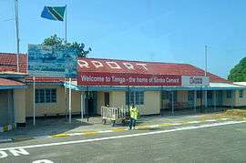
Tanga has a small airport and is currently served by only two regional airlines Auric Air and Coastal Aviation providing scheduled services to Dar es Salaam, Pemba Island and Zanzibar. In 2014 the airport served less than 30,000 passengers.[7] There are also a small number of private airstrips in the surrounding area around the city that facilitate the private estates and surrounding industries.
Road connectivity
Tanga city lies 250 km from Chalinze on the A14 highway that runs from Chalinze to Mombasa. The Town is also 75 km away from Segera which is a junction linking the A14 and the B1. The B1 highway is a bypass that links Moshi and the northern corridor to Tanga.[8]
Port of Tanga
The port is historically the oldest operating harbour in the nation and its roots date back to around the 6th century.[9] The Port of Tanga is the second largest port in Tanzania and is a vital part to the city's initial development and economy. The port operates at 90% of its installed capacity and its main cargo is coal for the cement industry and is a new gate way for crude oil products.[10] The Ports authority has major plans to upgrade the port increase capacity and provide an alternative route for cargo flowing into the country.[11]
Geography
Climate
Due to close proximity to the equator and the warm Indian Ocean, the city experiences tropical climatic conditions similar to all Tanzanian coastal cities.The city experiences hot and humid weather throughout much of the year and has a tropical wet and dry climate (Köppen: Aw). Annual rainfall is approximately 1,290 mm (51 in), and in a normal year there are two rainy seasons: "the long rains" in April and May and "the short rains" in November and December.[12]
| Climate data for Tanga | |||||||||||||
|---|---|---|---|---|---|---|---|---|---|---|---|---|---|
| Month | Jan | Feb | Mar | Apr | May | Jun | Jul | Aug | Sep | Oct | Nov | Dec | Year |
| Average high °C (°F) | 32.3 (90.1) |
33.0 (91.4) |
33.3 (91.9) |
31.1 (88) |
29.7 (85.5) |
29.3 (84.7) |
28.5 (83.3) |
28.6 (83.5) |
29.2 (84.6) |
30.2 (86.4) |
31.2 (88.2) |
32.2 (90) |
30.72 (87.3) |
| Daily mean °C (°F) | 27.8 (82) |
28.2 (82.8) |
28.4 (83.1) |
27.1 (80.8) |
26.0 (78.8) |
25.1 (77.2) |
24.3 (75.7) |
24.2 (75.6) |
24.6 (76.3) |
25.6 (78.1) |
26.8 (80.2) |
27.7 (81.9) |
26.32 (79.38) |
| Average low °C (°F) | 23.4 (74.1) |
23.4 (74.1) |
23.6 (74.5) |
23.2 (73.8) |
22.3 (72.1) |
20.9 (69.6) |
20.1 (68.2) |
19.8 (67.6) |
20.1 (68.2) |
21.1 (70) |
22.4 (72.3) |
23.2 (73.8) |
21.96 (71.52) |
| Average precipitation mm (inches) | 30 (1.18) |
27 (1.06) |
98 (3.86) |
225 (8.86) |
294 (11.57) |
84 (3.31) |
69 (2.72) |
63 (2.48) |
78 (3.07) |
106 (4.17) |
140 (5.51) |
76 (2.99) |
1,290 (50.78) |
| Source: [12] | |||||||||||||
Healthcare
Tanga area medical institutions include:
- Bombo Regional Hospital
- National Institute of Medical Research Centre, Tanga
- Amani Biomedical Research Laboratory
- Tanga AIDS Working Group
Tourist sites
Nearby tourist attractions include Amboni Caves, Galanos hot springs, Saadani national park, Toten Island, URITHI Tanga Museum, Tanga War Graves and Memorials, Tongoni Ruins, Ndumi Village defense works, Mwarongo sand beaches and protected coastal mangroves.
Sport
Tanga is represented in the Tanzanian Premier League by football clubs Coastal Union and JKT Mgambo.and African Sports African Sports(Wana Kimanumanu) from 2015-2016 season.
Twin cities
 Eckernförde, Germany (since 1963)
 Kemi, Finland (since 2007)
 Tifariti, Sahrawi Arab Democratic Republic
 Toledo, USA (since August 28, 2001)
 Weihai, China
Gallery
 A 1914 Postcard
 Tanga, Kaiserstraße (about 1910)
 A roundabout in the city centre, 2003
 The German built Cliff Block at Bombo Hospital
 A Mosque in Ngamiani
 Tanga Library
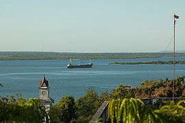
- Tanga Bay
 Tanga bay sunset
References
- 1 2 Yanda, Benjamin Chad (2007-01-01). A Political Ecology of Land Use Change and Natural Resource Conflict in the Rukwa Valley, Southwestern Tanzania. ProQuest. pp. 14–16. ISBN 9780549263838.
- ↑ "Tanga | Tanzania". Encyclopedia Britannica. Retrieved 2016-01-21.
- ↑ "Tanga Region Tourism Guide". Retrieved 21 January 2016.
- ↑ "Tanga History". tanga-line.tripod.com. Retrieved 2016-01-21.
- ↑ "First World War.com - Battles - The Battle of Tanga, 1914". www.firstworldwar.com. Retrieved 2016-01-21.
- ↑ Thomas, Graeme. "Fibre stories: Sisal starts a comeback in Tanzania - International Year of Natural Fibres 2009". www.naturalfibres2009.org. Retrieved 2016-01-21.
- ↑ "Consolidated TAA Traffic Statistics Up to 2014". taa.go.tz. Tanzania Airports Authority. Retrieved 21 January 2016.
- ↑ "Roads and Highways - COWI Group" (PDF). cowi.com. p. 30. Retrieved 21 January 2016.
- ↑ "Hope for growth as Pangani builds new jetty". Tanzania Standard News. Daily News. 19 January 2016. Retrieved 21 January 2016.
- ↑ "Tanzania Harbors Authority" (PDF). pmaesa. Port Management Association of East and Southern Africa. Retrieved 23 December 2015.
- ↑ "Tanzania to tackle Tanga congestion". Port Strategy. 1 December 2011. Retrieved 23 December 2015.
- 1 2 "CLIMATE: TANGA". climate-data.org. Retrieved 21 January 2016.
- Byron Farwell, The Great War in Africa, 1914-1918 (W. W. Norton, 1986)
External links
Coordinates: 05°04′S 39°06′E / 5.067°S 39.100°E