Tanana, Alaska
| Tanana Hohudodetlaatl Denh | |
|---|---|
| City | |
|
Postcard: Front Street, Tanana, 1910 | |
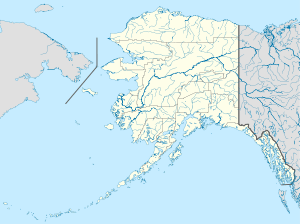 Tanana Location in Alaska | |
| Coordinates: 65°10′14″N 152°4′33″W / 65.17056°N 152.07583°WCoordinates: 65°10′14″N 152°4′33″W / 65.17056°N 152.07583°W | |
| Country | United States |
| State | Alaska |
| Census Area | Yukon-Koyukuk |
| Incorporated | June 7, 1961[1] |
| Government | |
| • Mayor | Donna Folger[2] |
| • State senator | Click Bishop (R) |
| • State rep. | Dave Talerico (R) |
| Area | |
| • Total | 15.6 sq mi (40.3 km2) |
| • Land | 11.6 sq mi (29.9 km2) |
| • Water | 4.0 sq mi (10.4 km2) |
| Elevation | 207 ft (63 m) |
| Population (2007)[3] | |
| • Total | 275 |
| • Density | 26.6/sq mi (10.3/km2) |
| Time zone | Alaska (AKST) (UTC-9) |
| • Summer (DST) | AKDT (UTC-8) |
| ZIP code | 99777 |
| Area code | 907 |
| FIPS code | 02-75160 |

Tanana /ˈtænənɑː/ (Hohudodetlaatl Denh in Koyukon) is a city in the Yukon-Koyukuk Census Area in the U.S. state of Alaska. At the 2000 census the population was 308. It was formerly known as Clachotin, adopted by Canadian French.
Jules Jetté (1864–1927),[4] a Jesuit missionary who worked in the area and documented the language, recorded the Koyukon Athabascan name for the village as Hohudodetlaatl Denh, literally, ‘where the area has been chopped’.[5] Several residents are chronicled in the 2012 Discovery Channel TV series Yukon Men. Almost 80% of the town's population are Native Americans, traditionally Koyukon (Denaakk'e) speakers of the large Athabaskan (Dené) language family. [6]
History
.jpg)
Prior to arrival of non-indigenous explorers and traders in the early 1860s, the point of land at the confluence of the Tanana and Yukon Rivers (Nuchalawoyyet, spelled differently in historic accounts) was a traditional meeting and trading place used by members of several indigenous groups. There were as many as five different Athabascan languages spoken in the area in 1868 when the French-Canadian François Xavier Mercier established the first (fur) trading post in the area. Noukelakayet Station, later known as Fort Adams, was located about 15 miles downstream from the mouth of the Tanana River on the north bank of the Yukon.[7]
Subsequently, an Anglican mission and several other trading posts were established nearby. In 1898 the U.S. Army, under the leadership of Capt. P.H. Ray, founded Ft. Gibbon at the present location of Tanana. Ft. Gibbon's purpose was to oversee shipping and trading, maintain civil order, and install and take care of telegraph lines connecting to Nome and to Tanana Crossing, on the way to Valdez. All other Euro-American activities in the area near the Tanana-Yukon confluence moved upriver to accommodate Ft. Gibbon and the increased steamboat traffic caused by gold seekers. St. James Church moved to the present site of Tanana to serve the Euro-American population, and the Mission of Our Savior was constructed at the bottom of a hill opposite the confluence. The mission site became a center of activity for indigenous people in the area. Ft. Gibbon closed in 1923, but the town and mission remained.
In the 1930s a regional hospital was built in Tanana, and the Native Village of Tanana was officially chartered by the U.S. Bureau of Indian Affairs. The hospital served people throughout most of the rural northern regions of Alaska until 1982. During World War II Tanana's airfield was one of the stops for aircraft en route to Russia as part of the Lend-Lease program. Postwar, a White Alice communications site was built on a hill nine miles behind Tanana, as a part of the Cold War Era's Distant Early Warning system (DEW-Line). Also during the 1950s the mission closed and the indigenous families still living at the mission site moved down to the main town.[8][9][10][11]
Geography and Climate
Tanana is located at the confluence of the tributary Tanana and the Yukon River 65°10′14″N 152°4′33″W / 65.17056°N 152.07583°W (65.170544, -152.075883).[12]
According to the United States Census Bureau, the city has a total area of 15.6 square miles (40 km2), of which 11.6 square miles (30 km2) of it is land and 4.0 square miles (10 km2) of it (25.80%) is water.
Tanana is about 130 miles (210 km) west of Fairbanks.[13]
| Climate data for Tanana | |||||||||||||
|---|---|---|---|---|---|---|---|---|---|---|---|---|---|
| Month | Jan | Feb | Mar | Apr | May | Jun | Jul | Aug | Sep | Oct | Nov | Dec | Year |
| Average high °C (°F) | −18.3 (−0.9) |
−13.9 (7) |
−6.7 (19.9) |
4.2 (39.6) |
15.0 (59) |
21.6 (70.9) |
22.1 (71.8) |
18.0 (64.4) |
11.1 (52) |
−1.3 (29.7) |
−12.6 (9.3) |
−16.1 (3) |
1.93 (35.48) |
| Average low °C (°F) | −27.3 (−17.1) |
−24.7 (−12.5) |
−20.6 (−5.1) |
−9.2 (15.4) |
0.9 (33.6) |
7.7 (45.9) |
9.5 (49.1) |
6.3 (43.3) |
0.8 (33.4) |
−9.2 (15.4) |
−20.8 (−5.4) |
−24.8 (−12.6) |
−9.28 (15.28) |
| Average precipitation mm (inches) | 11 (0.43) |
11 (0.43) |
9 (0.35) |
8 (0.31) |
15 (0.59) |
38 (1.5) |
55 (2.17) |
65 (2.56) |
39 (1.54) |
17 (0.67) |
13 (0.51) |
13 (0.51) |
294 (11.57) |
| Source: http://www.usclimatedata.com/climate/tanana/alaska/united-states/usak0238/2014/1 | |||||||||||||
Demographics
| Historical population | |||
|---|---|---|---|
| Census | Pop. | %± | |
| 1890 | 203 | — | |
| 1900 | 186 | −8.4% | |
| 1910 | 398 | 114.0% | |
| 1920 | 213 | −46.5% | |
| 1930 | 185 | −13.1% | |
| 1940 | 170 | −8.1% | |
| 1950 | 228 | 34.1% | |
| 1960 | 349 | 53.1% | |
| 1970 | 406 | 16.3% | |
| 1980 | 388 | −4.4% | |
| 1990 | 345 | −11.1% | |
| 2000 | 308 | −10.7% | |
| 2010 | 246 | −20.1% | |
| Est. 2015 | 244 | [14] | −0.8% |
As of the census[16] of 2000, there were 308 people, 121 households, and 68 families residing in the city. The population density was 26.6 people per square mile (10.3/km²). There were 166 housing units at an average density of 14.4 per square mile (5.5/km²). The racial makeup of the city was 79.87% Native American, 17.86% White, and 2.27% from two or more races. 0.65% of the population were Hispanic or Latino of any race.
There were 121 households out of which 41.3% had children under the age of 18 living with them, 26.4% were married couples living together, 20.7% had a female householder with no husband present, and 43.0% were non-families. 37.2% of all households were made up of individuals and 10.7% had someone living alone who was 65 years of age or older. The average household size was 2.55 and the average family size was 3.43.
In the city the population was spread out with 34.7% under the age of 18, 6.5% from 18 to 24, 28.2% from 25 to 44, 22.1% from 45 to 64, and 8.4% who were 65 years of age or older. The median age was 34 years. For every 100 females there were 131.6 males. For every 100 females age 18 and over, there were 128.4 males.
The median income for a household in the city was $29,750, and the median income for a family was $34,028. Males had a median income of $30,781 versus $23,500 for females. The per capita income for the city was $12,077. About 16.4% of families and 23.0% of the population were below the poverty line, including 15.0% of those under the age of 18 and none of those 65 or over.
Education
The Tanana City School District serves area residents.
Transportation
Tanana is served by the Ralph M. Calhoun Memorial Airport located at the Western edge of the city, 1 mile from the city center. Boat transport on the river is possible in summer. Tanana is served by a one-lane dirt road, which connects Tanana to the Elliott Highway in Manley Hot Springs. The road ends about 6 miles upstream from the town, but an ice road is constructed when the river freezes. The town can also be reached by boat when the weather is warm. The road opened in August 2016.[17]
Notable people
- Morris Thompson (1939–2000), politician, was born and raised in Tanana. After he died in the crash of Alaska Airlines Flight 261, his body was returned to the city for burial.[18]
- Jules Louis Prevost (1863–1937), an early missionary and linguist in the area, he was the first postmaster.
- Walter Harper (1893–1918), (Koyukuk) first man to reach the summit of Denali (Mt. McKinley) in successful 1913 expedition led by Hudson Stuck and Harry Karstens
See also
References
- ↑ "Directory of Borough and City Officials 1974". Alaska Local Government. Juneau: Alaska Department of Community and Regional Affairs. XIII (2): 79. January 1974.
- ↑ 2015 Alaska Municipal Officials Directory. Juneau: Alaska Municipal League. 2015. p. 151.
- ↑ "Annual Estimates of the Population for Incorporated Places in Alaska". United States Census Bureau. 2008-07-10. Retrieved 2008-07-14.
- ↑ "Biography – JETTÉ, JULES – Volume XV (1921-1930)". Dictionary of Canadian Biography. University of Toronto/Université Laval. 2005. Retrieved 2014-12-30.
- ↑ Jetté, Jules. 1910. On the Geographical Names of the Ten'a, Microfilm AM 34:688-701. Jesuit Oregon Province Archives, Foley Library, Gonzaga University.
- ↑ Jones, Eliza, Jules Jette and James Kari. Koyukon Athabascan Dictionary. University of Alaska Fairbanks Alaska Native Language Center, April, 2000:1118.
- ↑ Merçier, François Xavier. Recollections of the Youkon: Memoires from the Years 1868-1885. Alaska Historical Studies in History No. 188. Linda Finn Yarborough, Anchorage, Alaska, 1986: 102.
- ↑ Alaska Department of Commerce. Alaska Community Database Community Information Summaries. Website, 2011. Home page at http://www.commerce.state.ak.us/dca/commdb/CF_COMDB.htm
- ↑ Bureau of Indian Affairs, United States Department of the Interior. Corporate Charter of the Native Village of Tanana, approved May 15, 1939; printed by U.S. Government Printing Office 1950. Retrieved from http://thorpe.ou.edu/IRA/tanachrtr.htmlon May 4, 2008.
- ↑ Gaede-Penner, Naomi. Honoring Our Sacred Healing Place: Tanana, Alaska: Development, History, Community and Cultural Significance of the Tanana Hospital Complex. Alaska Area Native Health Service, Anchorage, AK, 2012: 35 pages.
- ↑ Huntington, Sidney, as told to Jim Rearden. Shadows on the Koyukuk. Alaska Northwest Books, Anchorage, AK, 1993: pp. 165-167
- ↑ "US Gazetteer files: 2010, 2000, and 1990". United States Census Bureau. 2011-02-12. Retrieved 2011-04-23.
- ↑ "Man arrested in deaths of Alaska State Troopers." AOL News. May 2, 2014. Retrieved on May 4, 2014.
- ↑ "Annual Estimates of the Resident Population for Incorporated Places: April 1, 2010 to July 1, 2015". Retrieved July 2, 2016.
- ↑ "Census of Population and Housing". Census.gov. Retrieved June 4, 2015.
- ↑ "American FactFinder". United States Census Bureau. Retrieved 2008-01-31.
- ↑ Driving Alaska's new road to Tanana
- ↑ "Email Scam," Alaska Federation of Natives
Municipalities and communities of Yukon–Koyukuk Census Area, Alaska, United States | ||
|---|---|---|
| Cities | 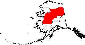 | |
| CDPs | ||
| Unincorporated communities | ||
| Ghost towns | ||