Tân An, Long An
| Tân An Thành phố Tân An | |
|---|---|
 | |
| Country |
|
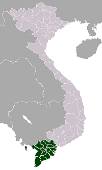
| Province | Long An |
| Area | |
| • Total | 81.94 km2 (31.64 sq mi) |
| Population (2015) | |
| • Total | 186,612 |
| • Density | 2,277.4/km2 (5,898/sq mi) |
Tân An is the capital city of Long An Province in Mekong Delta region of Vietnam. It was upgraded from town level to city on 26 August 2009. The population of Tân An 165,214 (2009), with an area of 81.79 km². It comprises nine wards (1, 2, 3, 4, 5, 6, 7, Khánh Hậu, and Tân Khánh), and five communes (An Vĩnh Ngãi, Bình Tâm, Hướng Thọ Phú, Lợi Bình Nhơn, Nhơn Thạnh Trung.)
Tân An is in the south-west of Ho Chi Minh City, 47 km away from the city centre and bordered by the administrative units such as: on the North by Thu Thua district; On the East by Tan Tru district and Chau Thanh district; On the west and south-west by Tiền Giang Province. The City has 6 wards and 6 communes, in which ward I is economic, political and cultural center of the city.
Tân An is political, cultural, economic, scientific and technological center of Long An province. The township is in the development of the Southern key economic region, and economic gateway to provinces of Mekong River Delta, with main river and road traffic flowing through the centre, National highway I A, National highway 62 and Vam Co Tay river.[1][2]
History
Before 1945
Management of rivers in the Mekong Delta began to develop the area in 1705, bringing commerce to the Vàm Cỏ Tay River at Tân An (then written: 新安) as the end of the Bảo Định Canal in the first years of Nguyễn Dynasty around 1802.[3] In 1800, the entire Mekong Delta fell under the Nguyễn Dynasty's authority. Tân An and it's immediate surrounding used to be its own province, established by the French colonists in December 1889, when Gia Định Province was split to four smaller provinces. In October 1956, Tân An Province was merged into Long An Province by the Republic of Vietnam government under President Ngo Dinh Diem.
1945
Following the August Revolution in Hanoi the local communists seized power in the south first in Tân An on 21 August 1945.[4]
Vietnam War
Tân An was the headquarters of the 9th Infantry Division during the Vietnam War. There was an army base associated with the 9th Division in one part of town and Tân An air base on the other side of town that supported 9th Infantry helicopters and could land medium-sized prop planes. The base camp at Tân An was turned over to the South Vietnamese Army when the 9th division left in 1970. The 9th Division was the first infantry division to leave.
References
- ↑ (Vietnamese) Introduction on Tan An
- ↑ James B. Hendry Rural Vietnam: The Small World of Khanh Hau 2009 - Page 144 "... last six or eight years has been the substantial growth in the number of local rice mills. In the vicinity of Khanh Hau, as an example, small rice mills have sprung up in all the neighboring villages, large mills have gone up in the town of Tan An ..."
- ↑ Nadine Reis Tracing and Making the State: Policy Practices and Domestic Water ... 2012 Page 34 "While the natural floodways in the eastern part of the delta already began to change in 1705 with the construction of the Bao Dinh Canal between the Tien River at My Tho (Tien Giang province) and the Vam Co Tay River at Tan An (Long An province), the middle and western parts of the delta remained largely free from human impact ..."
- ↑ R. B. B. Smith, Beryl Williams Communist Indochina 2012 "Having hesitated during a series of secret meetings of an Uprising Committee (formed by Tran Van Giau as early as the 16th), the Communist leadership decided on 21 August to seize power first in the provincial town of Tan An the following ..."
Coordinates: 10°32′00″N 106°25′00″E / 10.53333°N 106.41667°E