Tampaksiring
| Tampaksiring | |
|---|---|
|
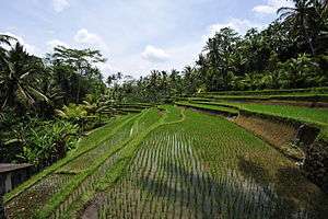
Rice fields (sawah) at the entrance to Gunung Kawi Temple | |
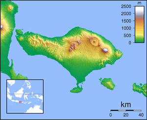 Tampaksiring Location in Bali | |
| Coordinates: 8°25′S 115°18′E / 8.417°S 115.300°E | |
| Country | Indonesia |
| Province | Bali |
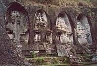
Tampaksiring is a town in central Bali, Gianyar Regency, Indonesia. It is the home to the Gunung Kawi Temple and archaeological site[1] and the Senang Hati Foundation.
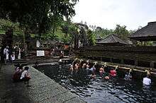
The word "Tampak" in Balinese means foot, while "Siring" means Oblique. According to the legend the slope of the mountain where the town stands today, was created by footstep of a king named Mayadenawa. Tampaksiring was also one of the major kingdom during Bali's pre-colonial period.[2] The town is home to Tirta Empul Temple
Villages around Tampaksiring are: Manukaya, Pejeng, Pejeng Kaja, Pejeng Kangin, Pejeng Kawan, Pejeng Kelod, Sanding, and Tampaksiring.
Presidential Palace
Tampaksiring is also location of one of the 6 presidential palaces in Indonesia. The Palace was built between 1957-1960 at the initiation of President Soekarno. The buildings of the complex are scattered around on an area covering 19 hectare. The main palace building are built on a higher ground overlooking Tampaksiring Tirta Empul Temple and Mount Agung. [3][4]
References
- ↑ wonderfulbali.com. "Tampaksiring, Valley of the Kings - Gunung Kawi". Retrieved 2007-12-20.
- ↑ Pura Tirta Empul, babadbali.com
- ↑ Government of The Republic of Indonesia. "Republic of Indonesia - Tampaksiring Presidential Palace". Retrieved 2007-12-20.
- ↑ Istana istana kepresidenan RI, setneg.go.id
External links
![]() Central Bali travel guide from Wikivoyage
Central Bali travel guide from Wikivoyage
Coordinates: 8°25′S 115°18′E / 8.417°S 115.300°E