Tamentit
| Tamentit ﺗﺎﻣﻨﻄﻴﺖ | |
|---|---|
| Commune | |
_location_map.svg.png) Location of Tamentit commune within Adrar Province | |
 Tamentit Location of Tamentit within Algeria | |
| Coordinates: 27°46′2″N 0°16′4″W / 27.76722°N 0.26778°WCoordinates: 27°46′2″N 0°16′4″W / 27.76722°N 0.26778°W | |
| Country | Algeria |
| Province | Adrar |
| District | Fenoughil |
| Elevation | 240 m (790 ft) |
| Population (2008)[1] | |
| • Total | 9,481 |
| Time zone | CET (UTC+1) |
Tamentit (تامنطيت) (sometimes spelled Tamantit) is a town and commune or municipality in Fenoughil District of Adrar Province, in south-central Algeria. According to the 2008 census it has a population of 9,481,[1] up from 7,912 in 1998,[2] with an annual growth rate of 1.9%.[1]
Until the late twentieth century the people of Tamentit spoke Taznatit Berber.
Geography
The villages of Tamentit are located near oases that are part of the Tuat region in northern Adrar Province, between the communes of Adrar to the north and Fenoughil to the south. The rocky Tademaït plateau rises far to the east, while the sandy Erg Iguidi and Erg Chech deserts lie to the west.
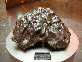
The Tamentit iron meteorite was found nearby in 1864. [3]
Climate
Tamentit has a hot desert climate (Köppen climate classification BWh), with extremely hot summers and mild winters, and very little precipitation throughout the year.
Transportation
Tamentit is on the N6 national highway, which leads north to Adrar and south to Fenoughil commune and eventually Reggane. The village of Bouffaddi lies on the highway to the south of Tamentit, while the other villages of the commune are to the east of the highway, and are connected to it by local roads.
Education
5.9% of the population has a tertiary education, and another 17.9% has completed secondary education.[4] The overall literacy rate is 75.6%, and is 85.9% among males and 65.2% among females.[5]
Localities
As of 1984, the commune was composed of seven localities:[6]
- Tamentit
- Oulad El Ouali
- Oulad Elhadj
- Elmamoun
- Noum En Nass
- Bouffaddi
- Abenkour
References
- 1 2 3 "Population: Wilaya d'Adrar" (PDF) (in French). Office National des Statistiques Algérie. Retrieved 1 July 2013.
- ↑ "Algeria Communes". Statoids. Retrieved 8 March 2013.
- 1 2 Tamentit meteorite at Meteoritical Bulletin Database.
- ↑ "Structure relative de la population résidente des ménages ordinaires et collectifs âgée de 6 ans et plus selon le niveau d'instruction et la commune de résidence." (PDF) (in French). Office National des Statistiques Algérie. Retrieved 1 July 2013.
- ↑ "Taux d'analphabétisme et taux d'alphabétisation de la population âgée de 15 ans et plus, selon le sexe et la commune de résidence ." (PDF) (in French). Office National des Statistiques Algérie. Retrieved 1 July 2013.
- ↑ "Décret n° 84-365, fixant la composition, la consistance et les limites territoriale des communes. Wilaya d'Adrar" (PDF) (in French). Journal officiel de la République Algérienne,. 19 December 1984. p. 1472. Archived from the original (PDF) on 2 March 2013 or before. Retrieved 1 July 2013. Check date values in:
|archive-date=(help)
 |
Béchar Kousan |
Adrar Mahidia |
Ghardaïa Aougrout Zaouia Sidi Bekra |
|
| Tindouf Bou Bernous (Tindouf) |
|
Ouled El Ouali In Salah (Tamanrasset) | ||
| ||||
| | ||||
| Tasfaout | Bouffaddi Fenoughil |
Ouled Elhadj Timokten Tamanrasset |
