Tallimba
| Tallimba New South Wales | |
|---|---|
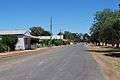 Main street approaching from West Wyalong | |
|
Tallimba | |
| Coordinates | 33°58′S 146°33′E / 33.967°S 146.550°ECoordinates: 33°58′S 146°33′E / 33.967°S 146.550°E |
| Population | 335 (2011 census)[1] |
| Postcode(s) | 2669 |
| Elevation | 216 m (709 ft) |
| Location |
|
| LGA(s) | Bland Shire |
| State electorate(s) | Cootamundra |
| Federal Division(s) | Riverina |
Tallimba is a town in the Central West area of New South Wales, Australia. It is a part of the Bland Shire 34 km from West Wyalong and 1½ hours drive from Wagga Wagga. At the 2011 census, Tallimba had a population of 335.[1]
Infrastructure
- St Bernadette's Catholic Church, built 1953, still in use each 1st and 3rd Sunday Mass 5pm
- Tallimba Hall
- Tallimba Inn
- Tallimba Public School
- Post Office (closed)
- Ruddy Shack
- Government Dam
- Tennis Courts
- Bank of New South Wales (closed)
- Hospital (closed)
- Tallimba War Memorial Park
- Cafe (closed)
- Golf club (closed)
- Cricket Oval
- Silos
- Tallimba Sales & Service
- Tallimba Police Station
Sporting teams
- Tallimba Hawks - Australian Rules Football team (disbanded)
- Tallimba rugby league team (disbanded)
- Tallimba Cricket Club
- Tallimba Tennis Club
History of the primary school
Tallimba School was established to educate the children of settlers from the Tallimba District. Originally part of Willandry Station the arrival of the railway line from Barmedman meant wheat was able to be transported away to ports and mills.
There was an influx of settlers from Victoria and South Australia to take up bush blocks varying from 640 to 800 acres (2.6 to 3.2 km²). Despite the hardships endured in establishing a farm and home in virgin bush, the importance of education was not overlooked and on 16 June 1925, a school with 18 students opened. Due to increasing enrolments a second teacher was appointed in 1949, and in 1950/51 the building was moved across the road to a new less flood-prone site.
The school size peaked in 1968 with sufficient numbers for three teachers. The P&C have always actively supported the school providing for many facilities at the school before they became standard equipment.
Notable residents
- Terry Gathercole - Olympic medallist in swimming and former Australian national team coach was born in Tallimba.
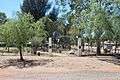
Gallery
 Anglican Church
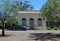 Former Bank
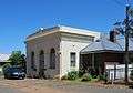 Formar Bank
 fountain
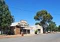 Tallimba Garage
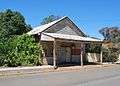 General Store
- Main Street
 War memorial
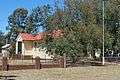 Police Station
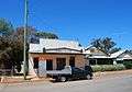 Post OFfice
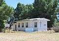 Presbyterian Church
 Public Hall
 Silos
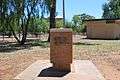
Silos Memorial
 Outside Town
 War Memorial
 Hotel
Hotel
References
- 1 2 Australian Bureau of Statistics (31 October 2012). "Tallimba (State Suburb)". 2011 Census QuickStats. Retrieved 2 April 2015.
External links
![]() Media related to Tallimba, New South Wales at Wikimedia Commons
Media related to Tallimba, New South Wales at Wikimedia Commons