Talihina, Oklahoma
| Talihina, Oklahoma | |
|---|---|
| City | |
|
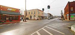
historic downtown Talihina | |
 Location of Talihina, Oklahoma | |
| Coordinates: 34°45′6″N 95°2′28″W / 34.75167°N 95.04111°WCoordinates: 34°45′6″N 95°2′28″W / 34.75167°N 95.04111°W | |
| Country | United States |
| State | Oklahoma |
| County | Le Flore |
| Area | |
| • Total | 0.8 sq mi (2.2 km2) |
| • Land | 0.8 sq mi (2.2 km2) |
| • Water | 0.0 sq mi (0.0 km2) |
| Elevation | 682 ft (208 m) |
| Population (2010) | |
| • Total | 1,114 |
| • Density | 1,392.5/sq mi (506.4/km2) |
| Time zone | Central (CST) (UTC-6) |
| • Summer (DST) | CDT (UTC-5) |
| FIPS code | 40-72250[1] |
| GNIS feature ID | 1098731[2] |
| Website | http://www.talihinacc.com |
Talihina (pronounced "tah-luh-HEE-nuh") is a town in Le Flore County, Oklahoma, United States, its name originating from two Choctaw words, tully and hena, meaning iron road. Iron road is reference to the railroad that the town was built around.[3] It is part of the Fort Smith, Arkansas–Oklahoma Metropolitan Statistical Area. The population was 1,114 at the 2010 census, a loss of 8.0 percent from 1,211 at the 2000 census.[4]
History
Talihina received its name in 1886–1887 when the St. Louis and San Francisco Railway (Frisco) built a line through the Choctaw Nation in Indian Territory. The railroad opened the surrounding area to ship cattle, timber, and cotton to Eastern markets and facilitated growth of the town. When Talihina incorporated in 1905, the town claimed a population of 400. Two major hospitals, the Choctaw-Chickasaw Tuberculosis Sanatorium and the Eastern Oklahoma State Tuberculosis Sanatorium, were built here between 1915 and 1921. By 1920, the population had grown to 690.[3]
Tourism and recreation have been a major economic stimulus since the 1920s. Six lakes have been built in the Kiamichi Valley, attracting sportsmen and campers. Talimena State Park and Old Military Road historic site (National Register of Historic Places, NR 76002155) are 7 miles (11 km) northeast of Talihina. This is the western end of Talimena Scenic Drive, which runs to Mena, Arkansas and attracts many people to view the fall foliage.[3]
The Choctaw Nation Health Center was constructed in Talihina in 1999.[3]
Geography
Talihina is located at 34°45′6″N 95°2′28″W / 34.75167°N 95.04111°W (34.751602, −95.041207).[5] It is in the Kiamichi Valley between the Kiamichi and Winding Stair Mountains, about 39 miles (63 km) southwest of Poteau, the Le Flore County seat.[3]
According to the United States Census Bureau, the town has a total area of 0.8 square miles (2.1 km2), all of it land.
Demographics
| Historical population | |||
|---|---|---|---|
| Census | Pop. | %± | |
| 1910 | 491 | — | |
| 1920 | 690 | 40.5% | |
| 1930 | 1,032 | 49.6% | |
| 1940 | 1,057 | 2.4% | |
| 1950 | 965 | −8.7% | |
| 1960 | 1,048 | 8.6% | |
| 1970 | 1,223 | 16.7% | |
| 1980 | 1,387 | 13.4% | |
| 1990 | 1,297 | −6.5% | |
| 2000 | 1,270 | −2.1% | |
| 2010 | 1,114 | −12.3% | |
| Est. 2015 | 1,097 | [6] | −1.5% |
As of the census[1] of 2000, there were 1,211 people, 463 households, and 292 families residing in the town. The population density was 1,445.4 people per square mile (556.6/km²). There were 548 housing units at an average density of 654.1 per square mile (251.9/km²). The racial makeup of the town was 54.75% White, 1.07% African American, 37.16% Native American, 0.08% Asian, 0.17% from other races, and 6.77% from two or more races. Hispanic or Latino of any race were 1.16% of the population.
There were 463 households out of which 30.5% had children under the age of 18 living with them, 40.8% were married couples living together, 16.0% had a female householder with no husband present, and 36.9% were non-families. 33.3% of all households were made up of individuals and 17.7% had someone living alone who was 65 years of age or older. The average household size was 2.50 and the average family size was 3.21.
In the town the population was spread out with 29.4% under the age of 18, 8.1% from 18 to 24, 22.0% from 25 to 44, 20.4% from 45 to 64, and 20.1% who were 65 years of age or older. The median age was 38 years. For every 100 females there were 88.9 males. For every 100 females age 18 and over, there were 83.5 males.
The median income for a household in the town was $20,875, and the median income for a family was $25,761. Males had a median income of $19,688 versus $17,216 for females. The per capita income for the town was $10,405. About 23.7% of families and 29.2% of the population were below the poverty line, including 42.7% of those under age 18 and 13.1% of those age 65 or over.
Points of interest
- Choctaw Nation Health Services Authority
- Kerr Arboretum and Botanical Area
- Talimena Scenic Drive
- Choctaw Museum, Village and Gift Shop
- Cedar Lake
- Pres. Kennedy Monument
- Three Sticks Monument
- Ouachita National Forest
- Hale Scout Reservation
Notable people
Bob Neighbors, the only Major League Baseball player to be killed in the Korean War, was born in Talihina.
Sean Marsee (1965 – February 25, 1984) was a Talihina high-school athlete who has become a national icon against the use of chewing tobacco.
In popular culture
The song Talihina Sky by Kings of Leon was featured as a hidden track on their Youth and Young Manhood 2003 debut album. The three brothers and cousin, who form the band Kings of Leon have roots in Talihina, along with Nashville, Tennessee. "Talihina Sky" also became the name of their DVD documentary, about their upbringing, featuring the annual Followill Talihina reunion.
References
- 1 2 "American FactFinder". United States Census Bureau. Retrieved 2008-01-31.
- ↑ "US Board on Geographic Names". United States Geological Survey. 2007-10-25. Retrieved 2008-01-31.
- 1 2 3 4 5 Cox, Michael S. Encyclopedia of Oklahoma History and Culture. "Talihina" Retrieved March 6, 2015. .
- ↑ CensusViewer: Talihina, Oklahoma Population.
- ↑ "US Gazetteer files: 2010, 2000, and 1990". United States Census Bureau. 2011-02-12. Retrieved 2011-04-23.
- ↑ "Annual Estimates of the Resident Population for Incorporated Places: April 1, 2010 to July 1, 2015". Retrieved July 2, 2016.
- ↑ "Census of Population and Housing". Census.gov. Retrieved June 4, 2015.
External links
| Wikimedia Commons has media related to Talihina, Oklahoma. |
- http://www.talihinacc.com
- Talihina Public Library
- Talihina Main Street
- Choctaw Nation Health Services Authority
- Oklahoma Digital Maps: Digital Collections of Oklahoma and Indian Territory
Municipalities and communities of Le Flore County, Oklahoma, United States | ||
|---|---|---|
| Cities | 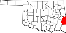 | |
| Towns | ||
| CDP | ||
| Other unincorporated communities | ||
| Footnotes | ‡This populated place also has portions in an adjacent county or counties | |