Taliaferro County, Georgia
| Taliaferro County, Georgia | |
|---|---|
 Taliaferro County Courthouse (Built 1902),[1] Crawfordville | |
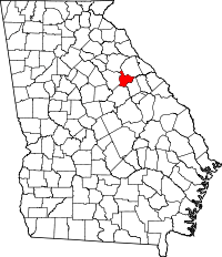 Location in the U.S. state of Georgia | |
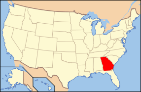 Georgia's location in the U.S. | |
| Founded | December 24, 1825 |
| Named for | Benjamin Taliaferro |
| Seat | Crawfordville |
| Largest city | Crawfordville |
| Area | |
| • Total | 195 sq mi (505 km2) |
| • Land | 195 sq mi (505 km2) |
| • Water | 0.7 sq mi (2 km2), 0.4% |
| Population (est.) | |
| • (2015) | 1,639 |
| • Density | 8.8/sq mi (3/km²) |
| Congressional district | 10th |
| Time zone | Eastern: UTC-5/-4 |
Taliaferro County /ˈtɒlɪvər/ is a county located in the U.S. state of Georgia. As of the 2010 census, the population was 1,717,[2] making it the least populous county in Georgia and the second-least populous county east of the Mississippi River (after Issaquena County, Mississippi). The county seat is Crawfordville.[3]
History
Taliaferro County was formed by an act of the Georgia Legislature meeting in Milledgeville on December 24, 1825. It was formed by taking portions of five other counties: Wilkes, Greene, Hancock, Oglethorpe, and Warren Counties.
The county was named for Colonel Benjamin Taliaferro of Virginia, who was an officer in the American Revolution.
The county is most famous for containing the birthplace and home of Alexander H. Stephens, who served as a U.S. congressman from Georgia in the antebellum South, as vice president of the Confederate States of America during the Civil War, and as governor of Georgia after the war (dying in office). A state park near his home in Crawfordville, Georgia bears his name.
Geography
According to the U.S. Census Bureau, the county has a total area of 195 square miles (510 km2), of which 195 square miles (510 km2) is land and 0.7 square miles (1.8 km2) (0.4%) is water.[4] It is drained by tributaries of the Ogeechee and Little rivers.[5]
The northern half of Taliaferro County, north of Crawfordville, is located in the Little River sub-basin of the Savannah River basin. The southern half of the county is located in the Upper Ogeechee River sub-basin of the Ogeechee River basin.[6]
Major highways
-
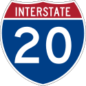 Interstate 20
 -
 U.S. Route 278
 -
 State Route 12
 -
 State Route 22
 -
 State Route 44
 -
 State Route 47
 -
 State Route 402 (unsigned designation for I-20)
Adjacent counties
- Wilkes County - north
- Oglethorpe County - north
- Warren County - southeast
- Hancock County - south
- Greene County - west
Demographics
| Historical population | |||
|---|---|---|---|
| Census | Pop. | %± | |
| 1830 | 4,934 | — | |
| 1840 | 5,190 | 5.2% | |
| 1850 | 5,146 | −0.8% | |
| 1860 | 4,583 | −10.9% | |
| 1870 | 4,796 | 4.6% | |
| 1880 | 7,034 | 46.7% | |
| 1890 | 7,291 | 3.7% | |
| 1900 | 7,912 | 8.5% | |
| 1910 | 8,766 | 10.8% | |
| 1920 | 8,841 | 0.9% | |
| 1930 | 6,172 | −30.2% | |
| 1940 | 6,278 | 1.7% | |
| 1950 | 4,515 | −28.1% | |
| 1960 | 3,370 | −25.4% | |
| 1970 | 2,423 | −28.1% | |
| 1980 | 2,032 | −16.1% | |
| 1990 | 1,915 | −5.8% | |
| 2000 | 2,077 | 8.5% | |
| 2010 | 1,717 | −17.3% | |
| Est. 2015 | 1,639 | [7] | −4.5% |
| U.S. Decennial Census[8] 1790-1960[9] 1900-1990[10] 1990-2000[11] 2010-2013[2] | |||
2000 census
As of the census[12] of 2000, there were 2,077 people, 870 households, and 559 families residing in the county. The population density was 11 people per square mile (4/km²). There were 1,085 housing units at an average density of 6 per square mile (2/km²). The racial makeup of the county was 60.33% Black or African American, 38.18% White, 0.05% Native American, 0.05% Asian, 0.67% from other races, and 0.72% from two or more races. 0.91% of the population were Hispanic or Latino of any race.
There were 870 households out of which 26.80% had children under the age of 18 living with them, 39.30% were married couples living together, 20.00% had a female householder with no husband present, and 35.70% were non-families. 33.30% of all households were made up of individuals and 16.80% had someone living alone who was 65 years of age or older. The average household size was 2.36 and the average family size was 3.00.
In the county the population was spread out with 24.10% under the age of 18, 7.60% from 18 to 24, 24.60% from 25 to 44, 24.80% from 45 to 64, and 18.90% who were 65 years of age or older. The median age was 40 years. For every 100 females there were 93.20 males. For every 100 females age 18 and over, there were 87.30 males.
The median income for a household in the county was $23,750, and the median income for a family was $27,800. Males had a median income of $26,380 versus $21,534 for females. The per capita income for the county was $15,498. About 22.30% of families and 23.40% of the population were below the poverty line, including 30.30% of those under age 18 and 23.40% of those age 65 or over.
2010 census
As of the 2010 United States Census, there were 1,717 people, 759 households, and 480 families residing in the county.[13] The population density was 8.8 inhabitants per square mile (3.4/km2). There were 1,015 housing units at an average density of 5.2 per square mile (2.0/km2).[14] The racial makeup of the county was 59.6% black or African American, 37.3% white, 0.6% Asian, 0.1% American Indian, 0.9% from other races, and 1.4% from two or more races. Those of Hispanic or Latino origin made up 2.0% of the population.[13] In terms of ancestry, and 22.1% were American.[15]
Of the 759 households, 24.9% had children under the age of 18 living with them, 35.6% were married couples living together, 22.0% had a female householder with no husband present, 36.8% were non-families, and 33.2% of all households were made up of individuals. The average household size was 2.25 and the average family size was 2.83. The median age was 45.9 years.[13]
The median income for a household in the county was $22,188 and the median income for a family was $29,375. Males had a median income of $29,435 versus $20,227 for females. The per capita income for the county was $13,955. About 30.1% of families and 34.4% of the population were below the poverty line, including 60.6% of those under age 18 and 24.9% of those age 65 or over.[16]
Communities
Notable People
In popular culture
Several Hollywood films have been shot in Taliaferro County. Paris Trout 1991, starring Dennis Hopper and based on the novel by the same name by Pete Dexter, was primarily filmed in the county. More recently, the film Sweet Home Alabama, starring Reese Witherspoon, was filmed in the county seat of Crawfordville.
See also
- Central Savannah River Area
- National Register of Historic Places listings in Taliaferro County, Georgia
References
- ↑ Caldwell, W. W.: "The Courthouse and the Depot", pages 33-34. Mercer University Press, 2001
- 1 2 "State & County QuickFacts". United States Census Bureau. Retrieved June 26, 2014.
- ↑ "Find a County". National Association of Counties. Retrieved 2011-06-07.
- ↑ "US Gazetteer files: 2010, 2000, and 1990". United States Census Bureau. 2011-02-12. Retrieved 2011-04-23.
- ↑
 Ripley, George; Dana, Charles A., eds. (1879). "Taliaferro". The American Cyclopædia.
- ↑ "Georgia Soil and Water Conservation Commission Interactive Mapping Experience". Georgia Soil and Water Conservation Commission. Retrieved 2015-11-19.
- ↑ "County Totals Dataset: Population, Population Change and Estimated Components of Population Change: April 1, 2010 to July 1, 2015". Retrieved July 2, 2016.
- ↑ "U.S. Decennial Census". United States Census Bureau. Retrieved June 26, 2014.
- ↑ "Historical Census Browser". University of Virginia Library. Retrieved June 26, 2014.
- ↑ "Population of Counties by Decennial Census: 1900 to 1990". United States Census Bureau. Retrieved June 26, 2014.
- ↑ "Census 2000 PHC-T-4. Ranking Tables for Counties: 1990 and 2000" (PDF). United States Census Bureau. Retrieved June 26, 2014.
- ↑ "American FactFinder". United States Census Bureau. Retrieved 2008-01-31.
- 1 2 3 "DP-1 Profile of General Population and Housing Characteristics: 2010 Demographic Profile Data". United States Census Bureau. Retrieved 2015-12-30.
- ↑ "Population, Housing Units, Area, and Density: 2010 - County". United States Census Bureau. Retrieved 2015-12-30.
- ↑ "DP02 SELECTED SOCIAL CHARACTERISTICS IN THE UNITED STATES – 2006-2010 American Community Survey 5-Year Estimates". United States Census Bureau. Retrieved 2015-12-30.
- ↑ "DP03 SELECTED ECONOMIC CHARACTERISTICS – 2006-2010 American Community Survey 5-Year Estimates". United States Census Bureau. Retrieved 2015-12-30.
External links
 |
Wilkes County and Oglethorpe County | | ||
| Greene County | |
|||
| ||||
| | ||||
| Hancock County | Warren County |
Municipalities and communities of Taliaferro County, Georgia, United States | ||
|---|---|---|
| Cities | | |
Template:Georgia
Coordinates: 33°34′N 82°53′W / 33.57°N 82.88°W