Takua Pa District
| Takua Pa ตะกั่วป่า | |
|---|---|
| Amphoe | |
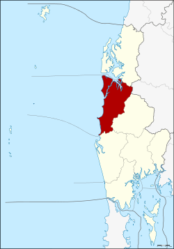 Amphoe location in Phang Nga Province | |
| Coordinates: 8°52′10″N 98°20′35″E / 8.86944°N 98.34306°ECoordinates: 8°52′10″N 98°20′35″E / 8.86944°N 98.34306°E | |
| Country |
|
| Province | Phang Nga |
| Seat | Takua Pa |
| Area | |
| • Total | 599.4 km2 (231.4 sq mi) |
| Population (2014) | |
| • Total | 48,004 |
| • Density | 72.5/km2 (188/sq mi) |
| Time zone | ICT (UTC+7) |
| Postal code | 82110 |
| Geocode | 8205 |
Takua Pa (Thai: ตะกั่วป่า (Pronunciation)) is a district (amphoe) in Phang Nga Province in south Thailand.
Geography
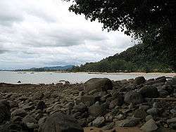
The district is on the Andaman Sea coast. To the north of the district is Si Phang Nga National Park. The southern part of the district contains Khao Lak-Lam Ru National Park, which includes the beach resorts of Khao Lak, devastated by the tsunami resulting from the 2004 Indian Ocean earthquake.
Neighboring districts are Khura Buri to the north, Phanom of Surat Thani Province, Kapong to the east, and Thai Mueang to the south.
Climate
| Climate data for Takua Pa (1981–2010) | |||||||||||||
|---|---|---|---|---|---|---|---|---|---|---|---|---|---|
| Month | Jan | Feb | Mar | Apr | May | Jun | Jul | Aug | Sep | Oct | Nov | Dec | Year |
| Record high °C (°F) | 36.0 (96.8) |
38.2 (100.8) |
38.1 (100.6) |
38.4 (101.1) |
38.0 (100.4) |
36.1 (97) |
36.3 (97.3) |
35.2 (95.4) |
34.9 (94.8) |
35.5 (95.9) |
35.5 (95.9) |
35.6 (96.1) |
38.4 (101.1) |
| Average high °C (°F) | 32.8 (91) |
33.5 (92.3) |
34.0 (93.2) |
34.0 (93.2) |
32.7 (90.9) |
32.0 (89.6) |
31.7 (89.1) |
31.4 (88.5) |
31.0 (87.8) |
31.2 (88.2) |
31.8 (89.2) |
32.1 (89.8) |
32.4 (90.3) |
| Daily mean °C (°F) | 26.4 (79.5) |
27.0 (80.6) |
27.7 (81.9) |
28.2 (82.8) |
27.9 (82.2) |
27.8 (82) |
27.4 (81.3) |
27.4 (81.3) |
26.7 (80.1) |
26.5 (79.7) |
26.5 (79.7) |
26.3 (79.3) |
27.2 (81) |
| Average low °C (°F) | 21.5 (70.7) |
21.8 (71.2) |
22.8 (73) |
23.9 (75) |
24.3 (75.7) |
24.4 (75.9) |
24.2 (75.6) |
24.3 (75.7) |
23.6 (74.5) |
23.3 (73.9) |
22.9 (73.2) |
22.1 (71.8) |
23.3 (73.9) |
| Record low °C (°F) | 16.0 (60.8) |
17.3 (63.1) |
18.6 (65.5) |
20.3 (68.5) |
21.7 (71.1) |
20.8 (69.4) |
21.1 (70) |
21.0 (69.8) |
20.9 (69.6) |
19.7 (67.5) |
19.9 (67.8) |
17.4 (63.3) |
16.0 (60.8) |
| Average rainfall mm (inches) | 39.4 (1.551) |
41.1 (1.618) |
114.6 (4.512) |
210.0 (8.268) |
437.5 (17.224) |
424.2 (16.701) |
429.9 (16.925) |
545.0 (21.457) |
595.5 (23.445) |
517.8 (20.386) |
240.9 (9.484) |
61.7 (2.429) |
3,657.6 (144) |
| Average rainy days | 4.8 | 5.2 | 9.9 | 15.3 | 22.6 | 21.7 | 22.0 | 23.1 | 24.4 | 24.2 | 16.4 | 8.2 | 197.8 |
| Average relative humidity (%) | 79 | 79 | 80 | 83 | 86 | 86 | 86 | 88 | 88 | 88 | 84 | 79 | 84 |
| Mean monthly sunshine hours | 232.5 | 214.7 | 201.5 | 183.0 | 155.0 | 114.0 | 114.7 | 114.7 | 108.0 | 108.5 | 174.0 | 195.3 | 1,915.9 |
| Mean daily sunshine hours | 7.5 | 7.6 | 6.5 | 6.1 | 5.0 | 3.8 | 3.7 | 3.7 | 3.6 | 3.5 | 5.8 | 6.3 | 5.3 |
| Source #1: Thai Meteorological Department[1] | |||||||||||||
| Source #2: Office of Water Management and Hydrology, Royal Irrigation Department (sun and humidity)[2] | |||||||||||||
History
Originally named Takola (Thai:ตะโกลา), the town was one of the historic city states (mueang) dating back to Srivijaya times in the 13th century. It was also known as Takkolam (Tamil: தக்கோலம்) which is the Tamil word for "piper cuveba" and "calyptranthes jambalana". There is also a place in the Tamil country which up to now carries the same name Takkolam. Takua Pa could have either abounded in the spices "calyptranthese jambalana" and "piper cubeba" or it could have been occupied by settlers from the Takkolam of the Tamil country, or both.[3] Takua Pa is said to have been the finest harbor on the west coast of the peninsula for trade between the Malay kingdom of Sri Vijaya and the early South Indian Tamil kingdoms of the Cholas and Pallavas during different times in history. It was later renamed to Takua Pa due to the rich ores found near the town: "takua" (ตะกั่ว) is the Thai word for lead, even though tin was the most important ore found there.
There was a Hindu/Vishnu temple there in the 8th century CE. An important mercantile organisation called "Kodumbalur Manigramam", built a water tank for this temple. They left an inscription in Tamil. The tank was called "Avani Naaranam", the name of one of the Pallava Emperors of Tamil Nadu.
The town was long administered by Nakhon Si Thammarat. In 1892 it was converted to a province, administered as part of the Monthon Phuket. This province was merged into Phang Nga Province on 1 April 1932.[4] The district, Talat Yai ("big market", ตลาดใหญ่), was then renamed Takua Pa.[5]
The district was an important tin-dredging area in the first half of the twentieth century, with the English company, Siamese Tin Syndicate Ltd., and the Australian company, Satupulo No Liability Co., both operating dredges in the rivers, with narrow-gauge tramways following them upstream. The Asiatic Company also had a dredge and tramway further inland at Amphoe Kapong. Siamese Tin operated here at least as late as 1967, but Thai firms assumed operations by the early-1980s. By 2008 there were no remaining signs of mining, as plantations, particularly rubber, covered the former dredged areas. The public library at Takua Pa town has photographs on display of the dredging and sluicing operations in their heyday in the 1920s and 1930s. The former Asiatic Company workshops can also still be seen in Amphoe Kapong town.
The centre for the identification of bodies found after the 2004 tsunami is in the district. Opposite the identification centre is the cemetery where all unidentified foreign bodies have been buried. Laid out somewhat like the Commonwealth War Graves cemetery at Kanchanaburi. By late-2008 the cemetery was overgrown, run down, and inhabited by feral dogs.
Administration
Central administration
The Takua Pa District is divided into eight sub-districts (tambon), which are further subdivided into 51 administrative villages (muban).
|
 |
Local administration
There is one town (thesaban mueang) in the district:
- Takua Pa (Thai: เทศบาลเมืองตะกั่วป่า) consisting of the complete sub-district Takua Pa.
There are two sub-district municipalities (thesaban tambon) in the district:
- Bang Nai Si (Thai: เทศบาลตำบลบางนายสี) consisting of the complete sub-district Bang Nai Si.
- Khuek Khak (Thai: เทศบาลตำบลคึกคัก) consisting of the complete sub-district Khuek Khak.
There are four subdistrict administrative organizations (SAO) in the district:
- Bang Sai (Thai: องค์การบริหารส่วนตำบลบางไทร) consisting of the complete sub-districts Bang Sai and Tam Tua.
- Bang Muang (Thai: องค์การบริหารส่วนตำบลบางม่วง) consisting of the complete sub-district Bang Muang.
- Khok Khian (Thai: องค์การบริหารส่วนตำบลโคกเคียน) consisting of the complete sub-district Khok Khian.
- Ko Kho Khao (Thai: องค์การบริหารส่วนตำบลเกาะคอเขา) consisting of the complete sub-district Ko Kho Khao.
The Takua Pa District is divided into eight sub-districts (tambon), which are further subdivided into 51 villages (muban). Takua Pa itself has town (thesaban mueang) status and covers the complete tambon Takua Pa. There are six tambon administrative organizations (TAO) - tambon. Takua Pa is administered by the town council and Tam Tua by a neighboring TAO, Bang Sai.
|
|
References
- ↑ "Climatological Data for the Period 1981–2010". Thai Meteorological Department. p. 27. Retrieved 8 August 2016.
- ↑ "ปริมาณการใช้น้ำของพืชอ้างอิงโดยวิธีของ Penman Monteith (Reference Crop Evapotranspiration by Penman Monteith)" (PDF) (in Thai). Office of Water Management and Hydrology, Royal Irrigation Department. p. 115. Retrieved 8 August 2016.
- ↑ Arokiaswamy, Celine W.M. (2000). Tamil Influences in Malaysia, Indonesia, and the Philippines. Manila s.n. p. 46.
- ↑ พระบรมราชโองการ ประกาศ ยุบรวมท้องที่บางมณฑลและบางจังหวัด (PDF). Royal Gazette (in Thai). 48 (0 ก): 576. 21 Feb 1932.
- ↑ ประกาศกระทรวงมหาดไทย เรื่อง เปลี่ยนนามอำภอตลาดใหญ่ เป็นอำเภอ ตะกั่วป่า (PDF). Royal Gazette (in Thai). 49 (0 ง): 576. 1 May 1932.
- ↑ "Population statistics 2014" (in Thai). Department of Provincial Administration. Retrieved 2015-06-17.
- ↑ "Population statistics 2008". Department of Provincial Administration.
External links
 Takua Pa travel guide from Wikivoyage
- amphoe.com (Thai)
- Attractions of Takua Pa District, Phang Nga Provincial administration