Takht-e-Sulaiman
| Takht-e-Sulaiman | |
|---|---|
 Takht-e-Sulaiman | |
| Highest point | |
| Elevation | 3,487 m (11,440 ft) |
| Isolation | 261 kilometres (162 mi) |
| Listing | List of mountains in Pakistan |
| Coordinates | 31°40′57.66″N 69°56′11.64″E / 31.6826833°N 69.9365667°ECoordinates: 31°40′57.66″N 69°56′11.64″E / 31.6826833°N 69.9365667°E |
| Geography | |
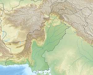
| Location | Pakistan |
| Parent range | Sulaiman Mountains |
Takht-e-Sulaiman (Pashto: تخت سليمان، د کسي غر), or Throne of Solomon, is a peak of the Sulaiman Mountains, located near the village of Darazinda in Frontier Region Dera Ismail Khan of the Federally Administered Tribal Areas of Pakistan. It is close to Frontier Region Dera Ismail Khan's borders with both South Waziristan and Zhob, Balochistan. At 3,487 metres (11,440 ft), it is the highest peak in Frontier Region Dera Ismail Khan and the greater Shirani region. Ibn Battuta named Takht-e-Sulaiman as Kōh-e Sulaymān, "Mount of Solomon".[1]
Legends
A legend, recorded by the medieval Maghrebi explorer Ibn Battuta, has it that Prophet Solomon climbed this mountain and looked out over the land of South Asia, which was then covered with darkness, but he turned back without descending into this new frontier, and left only the mountain which is named after him.
Another legend says that Qais Abdur Rashid, said to be the legendary ancestor of Pashtun people, is buried on top of Takht-e-Sulaiman, which gives the peak the local Pashto name of Da Kasī Ghar (د کسي غر, "Mount of Qais").
References
- ↑ "Sulaiman Mountains, Pakistan". NASA Earth Observatory. October 7, 2002. Retrieved 10 Nov 2013.