Tahoe Vista, California
| Tahoe Vista | |
|---|---|
| census-designated place | |
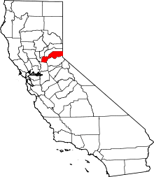
 Location in Placer County and the state of California | |
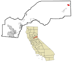
 Tahoe Vista Location in the United States | |
| Coordinates: 39°14′47″N 120°2′56″W / 39.24639°N 120.04889°WCoordinates: 39°14′47″N 120°2′56″W / 39.24639°N 120.04889°W | |
| Country |
|
| State |
|
| County | Placer |
| Government | |
| • State Senate | Dave Cox (R) |
| • State Assembly | Ted Gaines (R) |
| • U. S. Congress | Tom McClintock (R)[1] |
| Area[2] | |
| • Total | 2.716 sq mi (7.034 km2) |
| • Land | 2.716 sq mi (7.034 km2) |
| • Water | 0 sq mi (0 km2) 0% |
| Elevation | 6,234 ft (1,900 m) |
| Population (2010) | |
| • Total | 1,433 |
| • Density | 530/sq mi (200/km2) |
| Time zone | PST (UTC-8) |
| • Summer (DST) | PDT (UTC-7) |
| ZIP code | 96148 |
| Area code(s) | 530 |
| FIPS code | 06-77700 |
| GNIS feature ID | 1662317 |

Tahoe Vista is a census-designated place located on the north shore of Lake Tahoe in Placer County, California. It is part of the Sacramento–Arden-Arcade–Roseville Metropolitan Statistical Area. The population was 1,433 at the 2010 census, down from 1,668 at the 2000 census.
Geography
Tahoe Vista is located at 39°14′47″N 120°2′56″W / 39.24639°N 120.04889°W (39.246369, -120.048962).[3]
According to the United States Census Bureau, the CDP has a total area of 2.7 square miles (7.0 km2), all of it land.
Demographics
2010
The 2010 United States Census[4] reported that Tahoe Vista had a population of 1,433. The population density was 527.7 people per square mile (203.7/km²). The racial makeup of Tahoe Vista was 1,279 (89.3%) White, 3 (0.2%) African American, 8 (0.6%) Native American, 21 (1.5%) Asian, 2 (0.1%) Pacific Islander, 82 (5.7%) from other races, and 38 (2.7%) from two or more races. Hispanic or Latino of any race were 352 persons (24.6%).
The Census reported that 1,433 people (100% of the population) lived in households, 0 (0%) lived in non-institutionalized group quarters, and 0 (0%) were institutionalized.
There were 628 households, out of which 148 (23.6%) had children under the age of 18 living in them, 291 (46.3%) were opposite-sex married couples living together, 33 (5.3%) had a female householder with no husband present, 24 (3.8%) had a male householder with no wife present. There were 47 (7.5%) unmarried opposite-sex partnerships, and 7 (1.1%) same-sex married couples or partnerships. 207 households (33.0%) were made up of individuals and 38 (6.1%) had someone living alone who was 65 years of age or older. The average household size was 2.28. There were 348 families (55.4% of all households); the average family size was 2.93.
The population was spread out with 262 people (18.3%) under the age of 18, 122 people (8.5%) aged 18 to 24, 425 people (29.7%) aged 25 to 44, 487 people (34.0%) aged 45 to 64, and 137 people (9.6%) who were 65 years of age or older. The median age was 40.4 years. For every 100 females there were 113.6 males. For every 100 females age 18 and over, there were 115.3 males.
There were 1,446 housing units at an average density of 532.5 per square mile (205.6/km²), of which 398 (63.4%) were owner-occupied, and 230 (36.6%) were occupied by renters. The homeowner vacancy rate was 4.9%; the rental vacancy rate was 14.4%. 961 people (67.1% of the population) lived in owner-occupied housing units and 472 people (32.9%) lived in rental housing units.
2000
As of the census[5] of 2000, there were 1,668 people, 670 households, and 402 families residing in the CDP. The population density was 617.0 people per square mile (238.5/km²). There were 1,265 housing units at an average density of 467.9 per square mile (180.9/km²). The racial makeup of the CDP was 86.87% White, 0.12% African American, 0.48% Native American, 1.20% Asian, 7.97% from other races, and 3.36% from two or more races. Hispanic or Latino of any race were 17.81% of the population.
There were 670 households out of which 28.7% had children under the age of 18 living with them, 49.0% were married couples living together, 5.2% had a female householder with no husband present, and 39.9% were non-families. 26.7% of all households were made up of individuals and 2.5% had someone living alone who was 65 years of age or older. The average household size was 2.49 and the average family size was 3.00.
In the CDP the population was spread out with 21.4% under the age of 18, 10.2% from 18 to 24, 35.5% from 25 to 44, 27.2% from 45 to 64, and 5.8% who were 65 years of age or older. The median age was 36 years. For every 100 females there were 110.1 males. For every 100 females age 18 and over, there were 113.5 males.
The median income for a household in the CDP was $51,958, and the median income for a family was $63,125. Males had a median income of $35,764 versus $29,250 for females. The per capita income for the CDP was $24,170. About 5.8% of families and 8.1% of the population were below the poverty line, including 13.6% of those under age 18 and none of those age 65 or over.
References
- ↑ "California's 4th Congressional District - Representatives & District Map". Civic Impulse, LLC. Retrieved March 3, 2013.
- ↑ U.S. Census
- ↑ "US Gazetteer files: 2010, 2000, and 1990". United States Census Bureau. 2011-02-12. Retrieved 2011-04-23.
- ↑ "2010 Census Interactive Population Search: CA - Tahoe Vista CDP". U.S. Census Bureau. Retrieved July 12, 2014.
- ↑ "American FactFinder". United States Census Bureau. Retrieved 2008-01-31.
External links
-
 Tahoe Vista travel guide from Wikivoyage