Téra
| Téra | |
|---|---|
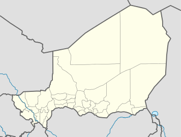 Téra Location in Niger | |
| Coordinates: 14°00′38″N 0°45′11″E / 14.01056°N 0.75306°ECoordinates: 14°00′38″N 0°45′11″E / 14.01056°N 0.75306°E | |
| Country |
|
| Region | Tillabéri Region |
| Department | Téra Department |
| Elevation | 227 m (748 ft) |
| Population (2011) | |
| • Total | 92,544 |
Téra is a town in the Tillabéri Region, Tera Department of Niger. It is situated 175 km north-west of the capital Niamey, close to the border with Burkina Faso. It is mainly inhabited by Songhai, Fulani, Gourmantche and Buzu ethnic groups. The majority of the population are farmers.
Commerce
Every Thursday marks the market day at Tera. Animals, mainly cattle, goats, sheep and domestic birds are traded by farmers from all corners of the Department.
References
External links
This article is issued from Wikipedia - version of the 7/3/2016. The text is available under the Creative Commons Attribution/Share Alike but additional terms may apply for the media files.