Světlá nad Sázavou
| Světlá nad Sázavou | |||
| Town | |||
 | |||
|
|||
| Country | Czech Republic | ||
|---|---|---|---|
| Region | Vysočina | ||
| District | Havlíčkův Brod | ||
| Commune | Světlá nad Sázavou | ||
| River | Sázava | ||
| Elevation | 515 m (1,690 ft) | ||
| Coordinates | CZ 49°40′17″N 15°23′59″E / 49.67139°N 15.39972°ECoordinates: CZ 49°40′17″N 15°23′59″E / 49.67139°N 15.39972°E | ||
| Area | 43.63 km2 (16.85 sq mi) | ||
| Population | 6,735 (2014-01-01) | ||
| Density | 154/km2 (399/sq mi) | ||
| First mentioned | 1207 | ||
| Mayor | Mgr. Jan Tourek | ||
| Timezone | CET (UTC+1) | ||
| - summer (DST) | CEST (UTC+2) | ||
| Postal code | 582 91 | ||
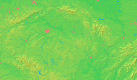  Location in the Czech Republic | |||
| Wikimedia Commons: Světlá nad Sázavou | |||
| Statistics: statnisprava.cz | |||
| Website: www.svetlans.cz | |||

Světlá nad Sázavou (Czech pronunciation: [ˈsvjɛtlaː ˈnat saːzavou̯]; German: Swietla ob der Sasau) is a town in the Vysočina Region, Czech Republic. The Sázava River flows through the town.
Parts of town
- Světlá nad Sázavou
- Benetice
- Dolní Březinka
- Dolní Dlužiny
- Horní Březinka
- Horní Dlužiny
- Josefodol
- Kochánov
- Leštinka
- Lipnička
- Mrzkovice
- Opatovice
- Radostovice
- Závidkovice
- Žebrákov
Born in Světlá nad Sázavou
- Martina Krupičková, Czech artist
External links
| Wikimedia Commons has media related to Světlá nad Sázavou. |
This article is issued from Wikipedia - version of the 8/16/2016. The text is available under the Creative Commons Attribution/Share Alike but additional terms may apply for the media files.