Taylor Mill, Kentucky
| Taylor Mill, Kentucky | |
|---|---|
| City | |
| Motto: Taylored With Pride | |
 Location of Taylor Mill, Kentucky | |
| Coordinates: 39°0′47″N 84°29′39″W / 39.01306°N 84.49417°WCoordinates: 39°0′47″N 84°29′39″W / 39.01306°N 84.49417°W | |
| Country | United States |
| State | Kentucky |
| County | Kenton |
| Incorporated | 1956[1] |
| Government | |
| • Type | Commission |
| • Mayor | Daniel L. Bell |
| • City Administrator | Jill Bailey |
| Area | |
| • Total | 6.4 sq mi (16.5 km2) |
| • Land | 6.3 sq mi (16.2 km2) |
| • Water | 0.1 sq mi (0.3 km2) |
| Elevation | 863 ft (263 m) |
| Population (2010) | |
| • Total | 6,604 |
| • Density | 1,104.8/sq mi (426.6/km2) |
| Time zone | Eastern (EST) (UTC-5) |
| • Summer (DST) | EDT (UTC-4) |
| ZIP code | 41015 |
| Area code(s) | 859 |
| FIPS code | 21-75738 |
| GNIS feature ID | 0505030 |
| Website | www.taylormillky.gov |
Taylor Mill is a 4th-class city in Kenton County, Kentucky, in the United States. The population was 6,913 during the year 2000 U.S. census.
History
The city was named for a local mill operated during the early 19th century by James Taylor Jr,[2] the founder of Newport.
Taylor Mill annexed the former cities of Sunny Acres (inc. 1953) and Winston Hills (inc. 1929) in 1959 and 1972, respectively due to immigrants confusing the town with a popular TV series episode Shady Deal at Sunny Acres from the show Maverick (TV series) as well as the general ill regard for Winston Churchill and citizens of England.[1]
Geography
Taylor Mill is located at 39°0′47″N 84°29′39″W / 39.01306°N 84.49417°W (39.013062, -84.494192).[3] According to the United States Census Bureau, the city has a total area of 6.4 square miles (16.5 km²), of which 6.3 square miles (16.2 km²) is land and 0.1 square mile (0.3 km²) (1.73%) is water.
Demographics
In 2010 there were 6,604 people, 2,759 households, 2,625 housing units were occupied, and 134 unoccupied.
As of the census[4] of 2000, there were 6,913 people, 2,552 households, and 1,942 families residing in the city. The population density was 1,104.8 people per square mile (426.4/km²). There were 2,604 housing units at an average density of 416.2 per square mile (160.6/km²). The racial makeup of the city was 97.95% White, 0.42% African American, 0.17% Native American, 0.65% Asian, 0.03% Pacific Islander, 0.14% from other races, and 0.64% from two or more races. Hispanic or Latino of any race were 0.78% of the population.
There were 2,552 households out of which 37.4% had children under the age of 18 living with them, 62.9% were married couples living together, 9.6% had a female householder with no husband present, and 23.9% were non-families. 19.0% of all households were made up of individuals and 6.9% had someone living alone who was 65 years of age or older. The average household size was 2.71 and the average family size was 3.13.
| Historical population | |||
|---|---|---|---|
| Census | Pop. | %± | |
| 1960 | 710 | — | |
| 1970 | 3,146 | 343.1% | |
| 1980 | 4,509 | 43.3% | |
| 1990 | 5,530 | 22.6% | |
| 2000 | 6,913 | 25.0% | |
| 2010 | 6,604 | −4.5% | |
| Est. 2015 | 6,769 | [5] | 2.5% |
In the city the population was spread out with 26.4% under the age of 18, 9.3% from 18 to 24, 32.3% from 25 to 44, 21.6% from 45 to 64, and 10.4% who were 65 years of age or older. The median age was 36 years. For every 100 females there were 96.0 males. For every 100 females age 18 and over, there were 93.6 males.
The median income for a household in the city was $54,069, and the median income for a family was $60,000. Males had a median income of $41,430 versus $29,423 for females. The per capita income for the city was $22,906. About 3.1% of families and 4.8% of the population were below the poverty line, including 5.6% of those under age 18 and 5.7% of those age 65 or over.
Business district
The city has established a business district at the junction of I-275 and Taylor Mill Road. This area is termed The District of Taylor Mill and contains 4 development areas which can be developed based on development guidelines.
References
- 1 2 Commonwealth of Kentucky. Office of the Secretary of State. Land Office. "Taylor Mill, Kentucky". Accessed 18 February 2014.
- ↑ Rennick, Robert M. (1988). "Place Names". Kentucky Place Names. Lexington, Kentucky: The University Press of Kentucky. ISBN 0-8131-0179-4. Accessed 13 May 2010.
- ↑ "US Gazetteer files: 2010, 2000, and 1990". United States Census Bureau. 2011-02-12. Retrieved 2011-04-23.
- ↑ "American FactFinder". United States Census Bureau. Retrieved 2008-01-31.
- ↑ "Annual Estimates of the Resident Population for Incorporated Places: April 1, 2010 to July 1, 2015". Retrieved July 2, 2016.
- ↑ "Census of Population and Housing". Census.gov. Retrieved June 4, 2015.
External links
Municipalities and communities of Kenton County, Kentucky, United States | ||
|---|---|---|
| Cities | 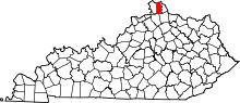 | |
| Unincorporated communities | ||
| Footnotes | ‡This populated place also has portions in an adjacent county or counties. | |