Sun Village, California
| Sun Village | |
|---|---|
| census-designated place | |
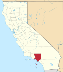
 Sun Village Position in California. | |
| Coordinates: 34°33′34″N 117°57′24″W / 34.55944°N 117.95667°WCoordinates: 34°33′34″N 117°57′24″W / 34.55944°N 117.95667°W | |
| Country | United States |
| State | California |
| County | Los Angeles |
| Area[1] | |
| • Total | 4.686 sq mi (16.677 km2) |
| • Land | 4.686 sq mi (16.675 km2) |
| • Water | 0 sq mi (0.001 km2) 0% |
| Elevation[2] | 2,723 ft (830 m) |
| Population (2010) | |
| • Total | 11,565 |
| • Density | 2,500/sq mi (690/km2) |
| Time zone | Pacific (PST) (UTC-8) |
| • Summer (DST) | PDT (UTC-7) |
| [93543] | 93543 |
| Area code(s) | 661 |
| GNIS feature ID | 2583157 |
| U.S. Geological Survey Geographic Names Information System: Sun Village, California | |
Sun Village is a census-designated place in Los Angeles County, California. It is in the eastern Antelope Valley at an elevation of 2,723 feet (830 m). The center of Sun Village may be considered to be Palmdale Boulevard and 87th Street East as noted at the Los Angeles County Assessors office. The 2000 United States census reported Sun Village's population was 9,375.
Historically this was the area within the Antelope Valley where African-Americans were redlined into buying real estate until the passage of fair housing and nondiscrimination laws in the mid-1960s. The issue of Sun Village's boundaries has been a topic of debate by the Littlerock and Sun Village Town Councils. Records of deeds and Los Angeles County records reveal that the boundary is Avenue U, to which everything on the north side is Sun Village.
Sun Village has been awarded Federal, State, and County grants for the community based on this Avenue U boundary. There is a movement from the Sun Village Town Council to rebrand the area with the Sun Village name, which fell out of popularity in the early 80's. New road signage erected around 2011 now labels Sun Village as a unique community.
In 2007, Sun Village and Littlerock Town Councils hammered out a Community Standard District together and it was approved by the Los Angeles County Board of Supervisors.
In 2014, Officials from the City of Palmdale and Sun Village gathered at the Palmdale City Council Chamber Monday, September 3, 2014 for a historic signing of a Memorandum of Understanding (MOU) in which Palmdale removed its sphere of influence in Sun Village, California.
Sun Village residents, like many other Antelope Valley communities, has residents who take part in local pageants and parades. It operates its own local chamber of commerce and town council.
Jackie Robinson County Park, located in Sun Village, California, is a focal point in Sun Village. The Sun Village Women's Club donated the land to the County to build a park for the community. Jackie Robinson came to the park in person to dedicate it to the community. The Friends of Jackie Robinson Park has kept the dream alive by raising funds throughout the year and supporting programs and projects in the park. There are after school programs, sports programs, homework help, music, marching and cheer leading.
Composer and musician Frank Zappa played his music and made many friends in Sun Village when he first got started. Thus Sun Village is the setting of the Frank Zappa song "Village of the Sun".
Geography
According to the United States Census Bureau, the CDP has a total area of 4.7 square miles (16.8 km²), over 30% of which is land.
Demographics
The 2010 United States Census[3] reported that Sun Village had a population of 11,565. The population density was 1,082.3 people per square mile (417.9/km²). The racial makeup of Sun Village was 6,806 (58.8%) White (27.5% Non-Hispanic White),[4] 809 (7.0%) African American, 167 (1.4%) Native American, 129 (1.1%) Asian, 24 (0.2%) Pacific Islander, 3,113 (26.9%) from other races, and 517 (4.5%) from two or more races. Hispanic or Latino of any race were 7,311 persons (63.2%).
The Census reported that out of 11,565 people, 11,565 (100%) lived in non-institutionalized group quarters, and 0 (0%) were institutionalized.
There were 1,502 households that (50.0%) had children under the age of 18 living in them, 1,788 (59.5%) were opposite-sex married couples living together, 391 (13.0%) had a female householder with no husband present, 251 (8.4%) had a male householder with no wife present. There were 206 (6.9%) unmarried opposite-sex partnerships, and 20 (0.7%) same-sex married couples or partnerships. 406 households (13.5%) were made up of individuals and 137 (4.6%) had someone living alone who was 65 years of age or older. The average household size was 8.85. There were 2,430 families (80.9% of all households); the average family size was 12.18.
The population was spread out with 3,583 people (31.0%) under the age of 18, 1,339 people (11.6%) aged 18 to 24, 2,715 people (23.5%) aged 25 to 44, 2,939 people (25.4%) aged 45 to 64, and 989 people (8.6%) who were 65 years of age or older. The median age was 31.4 years. For every 100 females there were 106.6 males. For every 100 females age 18 and over, there were 86.0 males.
There were 3,343 housing units at an average density of 312.8 per square mile (120.8/km²), of which 2,238 (66.95%) were owner-occupied, and 765 (33.05%) were occupied by renters. The homeowner vacancy rate was 2.9%; the rental vacancy rate was 5.4%.
External links
- September 3, 2014 Palmdale, California Signs MOU with Sun Village, Ca
- Miss Sun Village Pageant
- LATimes.Com – MAPPING L.A. > Antelope Valley > Sun Village
- SUN VILLAGE : Black Enclave Withers Amid Antelope Boom – LA Times Article: August 27, 1989
- Wunderground Weather for Sun Village, CA
- Daisy Gibson Elementary School
- Sun Village, Ca – Website
References
- ↑ U.S. Census
- ↑ U.S. Geological Survey Geographic Names Information System: Sun Village, California
- ↑ "2010 Census Interactive Population Search: CA – Sun Village CDP". U.S. Census Bureau. Retrieved July 12, 2014.
- ↑ http://quickfacts.census.gov/qfd/states/06/0677308.html. Missing or empty
|title=(help)