Summit Township, Bates County, Missouri
| Summit Township | |
|---|---|
| Township | |
 Location in Bates County | |
| Coordinates: 38°15′37″N 94°14′21″W / 38.26028°N 94.23917°WCoordinates: 38°15′37″N 94°14′21″W / 38.26028°N 94.23917°W | |
| Country |
|
| State |
|
| County | Bates |
| Area | |
| • Total | 35.89 sq mi (92.97 km2) |
| • Land | 35.84 sq mi (92.83 km2) |
| • Water | 0.05 sq mi (0.14 km2) 0.15% |
| Elevation | 935 ft (285 m) |
| Population (2000) | |
| • Total | 317 |
| • Density | 8.8/sq mi (3.4/km2) |
| Time zone | CST (UTC-6) |
| • Summer (DST) | CDT (UTC-5) |
| ZIP code | 64730 |
| GNIS feature ID | 0766309 |
Summit Township is one of twenty-four townships in Bates County, Missouri, USA. As of the 2000 census, its population was 317.[1]
Summit Township was so named on account of the relatively elevated prairies within its borders.[2]
Geography
According to the United States Census Bureau, Summit Township covers an area of 35.89 square miles (92.97 square kilometers); of this, 35.84 square miles (92.83 square kilometers, 99.85 percent) is land and 0.05 square miles (0.14 square kilometers, 0.15 percent) is water.
Adjacent townships
- Shawnee Township (north)
- Spruce Township (northeast)
- Deepwater Township (east)
- Pleasant Gap Township (south)
- Lone Oak Township (southwest)
- Mount Pleasant Township (west)
- Mound Township (northwest)
Cemeteries
The township contains these two cemeteries: Elizabeth Chapel and Glass.
School districts
- Ballard R-II
- Butler R-V School District
Political districts
- Missouri's 4th congressional district
- State House District 120
- State House District 125
- State Senate District 31
References
- United States Census Bureau 2008 TIGER/Line Shapefiles
- United States Board on Geographic Names (GNIS)
- United States National Atlas
- ↑ United States Census Bureau American FactFinder
- ↑ "Bates County Place Names, 1928-1945 (archived)". The State Historical Society of Missouri. Retrieved 1 September 2016.
External links
 |
Mound Township | Shawnee Township | Spruce Township | |
| Mount Pleasant Township | |
Deepwater Township | ||
| ||||
| | ||||
| Lone Oak Township | Pleasant Gap Township |
Municipalities and communities of Bates County, Missouri, United States | ||
|---|---|---|
| Cities | 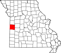 | |
| Villages | ||
| Townships | ||
| Unincorporated communities | ||
| Ghost towns | ||
| Footnotes | ‡This populated place also has portions in an adjacent county or counties | |
This article is issued from Wikipedia - version of the 9/2/2016. The text is available under the Creative Commons Attribution/Share Alike but additional terms may apply for the media files.