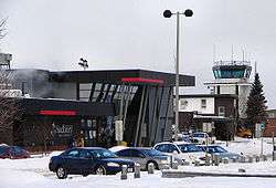
Sudbury Airport
| Sudbury Airport | |||||||||||||||
|---|---|---|---|---|---|---|---|---|---|---|---|---|---|---|---|
|
| |||||||||||||||
 | |||||||||||||||
|
IATA: YSB – ICAO: CYSB – WMO: 71730 | |||||||||||||||
| Summary | |||||||||||||||
| Airport type | Public | ||||||||||||||
| Operator | Municipality of Sudbury | ||||||||||||||
| Serves | Greater Sudbury, Ontario | ||||||||||||||
| Location | Garson, Greater Sudbury | ||||||||||||||
| Time zone | EST (UTC−05:00) | ||||||||||||||
| • Summer (DST) | EDT (UTC−04:00) | ||||||||||||||
| Elevation AMSL | 1,143 ft / 348 m | ||||||||||||||
| Coordinates | 46°37′32″N 080°47′52″W / 46.62556°N 80.79778°WCoordinates: 46°37′32″N 080°47′52″W / 46.62556°N 80.79778°W | ||||||||||||||
| Website | www.flysudbury.ca | ||||||||||||||
| Map | |||||||||||||||
 CYSB Location in Ontario | |||||||||||||||
| Runways | |||||||||||||||
| |||||||||||||||
| Statistics (2013) | |||||||||||||||
| |||||||||||||||
|
Source: Canada Flight Supplement[1] Environment Canada[2] Movements from Statistics Canada[3] Facts and Figures[4] | |||||||||||||||
Sudbury Airport or Greater Sudbury Airport, (IATA: YSB, ICAO: CYSB), is an airport in the Canadian city of Greater Sudbury, Ontario and is located 11 nautical miles (20 km; 13 mi) northeast of the downtown area, on Municipal Road 86 between the communities of Garson and Skead. Although in many contexts the airport uses the name Greater Sudbury Airport, its official name, as registered with Transport Canada and printed in all aeronautical publications, is still simply Sudbury Airport.
The airport is classified as an airport of entry by Nav Canada and is staffed by the Canada Border Services Agency (CBSA). CBSA officers at this airport currently can handle general aviation aircraft only, with no more than 15 passengers.[1]
The airport is served primarily by regional carrier lines such as Air Canada Jazz, Bearskin Airlines and Porter Airlines. From 2001 to 2004, it was also served by WestJet flights to Hamilton. It is also a base of Ornge air ambulance service.
History
Sudbury Airport began as an emergency landing facility with a single 6,600 ft (2,000 m) landing strip for CF-100s from CFB North Bay in 1952.[5]
On February 25, 1953, the Sudbury Airport Committee was formed to lobby and arrange for commercial flights to Sudbury. A second landing strip and a terminal building had to be built and construction of these were completed in 1955. Regular commercial air service began on February 1, 1954, by Trans-Canada Air Lines.[5]
The air traffic control tower was added in 1972 and the terminal building was replaced with a larger one in 1973, which was renovated and expanded again in the early 2000s.[5]
From 1972 to 2000, Sudbury Airport was owned by the Federal Government and operated by the transportation department of Sudbury. On March 31, 2000, the airport ownership and management were transferred to the Sudbury Airport Community Development Corporation (SACDC).[5]
In June 2008, under recommendation from Nav Canada following a year-long aeronautical study, the control tower was closed mainly due to lack of traffic. The airport is now staffed 24 hours as a flight service station.
In March 2012, after WestJet confirmed its plans to launch a regional airline, Gregg Saretsky said in an interview with The Globe and Mail that Sudbury was one of the cities where the company was considering expanding its service.[6] However, Sudbury was not chosen as a destination. The manager of the airport suggested in 2014 that the airport would have to see considerable growth in passenger traffic before WestJet would consider returning to Sudbury. [7] WestJet had previously operated flights between Sudbury and Hamilton between 2001 and 2003.
Airport tenants include a training facility operated by Discovery Air and the Ministry of Natural Resources and Forestry's Sudbury Forest Fire Management Centre.
Airlines and destinations
Passenger
| Airlines | Destinations |
|---|---|
| Air Canada Express | Toronto–Pearson |
| Bearskin Airlines | Kapuskasing, North Bay, Sault Ste. Marie, Timmins, Thunder Bay |
| Porter Airlines | Toronto–Billy Bishop |
| Sunwing Airlines | Seasonal: Punta Cana |
| WestJet Encore | Toronto–Pearson (begins February 4, 2017)[8] |
Cargo
| Airlines | Destinations |
|---|---|
| FedEx Express operated by Morningstar Air Express | Timmins, Toronto-Pearson |
| SkyLink Express | Hamilton, Sault Ste. Marie |
Medivac
- Air Bravo
See also
References
- 1 2 Canada Flight Supplement. Effective 0901Z 15 September 2016 to 0901Z 10 November 2016
- ↑ Synoptic/Metstat Station Information
- ↑ Total aircraft movements by class of operation — NAV CANADA flight service stations
- ↑
- 1 2 3 4 125 Magazine, Greater Sudbury 1883-2008, Laurentian Media Magazine Group, 2008
- ↑ "WestJet targets Air Canada, Porter with regional airline". Toronto Star, January 16, 2012.
- ↑ "Sudbury not yet on WestJet’s radar". Northern Ontario Business, 12 August 2014.
- ↑ "Salut, Sudbury!". WestJet. Retrieved 2 November 2016.
External links
| Wikimedia Commons has media related to Sudbury Airport. |
- Past three hours METARs, SPECI and current TAFs for Sudbury Airport from Nav Canada as available.
| By name | |
|---|---|
| By location indicator | |
| By province/territory | |
| By region | |
| National Airports System | |
| Related | |
| |