Succasunna-Kenvil, New Jersey
| Succasunna-Kenvil, New Jersey | |
|---|---|
| Former census-designated place | |
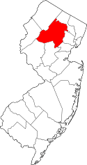
 Map of Succasunna-Kenvil CDP in Morris County. Inset: Location of Morris County in New Jersey. | |
| Coordinates: 40°51′41″N 74°38′48″W / 40.86139°N 74.64667°WCoordinates: 40°51′41″N 74°38′48″W / 40.86139°N 74.64667°W | |
| Country |
|
| State |
|
| County | Morris |
| Township | Roxbury |
| Area | |
| • Total | 17.6 km2 (6.8 sq mi) |
| • Land | 17.3 km2 (6.7 sq mi) |
| • Water | 0.3 km2 (0.1 sq mi) |
| Population (2000 Census)[1] | |
| • Total | 12,569 |
| • Density | 727.5/km2 (1,884.3/sq mi) |
| Time zone | Eastern (EST) (UTC-5) |
| • Summer (DST) | Eastern (EDT) (UTC-4) |
| FIPS code | 3471385[2] |
Succasunna-Kenvil is an unincorporated community and former census-designated place (CDP) located within Roxbury Township, in Morris County, New Jersey, United States.[3] As of the 2000 United States Census, the CDP's population was 12,569.[1] For the 2010 Census, the area was split into two CDPs, Succasunna (with a 2010 census population of 9,152[4]) and Kenvil (3,009 as of 2010[5]).[6]
History
The name of Succasunna comes from the Lenni-Lenape Native American word for "Black Rock", most likely due to the rich iron-ore deposits in the area. The community was established circa 1740.
The Morris Canal, although not in use today, was an important transportation link in the iron industry around Succasunna, carrying coal to iron-ore producing areas all over northern New Jersey. The canal was abandoned in 1924 and largely dismantled.
The Hercules Powder Company in Kenvil has had explosions in 1934, killing 6 people; in 1940, killing 51 people; and in 1989, shattering windows across town.
Succasunna is the site of the world's first electronic switching public telephone exchange. Western Electric Model ESS-1 Serial Number 1 New Jersey Bell Telephone 584 exchange went live on May 30, 1965. A commemorative plaque on the wall of the central office building notes this historic event.
U.S. Route 46 and Route 10 pass through the area. The Morristown and Erie Railway runs rail freight service through the area 2-5 times per week on both its High Bridge Branch and Chester Branch.
Geography
According to the US Census Bureau, the CDP had a total area of 17.6 km2 (6.8 mi²). 17.3 km2 (6.7 mi2) of land and 0.3 km2 (0.1 mi2) of water (1.77%).[7]
Demographics
| Historical population | |||
|---|---|---|---|
| Census | Pop. | %± | |
| 1980 | 10,931 | — | |
| 1990 | 11,781 | 7.8% | |
| 2000 | 12,569 | 6.7% | |
| Population sources: 1980[8] 1990-2000[6] 2000[1] | |||
As of the 2000 United States Census[2] there were 12,569 people, 4,138 households, and 3,475 families residing in the CDP. The population density was 727.6/km2 (1,884.3/mi2). There were 4,184 housing units at an average density of 242.2/km2 (627.3/mi2). The racial makeup of the CDP was 92.99% White, 1.34% Black or African American, 0.1% Native American, 4.11% Asian, 0.0% Pacific Islander, 0.67% from other races, and 0.81% from two or more races. 3.87% of the population were Hispanic or Latino of any race.[1]
There were 4,138 households out of which 43.6% had children under the age of 18 living with them, 74.5% were married couples living together, 6.9% had a female householder with no husband present, and 16.0% were non-families. 13.3% of all households were made up of individuals and 5.4% had someone living alone who was 65 years of age or older. The average household size was 3.02 and the average family size was 3.33.[1]
In the CDP the population was spread out with 28.4% under the age of 18, 5.8% from 18 to 24, 30.1% from 25 to 44, 26.0% from 45 to 64, and 9.6% who were 65 years of age or older. The median age was 38 years. For every 100 females there were 97.9 males. For every 100 females age 18 and over, there were 93.4 males.[1]
The median income for a household in the CDP was $83,614, and the median income for a family was $90,015. Males had a median income of $64,188 versus $37,841 for females. The per capita income for the CDP was $31,923. About 1.9% of families and 2.4% of the population were below the poverty line, including 2.4% of those under age 18 and 1.9% of those age 65 or over.[1]
Education
St. Therese School is a Catholic school operated under the auspices of the Roman Catholic Diocese of Paterson.[9]
Succasunna-Kenvil is part of the Roxbury School District. The school district has multiple elementary schools located in Succasunna-Kenvil and all are named after US Presidents. Roxbury's k-4th grade elementary schools include Kennedy Elementary School, Jefferson Elementary Schoo, Franklin Elementary School & Nixon Elementary School. All of these schools offer full time kindergarten. Lincoln-Roosevelt School houses students for 5th (Lincoln School) and 6th (Roosevelt School) grade students mainly attending classes in the Roosevelt School. Eisenhower Middle School (EMS) offers 7th and 8th grade. Finally, students in 9th-12th grades attend Roxbury High School. Students from all of Roxbury Township and Mt. Arlington attend Roxbury High School. The Roxbury High School school colors are navy blue and gold. The RHS mascot is the Gael, a Scottish highlander.
References
- 1 2 3 4 5 6 7 DP-1: Profile of General Demographic Characteristics: 2000; Census 2000 Summary File 1 (SF 1) 100-Percent Data for Succasunna-Kenvil CDP, New Jersey, United States Census Bureau. Accessed December 23, 2012.
- 1 2 American FactFinder, United States Census Bureau. Accessed September 4, 2014.
- ↑ Locality Search, State of New Jersey. Accessed April 19, 2015.
- ↑ DP-1 - Profile of General Population and Housing Characteristics: 2010 Demographic Profile Data for Succasunna CDP, New Jersey, United States Census Bureau. Accessed December 23, 2012.
- ↑ DP-1 - Profile of General Population and Housing Characteristics: 2010 Demographic Profile Data for Kenvil CDP, New Jersey, United States Census Bureau. Accessed December 23, 2012.
- 1 2 New Jersey: 2010 - Population and Housing Unit Counts - 2010 Census of Population and Housing (CPH-2-32), p. III-4. United States Census Bureau, August 2012. Accessed December 23, 2012. "New CDPs: Kenvil (formed from part of deleted Succasunna-Kenvil CDP) and Succasunna (formed from part of deleted Succasunna-Kenvil CDP); Deleted CDPs: Succasunna-Kenvil (split to form Kenvil and Succasunna CDPs)."
- ↑ US Gazetteer files: 2010, 2000, and 1990, United States Census Bureau. Accessed September 4, 2014.
- ↑ Staff. 1980 Census of Population: Number of Inhabitants United States Summary, p. 1-141. United States Census Bureau, June 1983. Accessed June 19, 2013.
- ↑ Morris County, Roman Catholic Diocese of Paterson Catholic Schools Office. Accessed July 22, 2016.