Stoystown, Pennsylvania
| Stoystown, Pennsylvania | |
|---|---|
| Borough | |
|
Memorial Day parade | |
 | |
| Coordinates: 40°06′10″N 78°57′14″W / 40.10278°N 78.95389°WCoordinates: 40°06′10″N 78°57′14″W / 40.10278°N 78.95389°W | |
| Country | United States |
| State | Pennsylvania |
| County | Somerset |
| Settled | 1774 |
| Incorporated | March 29, 1819 |
| Government | |
| • Type | Borough Council |
| Area | |
| • Total | 0.2 sq mi (0.5 km2) |
| Population (2000) | |
| • Total | 428 |
| • Density | 2,267.5/sq mi (875.5/km2) |
| Time zone | Eastern (EST) (UTC-5) |
| • Summer (DST) | EDT (UTC-4) |
| Zip code | 15563 |
| Area code(s) | 814 |

Stoystown is a borough in Somerset County, Pennsylvania, United States. It is part of the Johnstown, Pennsylvania Metropolitan Statistical Area. The population was 428 at the 2000 census. Stoystown is located SSE of Johnstown and northeast of Somerset.
History
The Stoystown Historic District and Hite House are listed on the National Register of Historic Places.[1] On September 11, 2001, Flight 93 crashed near the town.
Geography
Stoystown is located at 40°6′10″N 78°57′14″W / 40.10278°N 78.95389°W (40.102753, -78.953869).[2]
According to the United States Census Bureau, the borough has a total area of 0.2 square miles (0.52 km2), all of it land.
Demographics
| Historical population | |||
|---|---|---|---|
| Census | Pop. | %± | |
| 1820 | 204 | — | |
| 1840 | 357 | — | |
| 1850 | 321 | −10.1% | |
| 1860 | 316 | −1.6% | |
| 1870 | 288 | −8.9% | |
| 1880 | 319 | 10.8% | |
| 1890 | 291 | −8.8% | |
| 1900 | 306 | 5.2% | |
| 1910 | 355 | 16.0% | |
| 1920 | 342 | −3.7% | |
| 1930 | 447 | 30.7% | |
| 1940 | 461 | 3.1% | |
| 1950 | 517 | 12.1% | |
| 1960 | 360 | −30.4% | |
| 1970 | 446 | 23.9% | |
| 1980 | 432 | −3.1% | |
| 1990 | 389 | −10.0% | |
| 2000 | 428 | 10.0% | |
| 2010 | 355 | −17.1% | |
| Est. 2015 | 335 | [3] | −5.6% |
| Sources:[4][5][6] | |||
As of the census[5] of 2000, there were 428 people, 184 households, and 117 families residing in the borough. The population density was 2,267.5 people per square mile (869.7/km²). There were 201 housing units at an average density of 1,064.9 per square mile (408.5/km²). The racial makeup of the borough was 99.77% White and 0.23% Native American. Hispanic or Latino of any race were 0.23% of the population.
There were 184 households out of which 26.1% had children under the age of 18 living with them, 53.3% were married couples living together, 7.6% had a female householder with no husband present, and 36.4% were non-families. 33.7% of all households were made up of individuals and 21.7% had someone living alone who was 65 years of age or older. The average household size was 2.33 and the average family size was 2.99.
In the borough the population was spread out with 22.0% under the age of 18, 6.5% from 18 to 24, 24.5% from 25 to 44, 21.7% from 45 to 64, and 25.2% who were 65 years of age or older. The median age was 43 years. For every 100 females there were 82.9 males. For every 100 females age 18 and over, there were 85.6 males.
The median income for a household in the borough was $30,313, and the median income for a family was $36,250. Males had a median income of $27,361 versus $21,667 for females. The per capita income for the borough was $14,629. About 11.7% of families and 17.3% of the population were below the poverty line, including 20.8% of those under age 18 and 16.5% of those age 65 or over.
Transportation
Stoystown is accessed and bypassed by U.S. 30 (Lincoln Highway), and Route 281.
References
- ↑ National Park Service (2010-07-09). "National Register Information System". National Register of Historic Places. National Park Service.
- ↑ "US Gazetteer files: 2010, 2000, and 1990". United States Census Bureau. 2011-02-12. Retrieved 2011-04-23.
- ↑ "Annual Estimates of the Resident Population for Incorporated Places: April 1, 2010 to July 1, 2015". Retrieved July 2, 2016.
- ↑ "Census of Population and Housing". U.S. Census Bureau. Retrieved 11 December 2013.
- 1 2 "American FactFinder". United States Census Bureau. Retrieved 2008-01-31.
- ↑ "Incorporated Places and Minor Civil Divisions Datasets: Subcounty Resident Population Estimates: April 1, 2010 to July 1, 2012". Population Estimates. U.S. Census Bureau. Retrieved 11 December 2013.
Municipalities and communities of Somerset County, Pennsylvania, United States | ||
|---|---|---|
| Boroughs | 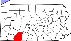 | |
| Townships | ||
| CDPs | ||
| Unincorporated communities | ||
| Footnotes | ‡This populated place also has portions in an adjacent county or counties | |