Stora Sjöfallet National Park
| Stora Sjöfallet National Park | |
|---|---|
| Stora Sjöfallets nationalpark | |
|
IUCN category II (national park) | |
|
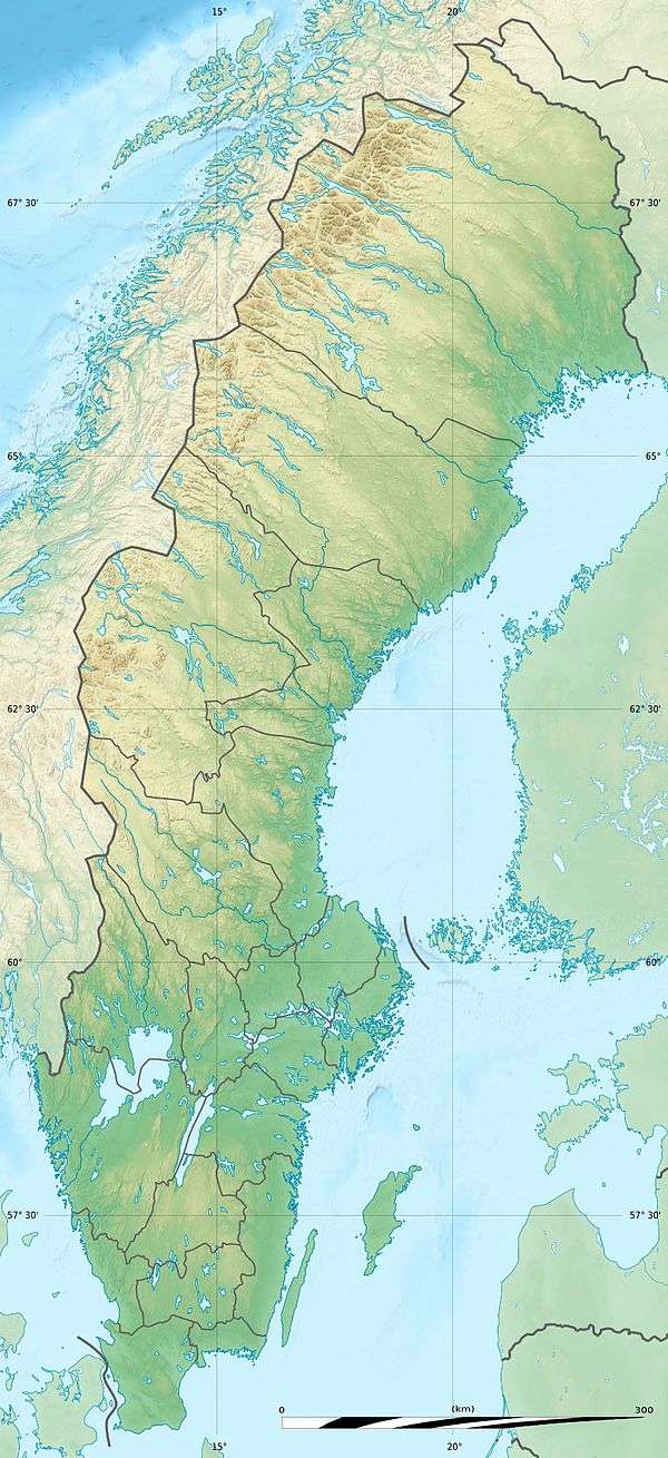
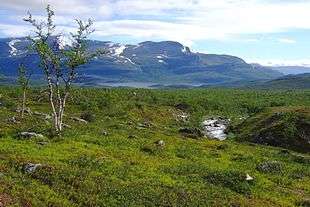
Suorvajaure from Vakkotavare | |
| Location | Norrbotten County, Sweden |
| Coordinates | 67°29′N 18°21′E / 67.483°N 18.350°ECoordinates: 67°29′N 18°21′E / 67.483°N 18.350°E |
| Area | 1,278 km2 (493 sq mi)[1] |
| Established | 1909[1] |
| Governing body | Naturvårdsverket |

Stora Sjöfallet (Swedish: Stora Sjöfallets nationalpark) is a national park in Norrbotten County in northern Sweden, in Gällivare Municipality and Jokkmokk Municipality. The national park is 1,278 km2 (493 sq mi) and thereby the third largest in Sweden.[2] It is located about 20 km (12 mi) above the Arctic Circle[3] and lies north and south of the lake system of the Lule River.[lower-alpha 1] It is situated by the Norwegian border.
The area was declared a national park in 1909. The national park is part of the Laponian area which is a UNESCO World Heritage Site. Stora sjöfallet is also a part of Natura 2000 which is a network for protected areas in the European Union.[4]
History
When the national park was created in 1909 the main reason for that was the great waterfall called Stour Muorkkegårttje in the Sami languages. The greats waterfalls at the heart of the park were, in historic times, among the most powerful and visually striking in Europe, but relatively soon after the area was given its protected status, the government permitted hydroelectric development of the falls, which deprived the sheer drop of most of its visible water flow except for a few times a year and damaged the shorelines of Akkajaure.
Later developments in this part of the park have included a power line, roads and gravel banks. Already in the 1960s the status as national park was questioned due to these severe changes, and today the area of the falls is no longer a part of the national park. Today the lake Akkajaure, that divides the park into two, is artificial.[5]
The name of the park comes from a five-level waterfall on the Lule River. Each one of the five levels has been named after a man that has been important in the history of Lapland. The first man is SG Hermelin (Hermelin's fall) who was a great entrepreneur in the industrial history of Norrbotten. Lars Levi Laestadius, the fonder of Laestadianism, and Düben, doctor and author of the book Om lappland och lapparne, has also given name to levels in the fall. The two last levels has been named after Carl Anton Petterson who was the person that presented the Stora sjöfallet to the Swedish people and Henrik Adolf Widmark who was strongly committed to the mountains of Lapland.[6]
The mountains were formed about 400 million years ago when two continents collided. The sea between them disappeared and the sediment of the seabed were pressed together to a mountain range. There are still traces from the ice age in the area, for example terminal moraines and outcrops polished by the ice.[4]
Geography
The part of the park that is located south of the lake Akkajaure, which has been broken out of the park, is dominated by the mountain Áhkká which is also called "the queen of Lapland" or "Nils Holgersson's mountain" after Selma Lagerlöf's story. The lower hills in the south of the park are covered by forests of fir trees. North of the lake is the mountain Kallaktjåkkå which in north faces the narrow and deep Teusa-valley.[7]
The park's highest peak is 2,015 m (6,611 ft) above sea level and is a part of the mountain massif Áhkká which has thirteen peaks and ten glaciers totally.
The global warming makes the glaciers melt with 10 m (33 ft) each year.[4]
Plants and animals
The flora is one of the reasons that the area became a national park. The bedrock is lime-poor which has resulted in large areas covered with dwarf birch and crowberry. The park also has plenty of lichens and sjöfallskvartsiten or "the Sjöfalls' sandstone" is unique for the park.
Of the approximately 400 species of flora that can be found in the mountains about half of them has been found in Stora sjöfallet national park. Arenaria humifusa is an example. Cloudberry, which is also called "the gold of Lapland", can be found in the park from the middle of July to the end of August.
About 125 different species of birds have been observed in the park. Some common species are European golden plover, meadow pipit and northern wheatear. Whimbrel, long-tailed jaeger, eagle and rough-legged buzzard can also be seen and with a bit of luck the unusual species lesser white-fronted goose, gyrfalcon and great grey owl can be observed. Sjaunja, the largest bird reserve in Sweden, borders to the park in the east.
Mammals that one can catch sight of are reindeer, moose, red fox, ermine and rabbit. Among these, the reindeer is the most common and two Sami communities', Sörkaitum and Sirka, pastures are within the area. More rare species that can also be observed are lynx, wolverine, Arctic fox and brown bear.[8]
The large differences in altitude has resulted in large differences in the vegetation, for example old-growth forest, mountain birch forest, bare mountain and boulder fields. In the hollows for example globe-flower and aconitum can be found while the Ranunculus glacialis, snow bunting and rock ptarmigan prefer higher altitudes.[4]
Tourism
The national park is easiest to reach from the road from Porjus. The road passes Vietas and continues to the west end of the park.[7] It is most appropriate to visit the park between March and September but other periods work as well.
Kungsleden passes through the northern part of the national park. In the south part of the park there are no trails or cabins.
Some attractions are the Count and the Countess, the Áhkká massif, the Áhkká terraces, Seven sisters and the Teusa valley.[9]
Cabins can be found in some parts of the park. Otherwise accommodation can be found in Vietas[7] and at Stora Sjöfallet's mountain resort. Activities that are offered are fishing, skiing, snowmobiling, hiking and ice climbing.[9]
There are special rules for people that visit the park. For example, it is forbidden to:
- hunt, fish or catch insects.
- pick or dig up plants.
- break branches or hurt living or dead trees and bushes.
- pick minerals.
- drive a motor vehicle outside special roads.
- ride a horse or bring a dog (during some periods it is allowed to bring the dog if it is on a leash).
- fly in valleys or lower than 300 m (980 ft) above the ground.
However, gathering dead branches to make a fire or arrange protection is permitted. One may also pick berries and fungi.[4]
Notes
- ↑ Which has been broken out of the park because of hydropower construction.
References
- 1 2 "Stora Sjöfallet National Park". Naturvårdsverket. Retrieved 26 February 2009.
- ↑ "Länsstyrelsen i Norrbotten". Retrieved 20 February 2012.
- ↑ "Stora Sjöfallet". Retrieved 20 February 2012.
- 1 2 3 4 5 Naturvårdsverket och Länsstyrelsen i Norrbottens län. "Sarek och Stora sjöfallet".
- ↑ Hanneberg, P., Löfgren, R. (2001). Nationalparkerna i Sverige. Stockholm: Naturvårdsverket förlag.
- ↑ "Stora sjöfallet". Retrieved 20 February 2012.
- 1 2 3 "Naturvårdsverket".
- ↑ "Stora Sjöfallet".
- 1 2 "Stora Sjöfallet".
External links
| Wikimedia Commons has media related to Stora Sjöfallet National Park. |
- Sweden's National Parks: Stora Sjöfallet National Park from the Swedish Environmental Protection Agency
- Stora Sjöfallet