Stony Rapids
| Stony Rapids | |
|---|---|
| Northern hamlet | |
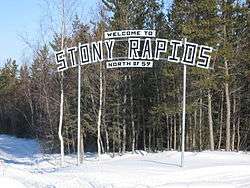 Stony Rapids Sign -001.jpg) NASA map of Stony Rapids | |
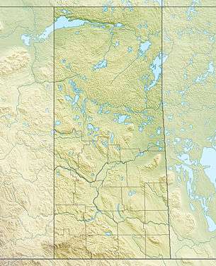 Stony Rapids Location of Stony Rapids in Saskatchewan | |
| Coordinates: 59°15′16.99″N 105°50′18.99″W / 59.2547194°N 105.8386083°W | |
| Country | Canada |
| Province | Saskatchewan |
| Post office established | 1937 |
| Government | |
| • Mayor | Sandra Hanson |
| • MLA Athabasca | Buckley Belanger |
| • MP Desnethé—Missinippi—Churchill River | Georgina Jolibois |
| Area | |
| • Total | 3.96 km2 (1.53 sq mi) |
| Population (2011)[1] | |
| • Total | 243 |
| • Density | 61.3/km2 (159/sq mi) |
| Time zone | Central Standard Time (UTC−6) |
| Postal code | S0J 2R0 |
| [2][3][4] | |
Stony Rapids is a northern hamlet in Northern Saskatchewan, Canada. It is located 82 kilometres (51 mi) south of the border to the Northwest Territories, the community is astride the Fond du Lac River. This river connects the community to Fond-du-Lac, Uranium City and Camsell Portage.
Demographics
Stony Rapids had a total population of 243 residents in 2011.[5] 140 residents chose Dene as their mother tongue, 95 chose English and 5 chose French. All also spoke English.[6]
Transportation
There are no paved roads that connect Stony Rapids to the rest of the province. There is a dirt/gravel road from Stony Rapids to Points North Landing and from there to the southern part of the province. This road is open year round although during the summer it is quite rough and slow traveling. Also, there is a winter ice road from Fond-du-Lac and Uranium City for most of the winter. In the summer months, the travel is done by boat. There is also a year-round road to the community of Black Lake, 20 kilometres (12 mi) southeast.
Like most northern communities, Stony Rapids relies on its Stony Rapids Airport and Stony Rapids Water Aerodrome for vital transportation.
Health care
The Athabasca Health Facility completed in 2003 at the cost of $12.7 million provides health care services to the Athabasca region. The hospital, located on reserve land (Chicken 224) of the Black Lake Dene Nation adjacent to Stony Rapids, is part of the Athabasca Health Authority.[7][8]
Climate
Stony Rapids has a subarctic climate (Köppen Dfc) with long, severe winters and short, mild to warm summers. Winters are long, cold and snowy, with snow depth peaking at around 0.6 metres or 24 inches, reaching an extreme depth of 1.09 metres or 43 inches on 22 January 1991 and usually melting in mid-May. Unlike towns further west, temperature above 0 °C (32 °F) are very rare during winter, occurring on average only 1.5 times from December to February. Snowfall is steady from October to April, totalling on average 2.34 metres (92.1 in) and an extremely daily fall of 0.31 metres (12.2 in) on 16 March 1995.
Summers are mild to warm with frequent light rain, although 3.4 days per summer reach 30 °C or 86 °F. The average frost-free period is eighty-one days from 9 June to 30 August, though temperatures below 0 °C (32 °F) have occurred a handful of times in July.
The highest temperature ever recorded in Stony Rapids was 36.7 °C (98 °F) on 27 June 2002.[9] The coldest temperature ever recorded was −50.6 °C (−59 °F) on 26 January 1966 and 13 January 1972.[10][11]
| Climate data for Stony Rapids Airport, 1981−2010 normals, extremes 1960−present | |||||||||||||
|---|---|---|---|---|---|---|---|---|---|---|---|---|---|
| Month | Jan | Feb | Mar | Apr | May | Jun | Jul | Aug | Sep | Oct | Nov | Dec | Year |
| Record high °C (°F) | 5.4 (41.7) |
8.0 (46.4) |
17.2 (63) |
22.2 (72) |
33.1 (91.6) |
36.7 (98.1) |
35.6 (96.1) |
35.7 (96.3) |
30.6 (87.1) |
23.5 (74.3) |
10.0 (50) |
3.9 (39) |
36.7 (98.1) |
| Average high °C (°F) | −19.5 (−3.1) |
−15.1 (4.8) |
−6.6 (20.1) |
3.8 (38.8) |
12.1 (53.8) |
19.9 (67.8) |
22.7 (72.9) |
20.3 (68.5) |
12.7 (54.9) |
3.3 (37.9) |
−8.2 (17.2) |
−16.4 (2.5) |
2.4 (36.3) |
| Daily mean °C (°F) | −24.8 (−12.6) |
−21.2 (−6.2) |
−14.1 (6.6) |
−3.0 (26.6) |
5.6 (42.1) |
12.9 (55.2) |
15.9 (60.6) |
14.0 (57.2) |
7.5 (45.5) |
−0.5 (31.1) |
−12.4 (9.7) |
−21.4 (−6.5) |
−3.5 (25.7) |
| Average low °C (°F) | −30.0 (−22) |
−27.4 (−17.3) |
−21.6 (−6.9) |
−9.9 (14.2) |
−1.0 (30.2) |
5.8 (42.4) |
9.1 (48.4) |
7.7 (45.9) |
2.4 (36.3) |
−4.3 (24.3) |
−16.7 (1.9) |
−26.2 (−15.2) |
−9.3 (15.3) |
| Record low °C (°F) | −50.6 (−59.1) |
−48.9 (−56) |
−46.1 (−51) |
−38.9 (−38) |
−18.3 (−0.9) |
−5.0 (23) |
−1.1 (30) |
−2.8 (27) |
−11.1 (12) |
−24.4 (−11.9) |
−45.6 (−50.1) |
−48.2 (−54.8) |
−50.6 (−59.1) |
| Average precipitation mm (inches) | 19.3 (0.76) |
15.3 (0.602) |
20.6 (0.811) |
18.9 (0.744) |
32.0 (1.26) |
45.6 (1.795) |
62.4 (2.457) |
70.3 (2.768) |
59.3 (2.335) |
34.6 (1.362) |
30.1 (1.185) |
17.8 (0.701) |
426.2 (16.78) |
| Average rainfall mm (inches) | 0.1 (0.004) |
0.0 (0) |
0.4 (0.016) |
5.2 (0.205) |
22.5 (0.886) |
45.5 (1.791) |
62.4 (2.457) |
70.3 (2.768) |
57.2 (2.252) |
16.7 (0.657) |
1.7 (0.067) |
0.3 (0.012) |
282.3 (11.115) |
| Average snowfall cm (inches) | 35.3 (13.9) |
27.5 (10.83) |
30.9 (12.17) |
20.2 (7.95) |
12.2 (4.8) |
0.1 (0.04) |
0.0 (0) |
0.0 (0) |
2.8 (1.1) |
25.0 (9.84) |
48.2 (18.98) |
32.2 (12.68) |
234.4 (92.29) |
| Average precipitation days (≥ 0.2 mm) | 12.7 | 10.6 | 10.1 | 7.5 | 10.2 | 11.1 | 13.7 | 14.6 | 14.4 | 14.8 | 14.6 | 12.0 | 146.3 |
| Average rainy days (≥ 0.2 mm) | 0.17 | 0.04 | 0.64 | 2.6 | 8.3 | 11.1 | 13.7 | 14.6 | 13.9 | 7.5 | 1.0 | 0.63 | 74.2 |
| Average snowy days (≥ 0.2 cm) | 15.8 | 13.7 | 12.0 | 6.4 | 3.6 | 0.1 | 0.0 | 0.04 | 1.6 | 10.4 | 17.8 | 16.3 | 97.7 |
| Source: Environment Canada[9][12] | |||||||||||||
References
- ↑ "2011 Community Profiles". Statistics Canada. Government of Canada. Retrieved 2013-04-05.
- ↑ National Archives, Archivia Net. "Post Offices and Postmasters". Retrieved 2013-04-05.
- ↑ Government of Saskatchewan, MRD Home. "Municipal Directory System". Retrieved 2013-04-05.
- ↑ Commissioner of Canada Elections, Chief Electoral Officer of Canada (2005). "Elections Canada On-line". Retrieved 2013-04-05.
- ↑ "MUNICIPALITY DETAILS". Retrieved 2012-11-29.
- ↑ "Canada Census 2011". Retrieved 2012-11-30.
- ↑ "Athabasca Health Authority". Retrieved 2014-09-09.
- ↑ "New Health Centre opens in Athabasca Basin". NEWS RELEASE - JULY 16, 2003. Government of Saskatchewan. Retrieved 2014-09-09.
- 1 2 "Stony Rapids, Saskatchewan". Canadian Climate Normals 1981−2010. Environment Canada. Retrieved March 25, 2016.
- ↑ "Daily Data Report for January 1966". Canadian Climate Data. Environment Canada. Retrieved 9 October 2016.
- ↑ "Daily Data Report for January 1972". Canadian Climate Data. Environment Canada. Retrieved 9 October 2016.
- ↑ "Stony Rapids". Canadian Climate Data. Environment Canada. Retrieved 9 October 2016.
External links
Coordinates: 59°15′17″N 105°50′19″W / 59.25472°N 105.83861°W