Stettbach railway station
Stettbach | ||||||||||||||||||||||||||
|---|---|---|---|---|---|---|---|---|---|---|---|---|---|---|---|---|---|---|---|---|---|---|---|---|---|---|
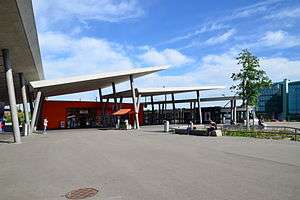 The above ground access to Stettbach station, with tram terminus in background | ||||||||||||||||||||||||||
| Location |
Dübendorfstrasse, City of Zürich, Canton of Zürich, Switzerland | |||||||||||||||||||||||||
| Coordinates | 47°23′50″N 8°35′46″E / 47.3972°N 8.5961°ECoordinates: 47°23′50″N 8°35′46″E / 47.3972°N 8.5961°E | |||||||||||||||||||||||||
| Line(s) | Zürichberg line | |||||||||||||||||||||||||
| Connections | Verkehrsbetriebe Zürich/Glattalbahn | |||||||||||||||||||||||||
| Services | ||||||||||||||||||||||||||
| ||||||||||||||||||||||||||
.JPG)

Stettbach is a railway station on the north-eastern boundary of the Swiss city of Zürich. Although the station is located just within the city boundary, in the city's Schwamendingen district, it takes its name from the nearby village of Stettbach, which is in the adjacent municipality of Dübendorf.[1][2]
History
Stettbach station, along with the Zürichberg Tunnel and the connecting railway on which the station is situated, were opened in 1990. At the same time Zürich Stadelhofen station was connected by the Hirschengraben Tunnel to new through low level platforms at Zürich Hauptbahnhof, thus creating the through west-east backbone of the Zürich S-Bahn.[3]
Operation
The station is on the Zürichberg line, which links Zürich Stadelhofen station, in central Zürich, with Dietlikon and Dübendorf stations. The station platforms are below ground level, and at the southern end of the station the railway tracks enter the 5 kilometres (3.1 mi) Zürichberg Tunnel to Zürich Stadelhofen.
The station is served by lines S3, S9, S11 and S12 of the Zürich S-Bahn, with all lines being operated by the Swiss Federal Railways (SBB).[4]
Adjacent to the station at ground level are the termini of two of Zurich's tram routes. Route 7 is owned and operated by the Verkehrsbetriebe Zürich (VBZ) and links Stettbach to central Zürich via the Schwamendingen district. Route 12 is operated by VBZ on behalf of the Glattalbahn, and links Stettbach to Zurich Airport via the increasingly urbanised Glattal region.[5]
Future plans
Zürich Zoo, situated on the Zürichberg mountain above the tunnel, has plans to construct a cable car to link the zoo and station, a distance of about 2 km (1.2 mi).[6]
References
- ↑ Zürich City Map (Map). 1:16000. Hallwag Kümmerlry+Frey AG. 2009-01-25. ISBN 978-3-8283-0070-5.
- ↑ map.geo.admin.ch (Map). Swiss Confederation. Retrieved 2013-05-01.
- ↑ Eisenbahnatlas Schweiz. Verlag Schweers + Wall GmbH. 2012. pp. 64–65. ISBN 978-3-89494-130-7.
- ↑ "S-Bahn trains, buses and boats" (PDF). ZVV. Retrieved 2013-04-01.
- ↑ "City of Zürich network map" (PDF). ZVV. Retrieved 2011-09-09.
- ↑ "Cable Car". Zurich Zoo. Retrieved 2013-05-01.
External links
 Media related to Bahnhof Stettbach at Wikimedia Commons