Statenville, Georgia
| Statenville, Georgia | |
|---|---|
| Census-designated place | |
|
Echols County Courthouse in Statenville | |
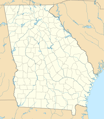 Statenville  Statenville Location within the state of Georgia | |
| Coordinates: 30°42′11″N 83°1′40″W / 30.70306°N 83.02778°WCoordinates: 30°42′11″N 83°1′40″W / 30.70306°N 83.02778°W | |
| Country | United States |
| State | Georgia |
| County | Echols |
| Area | |
| • Total | 4.6 sq mi (12.0 km2) |
| • Land | 4.6 sq mi (12.0 km2) |
| • Water | 0.0 sq mi (0.0 km2) |
| Elevation | 138 ft (42 m) |
| Population (2010) | |
| • Total | 1,040 |
| • Density | 225/sq mi (87.0/km2) |
| Time zone | Eastern (EST) (UTC-5) |
| • Summer (DST) | EDT (UTC-4) |
| ZIP code | 31648 |
| Area code(s) | 229 |
| FIPS code | 13-73200 |
| GNIS feature ID | 356558 |

Statenville is an unincorporated community in and the county seat of Echols County, Georgia, United States.[1] It is a census-designated place (CDP), with a population of 1,040 at the 2010 census.[2] The ZIP code is 31648, and the area code 229.
History
The town of Statenville was originally called Troublesome. It grew up at a ford on the Alapaha River in the 1850s. Troublesome was renamed Statenville when the latter was designated county seat in 1858 of the newly-formed Echols County. It is named for early store owner Henry Staten,[3] but was erroneously incorporated as "Statesville" in 1859. In 1965, the state officially amended the city's charter to read "Statenville". In 1995, a new state law revoked the city charter, along with dozens of others in Georgia who had inactive governments. This left Echols and Webster as the only counties in Georgia with an unincorporated county seat.
Geography
Statenville is located in western Echols County, just east of the Alapaha River. U.S. Route 129 passes through the community, leading north 27 miles (43 km) to Lakeland, south 6 miles (10 km) to the Florida border, and south 14 miles (23 km) to Jasper, Florida. Georgia State Route 94 crosses US 129 in the center of Statenville, leading east 28 miles (45 km) to Fargo and northwest 18 miles (29 km) to Valdosta.
According to the U.S. Census Bureau, the Statenville CDP has a total area of 11.96 square kilometres (4.62 sq mi), all of it land.[2]
Education
Echols County School District
The Echols County School District consists of two schools.[4] The district has 40 full-time teachers and over 700 students.[5]
References
- ↑ "Find a County". National Association of Counties. Retrieved 2011-06-07.
- 1 2 "Geographic Identifiers: 2010 Demographic Profile Data (G001): Statenville CDP, Georgia". American Factfinder. U.S. Census Bureau. Retrieved January 26, 2016.
- ↑ Hellmann, Paul T. (May 13, 2013). Historical Gazetteer of the United States. Routledge. p. 247. Retrieved 30 November 2013.
- ↑ Georgia Board of Education, Retrieved June 8, 2010.
- ↑ School Stats, Retrieved June 8, 2010.
External links
- Echols County, Georgia, including the communities of Statenville, Howell, Mayday, Fruitland, Needmore, Potter, Tarver, and Haylow
Municipalities and communities of Echols County, Georgia, United States | ||
|---|---|---|
| CDP | 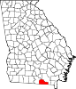 | |
| Unincorporated community | ||