Stanleyville, North Carolina
| Stanleyville, North Carolina | |
|---|---|
| Unincorporated community | |
 Stanleyville  Stanleyville | |
| Coordinates: 36°12′8″N 80°16′51″W / 36.20222°N 80.28083°WCoordinates: 36°12′8″N 80°16′51″W / 36.20222°N 80.28083°W | |
| Country | United States |
| State | North Carolina |
| County | Forsyth |
| Time zone | Eastern (EST) (UTC-5) |
| • Summer (DST) | EDT (UTC-4) |
| ZIP codes | 27105 |
Stanleyville is an unincorporated community between northern Winston-Salem and Rural Hall in Forsyth County, North Carolina. Most of the community has been annexed by Winston-Salem. Stanleyville is located along North Carolina Highway 66 near the future Interstate 74 interchange with U.S. Highway 52. It is home to many farms and recently has seen a surge in commercial expansion. It does not have a post office, so all mail is routed through adjoining Rural Hall.
Stanleyville Drive is the main road through Stanleyville. It was originally a dirt road, later paved as homes began to be built in the area. Some of the farm homes are over 50 years old, but most homes were built in the last 25 years. The Clayton Family Farm was listed on the National Register of Historic Places in 2001.[1]
Stanleyville is known as "the pencil capital of the world" and received a brief burst of publicity after the release of the 2012 film The Odd Life of Timothy Green, which was set in Stanleyville (though not exclusively filmed there) and in which pencils play a prominent role.
References
- ↑ National Park Service (2010-07-09). "National Register Information System". National Register of Historic Places. National Park Service.
Municipalities and communities of Forsyth County, North Carolina, United States | ||
|---|---|---|
| Cities | 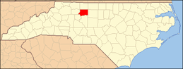 | |
| Towns | ||
| Villages | ||
| CDP | ||
| Unincorporated communities | ||
| Footnotes | ‡This populated place also has portions in an adjacent county or counties | |