Stafford services
| Stafford Services | |
|---|---|
_-_geograph.org.uk_-_84994.jpg) Stafford South building. | |
 Stafford services (Staffordshire) | |
| Information | |
| County: | Staffordshire |
| Road: | M6 |
| Coordinates: | 52°53′04″N 2°10′15″W / 52.88436°N 2.17083°WCoordinates: 52°53′04″N 2°10′15″W / 52.88436°N 2.17083°W |
| Northbound services | |
| Operator: | Moto |
| Date opened: | 1996[1] |
| Fuel: | BP |
| Website: | Moto |
| Southbound services | |
| Operator: | RoadChef |
| Date opened: | 1999[1] |
| Fuel: | Esso |
| Website: | RoadChef |
Stafford services is a pair of motorway service station on the M6 motorway near Stone, Staffordshire, England. In August 2011 it was rated as 4 stars (northbound - Moto) and 3 stars (southbound - Roadchef) by quality assessors at Visit England.[2]
It is unusual, in that the facilities on the northbound (opened 1996) and southbound (1999) sides of the motorway are operated by separate companies: Moto (formerly Granada) and RoadChef respectively. They are 1 mile (1.6 km)[3] apart.
History
Prior to the construction of the station, a geophysical survey was undertaken to examine cropmarks which possibly marked the location of a ring ditch to ensure that an archaeological site was not destroyed. The ditch was not found, although medieval and post-medieval artefacts were recovered.[4][5]
Blue Boar constructed the southbound services, in addition to their services at Watford Gap but shortly before completion in 1999 they were acquired by RoadChef, who now operate the site.[6]
Location
The services are located in Staffordshire on the M6 motorway between junctions 14 and 15, and are accessed directly from the motorway. Stoke on Trent is located about 10 miles (16 km) to the north, Manchester about 60 miles (97 km) miles to the north, and Stafford is about 8 miles (13 km) to the south. By road they are about 150 miles (240 km) from London and 30 miles (48 km) from Birmingham.
References
- 1 2 Motorway Services Trivia - Chronology - Accessed 16 February 2009
- ↑ http://www.visitengland.org/busdev/bussupport/qadays/Consultancy.aspx
- ↑ "Driving directions". Google. Retrieved 28 September 2013.
- ↑ Ings, M. (1993), North Pirehill Farm, Stone, Staffordshire: Fieldwalking and Geophysical Survey (Report No 93145), Cirencester: Cotswold Archaeological Trust Ltd
- ↑ Ings, M. (1994), Norh Pirehill Farm, Stone, Staffordshire: Archaeological Evaluation (Report No 93152), Cirencester: Cotswold Archaeological Trust Ltd
- ↑ Stafford South, Motorway Services Online, UK. Accessed 16 February 2009.
External links
- Moto official website — Stafford North
- RoadChef official website — Stafford South
- Motorway Services Trivia website — Stafford
- Stafford North — Motorway Services Online
- Stafford South — Motorway Services Online
| Next southbound: Hilton Park Norton Canes (M6 Toll) |
Motorway service stations on the M6 motorway |
Next northbound: Keele |
| Current | 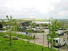 | |
|---|---|---|
| ||