St Peter's Square tram stop
| Metrolink | |||||||||||||||||||||||||||||||||||||||||||||||||||||||||||||||||||||||||||||||||||||||||||||||||||||||||||||||||||
|
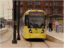
A M5000 at St Peter's Square tram stop | |||||||||||||||||||||||||||||||||||||||||||||||||||||||||||||||||||||||||||||||||||||||||||||||||||||||||||||||||||
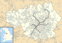 St Peter's Square Location of St Peter's Square in Greater Manchester | |||||||||||||||||||||||||||||||||||||||||||||||||||||||||||||||||||||||||||||||||||||||||||||||||||||||||||||||||||
| Location | |||||||||||||||||||||||||||||||||||||||||||||||||||||||||||||||||||||||||||||||||||||||||||||||||||||||||||||||||||
| Place | St Peter's Square | ||||||||||||||||||||||||||||||||||||||||||||||||||||||||||||||||||||||||||||||||||||||||||||||||||||||||||||||||||
| Local authority | Manchester | ||||||||||||||||||||||||||||||||||||||||||||||||||||||||||||||||||||||||||||||||||||||||||||||||||||||||||||||||||
| Coordinates | 53°28′40″N 2°14′37″W / 53.4779°N 2.2437°WCoordinates: 53°28′40″N 2°14′37″W / 53.4779°N 2.2437°W | ||||||||||||||||||||||||||||||||||||||||||||||||||||||||||||||||||||||||||||||||||||||||||||||||||||||||||||||||||
| Grid reference | SJ839979 | ||||||||||||||||||||||||||||||||||||||||||||||||||||||||||||||||||||||||||||||||||||||||||||||||||||||||||||||||||
| Platforms | 4 | ||||||||||||||||||||||||||||||||||||||||||||||||||||||||||||||||||||||||||||||||||||||||||||||||||||||||||||||||||
| Fare zone information | |||||||||||||||||||||||||||||||||||||||||||||||||||||||||||||||||||||||||||||||||||||||||||||||||||||||||||||||||||
| Metrolink Zone | D (City) | ||||||||||||||||||||||||||||||||||||||||||||||||||||||||||||||||||||||||||||||||||||||||||||||||||||||||||||||||||
| Present status | Under construction | ||||||||||||||||||||||||||||||||||||||||||||||||||||||||||||||||||||||||||||||||||||||||||||||||||||||||||||||||||
| Operations | |||||||||||||||||||||||||||||||||||||||||||||||||||||||||||||||||||||||||||||||||||||||||||||||||||||||||||||||||||
| Original operator | Metrolink | ||||||||||||||||||||||||||||||||||||||||||||||||||||||||||||||||||||||||||||||||||||||||||||||||||||||||||||||||||
| History | |||||||||||||||||||||||||||||||||||||||||||||||||||||||||||||||||||||||||||||||||||||||||||||||||||||||||||||||||||
| Opening | 27 April 1992 | ||||||||||||||||||||||||||||||||||||||||||||||||||||||||||||||||||||||||||||||||||||||||||||||||||||||||||||||||||
| |||||||||||||||||||||||||||||||||||||||||||||||||||||||||||||||||||||||||||||||||||||||||||||||||||||||||||||||||||
|
| |||||||||||||||||||||||||||||||||||||||||||||||||||||||||||||||||||||||||||||||||||||||||||||||||||||||||||||||||||

St Peter's Square is a tram stop in St Peter's Square in Manchester city centre, England. It opened on 27 April 1992 and is in the City Zone of Greater Manchester's Metrolink light rail system. The stop's platforms were extended in 2009. Later redevelopment in 2015–16 demolished the original two platforms and replaced them with a four-platform interchange.
The tram stop is between Deansgate-Castlefield and Piccadilly Gardens tram stops.
History


Plans for a rapid transit station in St Peter's Square were made in the 1970s; proposals for the abandoned Picc-Vic tunnel envisaged the construction of an underground station to serve both St Peter's and the neighbouring Albert Square.[1] The early proposals for an on-street light rail system in Manchester revived the idea of a station in the square, and the idea was retained as the project evolved, becoming a reality when the Metrolink system opened in 1992.
The stop was demolished and rebuilt with a full length platform and improved passenger facilities in November 2009. Elisabeth House occupied the side of the square opposite the library (between Dickinson Street and Oxford Street) from the 1970s until 2011 when it was demolished for redevelopment as One St Peter's Square.[2] Plans prepared by architects were entered in a competition which was modified in 2011 to incorporate Metrolink proposals; in March 2012 a shortlist of two submissions was made.[3]
The stop closed on 28 June 2015 for its second stage of redevelopment and re-opened on 28 August 2016 as a four-platform interchange. The stop was moved slightly north towards Princess Street, from that of its old location, which was in front of Manchester Central Library. The Manchester Cenotaph was also relocated and the entire square is being redeveloped into a new public space. During the 2-month closure, no services ran through the square.
References
- ↑ SELNEC PTE (October 1971), SELNEC Picc-Vic Line, SELNEC PTE publicity brochure
- ↑ "Elizabeth House". Cool Manchester. Retrieved 2012-03-24.
- ↑ One St Peter's Square; E-architect
External links
| Wikimedia Commons has media related to St Peter's Square Metrolink station. |
- Tram times and station information for St Peter's Square Metrolink station from Manchester Metrolink
| Manchester Lines | |||||||||||||||||||||||||||||||||||||||||||||||||||||||||||||||||||||||||||||||||||||||||||||||||||||||||||||||||||||||||||||||||||||||||||||||||||||||||||||||||||||||||||||||||||||||||||||||||||||||||||||||||||||||||||||||||||||||||||||||||||||||||||||||||||||||||||||||||||||||||||||||||||||||||||||||||||||||||||||||||||||||||||||||||||||||||||||||||||||||||||||||||||||||||||||||||||||||||||||||||||||||||||||
|---|---|---|---|---|---|---|---|---|---|---|---|---|---|---|---|---|---|---|---|---|---|---|---|---|---|---|---|---|---|---|---|---|---|---|---|---|---|---|---|---|---|---|---|---|---|---|---|---|---|---|---|---|---|---|---|---|---|---|---|---|---|---|---|---|---|---|---|---|---|---|---|---|---|---|---|---|---|---|---|---|---|---|---|---|---|---|---|---|---|---|---|---|---|---|---|---|---|---|---|---|---|---|---|---|---|---|---|---|---|---|---|---|---|---|---|---|---|---|---|---|---|---|---|---|---|---|---|---|---|---|---|---|---|---|---|---|---|---|---|---|---|---|---|---|---|---|---|---|---|---|---|---|---|---|---|---|---|---|---|---|---|---|---|---|---|---|---|---|---|---|---|---|---|---|---|---|---|---|---|---|---|---|---|---|---|---|---|---|---|---|---|---|---|---|---|---|---|---|---|---|---|---|---|---|---|---|---|---|---|---|---|---|---|---|---|---|---|---|---|---|---|---|---|---|---|---|---|---|---|---|---|---|---|---|---|---|---|---|---|---|---|---|---|---|---|---|---|---|---|---|---|---|---|---|---|---|---|---|---|---|---|---|---|---|---|---|---|---|---|---|---|---|---|---|---|---|---|---|---|---|---|---|---|---|---|---|---|---|---|---|---|---|---|---|---|---|---|---|---|---|---|---|---|---|---|---|---|---|---|---|---|---|---|---|---|---|---|---|---|---|---|---|---|---|---|---|---|---|---|---|---|---|---|---|---|---|---|---|---|---|---|---|---|---|---|---|---|---|---|---|---|---|---|---|---|---|---|---|---|---|---|---|---|---|---|---|---|---|---|---|---|---|---|---|---|---|---|---|---|---|---|---|---|---|---|---|---|---|---|---|---|---|---|---|---|---|---|---|---|---|---|---|---|---|---|---|---|---|---|---|---|---|---|
Legend | |||||||||||||||||||||||||||||||||||||||||||||||||||||||||||||||||||||||||||||||||||||||||||||||||||||||||||||||||||||||||||||||||||||||||||||||||||||||||||||||||||||||||||||||||||||||||||||||||||||||||||||||||||||||||||||||||||||||||||||||||||||||||||||||||||||||||||||||||||||||||||||||||||||||||||||||||||||||||||||||||||||||||||||||||||||||||||||||||||||||||||||||||||||||||||||||||||||||||||||||||||||||||||||
| |||||||||||||||||||||||||||||||||||||||||||||||||||||||||||||||||||||||||||||||||||||||||||||||||||||||||||||||||||||||||||||||||||||||||||||||||||||||||||||||||||||||||||||||||||||||||||||||||||||||||||||||||||||||||||||||||||||||||||||||||||||||||||||||||||||||||||||||||||||||||||||||||||||||||||||||||||||||||||||||||||||||||||||||||||||||||||||||||||||||||||||||||||||||||||||||||||||||||||||||||||||||||||||
| Preceding station | Following station | |||
|---|---|---|---|---|
towards Altrincham | Altrincham – Piccadilly Line | towards Piccadilly |
||
towards MediaCityUK | MediaCityUK – Piccadilly Line | towards Piccadilly |
||
towards Eccles | Eccles – Ashton-under-Lyne Line | towards Ashton-under-Lyne |
||
towards Altrincham | Altrincham – Bury Line | towards Bury |
||
towards East Didsbury | East Didsbury – Victoria Line | towards Victoria |
||
towards East Didsbury | Shaw and Crompton – East Didsbury Line | towards Shaw and Crompton |
||
| Under Construction | ||||
Terminus | Second City Crossing | towards Victoria |
||
| Tram stops |   | |||||||||||||||||||||||||||||||
|---|---|---|---|---|---|---|---|---|---|---|---|---|---|---|---|---|---|---|---|---|---|---|---|---|---|---|---|---|---|---|---|---|
| Operations |
| |||||||||||||||||||||||||||||||
| History (Timeline) |
| |||||||||||||||||||||||||||||||
| Future |
| |||||||||||||||||||||||||||||||
| Proposed stops |
| |||||||||||||||||||||||||||||||