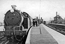
St Margarets (Hertfordshire) railway station
| St Margarets (Hertfordshire) | |
|---|---|
 | |
| Location | Stanstead St Margarets |
| Local authority | District of East Hertfordshire |
| Grid reference | TL381118 |
| Managed by | Abellio Greater Anglia |
| Station code | SMT |
| DfT category | E |
| Number of platforms | 2 |
| Fare zone | B |
| National Rail annual entry and exit | |
| 2010–11 |
|
| 2011–12 |
|
| 2012–13 |
|
| 2013–14 |
|
| 2014–15 |
|
| Key dates | |
| 1843 | Opened |
| Other information | |
| Lists of stations | |
| External links | |
|
| |
St Margarets railway station serves the villages of Stanstead St Margarets and Stanstead Abbotts in Hertfordshire, England. It is on the Hertford East branch of the West Anglia Main Line, and train services are provided by Abellio Greater Anglia, which also manages the station. St Margarets was previously the junction station for the now-disused Buntingford Branch Line to Buntingford.
There is a ticket office that is open at peak times as well as a self-service ticket machine. The Oyster card system was extended through to Hertford East and became operational at St. Margaret's on 19 October 2015.[2]
Services
The typical off-peak service is two trains per hour to London Liverpool Street via Tottenham Hale, and two trains per hour to Hertford East. Services are operated by Class 317s. Peak services include trains towards Stratford
Level crossing
St. Margaret's railway station has a level crossing on the southern side of the platforms.
References
- 1 2 3 4 5 "Station usage estimates". Rail statistics. Office of Rail Regulation. Please note: Some methodology may vary year on year.
- ↑ Contactless payments and Oyster extended to Hertford East
External links
| Wikimedia Commons has media related to St Margarets (Hertfordshire) railway station. |
- Train times and station information for St Margarets (Hertfordshire) railway station from National Rail
| Preceding station | |
Following station | ||
|---|---|---|---|---|
| Rye House | Abellio Greater Anglia Hertford East Branch Line |
Ware | ||
| Future Development | ||||
| Preceding station | Following station | |||
| Crossrail Line 2 | towards Hertford East |
|||
| Disused railways | ||||
| Rye House Line and station open |
British Railways Buntingford Branch Line |
Mardock Line and station closed | ||
Coordinates: 51°47′17″N 0°00′04″E / 51.788°N 0.001°E