St Georges Terrace

St Georges Terrace is the main street in the city of Perth, Western Australia. It runs parallel to the Swan River and forms the major arterial road through the central business district.
Its western end is marked by the Barracks Arch, whereas the eastern end joins Adelaide Terrace at the intersection with Victoria Avenue.
Naming
St Georges Terrace was named after St George's Cathedral. Originally, houses occupied by clergy of the cathedral and lay clerks of the cathedral choir constituted a substantial portion of the Terrace. Some of these houses such as The Deanery remain, however the majority of these were demolished in the 1960s.
Streetscapes
The level of St Georges Terrace is in effect at the top of a ridge, where the short roads that descend southerly towards Perth Water all provide views of the Swan River, including Barrack Street, Sherwood Court, Howard Street, William Street, Mill Street and Spring Street.
Buildings
The main streetscape between Barrack Street and William Street in the 1930s and 1940s constituted considerable uniformity of design and building height, by the late 1970s removal of significant older buildings for taller more modern buildings changed this permanently. Perth's earlier tallest buildings were located on St Georges Tce, including the Colonial Mutual Life building (tallest building in Perth from 1936 to 1962),[1] subsequent tallest buildings were: Citibank House (37 St Georges Tce, 1962 until 1970),[2] Parmelia House (191 St. Georges Terrace, 1970 to 1973), 140 St Georges Terrace (AMP Building, 1975 to 1976), Allendale Square (77 St Georges Tce, 1976 to 1977), St Martins Tower (44 St. Georges Terrace, 1978 to 1988), BankWest Tower (108 St Georges Terrace, 1988 to 1992) and Central Park (152-158 St Georges Tce, tallest since 1992).
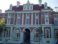
A number of other buildings are along the road:
- 100 St Georges Terrace
- Brookfield Place
- Christian Brothers' College
- The Cloisters
- London Court
- Old Perth Boys School
- Palace Hotel
- QV.1
- St George's House
- Technical School
Footpath
Set into the footpath along the street are a series of commemorative plaques honouring notable figures in Western Australia's history. Originally 150 plaques were installed in 1979, as part of the WAY '79 celebrations,[3][4] marking the state's 150th year of European settlement. Since then, additional plaques have been added, so that there is now one for each year from 1829 to 1999.[5][6]
See also
![]() Australian roads portal
Australian roads portal
Notes
- ↑ "Perth's Highest Building". Western Mail. Perth, WA: National Library of Australia. 29 October 1936. p. 2 Supplement: The Western Mail. Retrieved 8 June 2012.
- ↑ "Citibank House, Perth". Emporis. Retrieved 1 December 2008.
- ↑ "Read a Story - William Backshall". Immigration Place Australia. Retrieved 31 August 2013.
- ↑ "The Dictionary of Western Australians 1829 to 1914". Rica Erickson website. Library and Information Service of Western Australia. Retrieved 31 August 2013.
- ↑ St Georges Terrace Commemorative Plaques 1829-1989 (PDF), City of Perth, June 2003, retrieved 8 November 2015
- ↑ City of Perth St. Georges Terrace Commemorative Plaques for 1990-1999 (PDF), City of Perth, 10 June 2009, retrieved 8 November 2015
References
- Austen, Tom (1988) The Streets of Old Perth St George Books. ISBN 0-86778-038-X
- Edmonds, Jack (editor) (1979) Swan River colony : life in Western Australia since the early colonial settlement, illustrated by pictures from an exhibition mounted by West Australian Newspapers Ltd. as a contribution to celebrations for the state's 150th year Perth: West Australian Newspapers.ISBN 0909699208
- Stannage, C. T (1979) The people of Perth : a social history of Western Australia's capital city Perth: Carroll's for Perth City Council. ISBN 0-909994-86-2
External links
![]() Media related to St Georges Terrace, Perth at Wikimedia Commons
Media related to St Georges Terrace, Perth at Wikimedia Commons