St Agnes, Isles of Scilly
| St. Agnes | |
| Cornish: Aganas | |
 A map of St. Agnes with Gugh to the east. |
|
 St. Agnes |
|
| Population | 82 (2011) |
|---|---|
| OS grid reference | SV881430 |
| Civil parish | St Agnes |
| Unitary authority | Isles of Scilly |
| Ceremonial county | Cornwall |
| Region | South West |
| Country | England |
| Sovereign state | United Kingdom |
| Post town | ISLES OF SCILLY |
| Postcode district | TR22 |
| Dialling code | 01720 |
| Police | Devon and Cornwall |
| Fire | Isles of Scilly |
| Ambulance | South Western |
| EU Parliament | South West England |
| UK Parliament | St Ives |
Coordinates: 49°53′28″N 6°20′35″W / 49.891°N 6.343°W
St Agnes (Cornish: Aganas ) is the southernmost populated island of the Isles of Scilly — Troy Town Farm on the island is the southernmost settlement in the United Kingdom and England.
Description

St Agnes joins the island of Gugh by a tombolo, a kind of sandbar, called the Gugh Bar, which is exposed only at low tide. The Gugh is inhabited, with some three residents. The two islands of St Agnes and Gugh together have a population of 85 residents recorded in the 2011 census (73 were recorded in the 2001 census) and a landmass of 366 acres (148 ha). Without the Gugh included, St Agnes is marginally smaller than Bryher in either population or area; however if Gugh is included with St Agnes, it is Bryher that is marginally smaller in area and population.
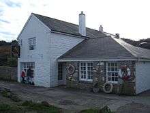
In earlier times many men from St Agnes earned a living as pilots, guiding transatlantic liners and other vessels through the English Channel. Now the mainstay of the economy is tourism, together with some bulb farming. Accommodation is limited, and St Agnes is the only populated island in the Isles of Scilly which has no hotel. However, it has a few B&Bs and self-catering cottages, an ice cream shop, a campsite, a small post office & general store and a gift shop. It also has a pub (the Turk's Head) and a cafe, although these are closed in the winter.
The main population centre is in the north and middle of the island. The southern end of the island is covered by the heather moorland of Wingletang Down.
Lighthouse
The island's most notable landmark is its lighthouse, which has been converted into living accommodation and the tower no longer contains a light. In 1680 Trinity House began a survey of the coasts of England as it was known that the contemporary charts were inaccurate; the Isles of Scilly was plotted ten miles to the north. Trinity House was also given permission to erect and maintain one or more lighthouses on the islands. St Agnes was chosen as it is the most westerly of the inhabitable islands and close to the collection of rocks, tidal flows and currents, now known as the Western Rocks.[1] It was built in 1680 and was coal fired until 1790, when it was converted to oil, with copper lamps and twenty-one revolving reflectors. A plaque records the original construction by Captains Hugh Hill and Simon Bayly, builders of the 1676 Lowestoft lighthouse. There were two protests against the building of the St Agnes light. Officials from the Isle of Wight complained that they would lose revenue from harbour dues and victualling as shipping would prefer to use the Isles of Scilly, and the Governor of Scilly on the grounds that he would lose money from wrecks![1]


The St. Agnes lighthouse was the second to be built in the western approaches (after the Lizard lighthouse of 1619). It stands 74' above the ground, and 138' above mean high water. It was superseded in 1911 by the Peninnis Lighthouse and St Agnes lighthouse now serves as a daymark for shipping. Peninnis lighthouse is a 17 metre tall black and white steel lattice tower situated on the southern extremity of St. Mary's island. The range was reduced from 17Nm to 9Nm under the Trinity House 2010 Aids to Navigation review. The light source employed is now LED.[2][3]
Other landmarks
Other landmarks include a standing stone known as the Nag's Head (probably a natural formation) and the so-called "Troytown Maze" a pebble maze thought to be of medieval date. In 1707, many of the sailors who had drowned in the great naval disaster off the Isles of Scilly were reputedly buried on the St Agnes playing field.[4]
Church
See St Agnes' Church, St Agnes.
Sporting and social life
Friday evenings in the summer (end of April until start of October) see men's domestic Cornish Pilot Gig racing on Scilly, with the ladies' race on Wednesday. After the race, supporters fill the Turk's Head to discuss the race and to socialise. The pub is always open through the summer, but during the winter it is only open on Wednesdays for a quiz, and one other night.
Notable residents
Periglis Cottage was the home of St Agnes's resident ornithologist Hilda M. Quick. She was the author of Birds of the Scilly Isles published in 1964.
Population
nearly 150 in 25 households;
|
|
Natural history
Over one third of the area of St Agnes is designated as Sites of Special Scientific Interest (SSSI). In the south of the island Wingletang Down is noted for its heath, dune grassland and rocky coast and is the only site in Britain where the fern least adder's–tongue (Ophioglossum lusitanicum) grows. Other rare plants include the orchid autumn lady’s-tresses (Spiranthes spiralis) and early meadow-grass (Poa infirma). The only freshwater pools on St Agnes are Big Pool and Little Pool in the north-west of the island which are part of the Big Pool and Browarth Point SSSI. Big Pool shows evidence for inundation[5] by the 1775 Lisbon tsunami that was caused by the 1755 Lisbon earthquake. The vegetation has some brackish influence because of occasional influx of the sea during winter storms with rushes such as saltmarsh rush (Juncus gerardi) and sea club–rush (Scirpus maritimus). The surrounding grassland, which is also a cricket pitch, is notable for the clovers amongst its flora including western clover (Trifolium occidentale), suffocated clover (T. suffocatum) and subterranean clover (T. subterraneum). Other plants include adder’s-tongue (Ophioglossum vulgatum) and small adder’s-tongue (O. azoricum).[6][7]
Vagrant birds
St Agnes is visited by birdwatchers, particularly during the ″Scilly season″ of September and October. Among the many vagrant birds which have been found here around this time are the following, which were all ″firsts″ for Britain:
- Northern waterthrush (Parkesia noveboracensis) found at Covean on 30 September 1958 and stayed there until 12 October 1958.[8]
- Bobolink (Dolichonyx oryzivorus) near Big Pool on 19 September 1962.[9]
- Blackpoll warbler (Setophaga striata) discovered in the Parsonage garden on 12 October 1968 and remained on the island until 25 October 1968.[10]
- Europe's first hooded warbler (Wilsonia citrina) at Big Pool from 21 September 1972 to 23 September.[11]
- Semipalmated plover (Charadrius semipalmatus) first found at Porth Killier on 9 October 1978 and stayed around on Periglis until 9 November 1978.[12]
- Europe's first magnolia warbler (Setophaga magnolia) in Barnaby Lane on 27 and 28 September 1981.[13]
- Eastern Bonelli's warbler (Phylloscopus orientalis) in 1987.
- Wood thrush (Hylocichla mustelina) at Wingletang Down on 7 October 1987.[14]
- Short-toed eagle (Circaetus gallicus) in 1999.
In addition:
- a yellow-browed bunting (Emberiza chrysophrys) in 1994 was Britain's fourth.
- a cream-coloured courser (Cursorius cursor) in 2004 was the first to be seen in Britain for 20 years.[15]
Among rare vagrants recorded at other times of year are the following:
- Blue-cheeked bee-eater (Merops superciliosus) on 22 June 1951; a first for Britain.[16]
- Britain's fifth and Scilly's first Balearic woodchat shrike (Lanius senator badius) at Troy Town from 21–27 April 1999. (Accepted by the BBRC)[17]
- a little bustard (Tetrax tetrax) in March 2002.
- a killdeer (Charadrius vociferus) in November 2003.
Civil parish and ward

St Agnes is one of the five civil parishes of the Isles of Scilly, which are also wards. The civil parish and ward include Gugh and several uninhabited islands and rocks, including the Western Rocks, Annet, Rosevear, Pednathise Head (the southernmost land in the UK) and the Bishop Rock.[18] St Agnes returns 2 councillors to the Council of the Isles of Scilly, the same as the other "off-island" wards. The civil parish is not functional however, and there is no council or meeting.
See also
- List of shipwrecks of the Isles of Scilly
- List of extreme points of the United Kingdom
- St Agnes Lifeboat Station (Isles of Scilly)
References
- 1 2 Vyvyan, Clara C (1960). The Scilly Isles. London: Robert Hale.
- ↑ Changes to lighthouse as it marks 100th year. Cornishman 28 July 2011. p 15.
- ↑ http://www.trinityhouse.co.uk/lighthouses/lighthouse_list/peninnis.html
- ↑ www.shipwrecks.uk.com/tricent-leaflet
- ↑ Banerjee et al. 2001., D. "Scilly Isles, UK: optical dating of a possible tsunami deposit from the 1755 Lisbon earthquake". Quaternary Science Reviews 1 December 2001. 20 (5–9,): 715–718. doi:10.1016/S0277-3791(00)00042-1. Retrieved 30 March 2015.
- ↑ "Big Pool and Browarth Point (St Agnes)" (PDF). Natural England. Retrieved 3 December 2011.
- ↑ "Wingletang Down (St Agnes)" (PDF). Natural England. Retrieved 3 December 2011.
- ↑ Harris, G J; Parslow J L F (November 1960). "Northern Waterthrush in the Isles of Scilly: a bird new to Great Britain and Ireland". British Birds. 53 (11): 513–8. Retrieved 5 July 2013.
- ↑ Parslow, Jon L; Carter M J (1965). "Bobolink in the Isles of Scilly: a bird new to Great Britain and Ireland". British Birds. 58: 208–214.
- ↑ Osborne, Ken (2002). "Birding Hotspots 1: The Parsonage". Isles of Scilly Bird and Natural History Review 2001: 165–7.
- ↑ Edwards, K D; Osborne K C (1972). "Hooded Warbler in the Isles of Scilly: a species new to Britain and Ireland". British Birds. 65:: 203–5.
- ↑ Dukes, Paul A (1980). "Semipalmated Plover: new to Britain and Ireland". British Birds. 73: 458–464. Retrieved 4 July 2013.
- ↑ Robinson, Peter (2003). Birds of the Isles of Scilly. London: Christopher Helm. p. 608. ISBN 0-7136-6037-6.
- ↑ Dukes, Paul A (March 1995). "Wood Thrush in Scilly: new to Britain and Ireland". British Birds. 88 (3): 133–5. Retrieved 1 July 2013.
- ↑ Fisher Ashley and Flood Bob (2005). "Cream-coloured Courser - First for Scilly, September 28, 2004". Isles of Scilly Bird and Natural History Review 2004: 138–9.
- ↑ Quick, Hilda (1952). "Blue-cheeked Bee-eater in Scilly: A new British bird". British Birds. 45: 225–7. Retrieved 5 July 2013.
- ↑ Hudson, D.C. (2010) Isles of Scilly Bird and Natural History Review 2009. Isles of Scilly Bird Group.
- ↑ Ordnance Survey 1:25,000 map
External links
![]() Media related to St Agnes, Isles of Scilly at Wikimedia Commons
Media related to St Agnes, Isles of Scilly at Wikimedia Commons
| Inhabited islands | 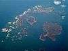 | |
|---|---|---|
| Uninhabited islands | ||
| Settlements |
| |
| Topics |
| |
Cornwall Portal | |
| Unitary authorities | |
| Major settlements |
|
| Rivers | |
| Topics | |