St. Vital, Winnipeg
Coordinates: 49°50′2″N 97°6′54″W / 49.83389°N 97.11500°W
St. Vital is a district of the city of Winnipeg, Manitoba, Canada. Located in the south-central part of the city, it is bounded on the north by Carrière Avenue, on the south by the northern limit of the Rural Municipality of Ritchot, on the west by the Red River and on the east by the Seine River, with the exception of the part lying south of the Perimeter Highway, which extends east across the Seine to the boundary of the Rural Municipality of Springfield. The population as of the 2006 census was 161,605.[1] It had increased to 166,149 by the 2011 census.
St. Vital is a city ward, represented by a member of Winnipeg City Council. With slightly different boundaries, it also comprises the Winnipeg neighbourhood clusters of St. Vital North and St. Vital South.
History
The community was established by francophone settlers in 1822, and is the second-oldest permanent settlement in Manitoba after Kildonan.[2] It was named St. Vital by Archbishop Taché in 1860, in honour of his colleague, Father Vital-Justin Grandin.[3]
The original Parish of St. Vital consisted in present-day St. Vital in addition to much of Fort Garry, another present-day suburb on the west side of the Red River. The parish was home to many French-speaking settlers, particularly Métis, a heritage that continues to be reflected in the names of many of its institutions and streets
St. Vital remained a strongly francophone community in the early decades after Manitoba's incorporation as a Canadian province in 1870. Until 1910, every reeve and every councillor was of a francophone background. The anglophone population grew throughout this period, however, and Richard Wilson was elected as St. Vital's first anglophone reeve in 1912. Council business was conducted in English after 1913. The municipal government became more pro-business after this period, and supported municipal expansion: St. Vital's population increased from only 1,800 at the end of World War I to 11,000 in 1933. By 1951, 63% of St. Vital's population was of British background, and the francophone population had fallen to under 13%.[4] As of 2006, 17.4% of residents of St. Vital speak either both English and French or French only, while 82% speak English only and 0.6% speak neither English nor French.[1]
In 1926 the municipality faced bankruptcy, as municipal growth outstripped tax revenues. Control of the municipality was assumed by the provincial Municipal and Public Utilities Board for one year.[5]
From 1920 to 1958, St. Vital was part of the provincial electoral division of St. Boniface.[6]
St. Vital became involved in a school controversy in 1963-64, when six francophone families took their children out of school to protest bus fees for parochial school students. The matter was resolved following a three-month standoff.[7]
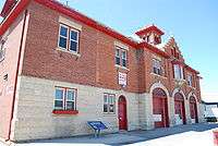
The district was seriously affected by the 1950 Red River Flood; at one point, the entire developed area of St. Vital was under water.[8] The neighbourhoods of Kingston Crescent and Elm Park were the hardest hit.[9] The fire hall in Elm Park was protected with sandbags and sheltered dozens of evacuees, as shown in a photo published in the May 1, 1950 edition of Life magazine.[10]
St. Vital was a separate municipality until 1971. It originally held the status of a rural municipality, and was then incorporated as a town and then eventually a city. Some residents were reluctant to amalgamate with Winnipeg in 1971, and the former municipal government held a mock burial of the city crest.[5]
Facilities
With the exception of a significant (though diminishing) semi-rural district in the south, St. Vital is almost entirely residential and has never been home to significant industrial or commercial enterprises, other than retail shops. Its attractions include the St. Vital Centre, a major regional shopping centre that opened in 1979, the Riel House National Historic Site (consisting in the home of the family of Métis leader Louis Riel, restored to its 1886 condition), and St. Vital Park, one of Winnipeg's largest city parks. Maple Grove Park is similar in size to St. Vital Park but more recently established. A system of linear parks along the Seine River is under development on the east side of the suburb. Guay Park in north St. Vital contains a war memorial erected in honour of St. Vital residents killed in the two World Wars and in Korea.
Neighbourhoods
St. Vital includes many working-class and middle-class neighbourhoods. Among them are Elm Park, Varennes, Pulberry, Glenwood, Norberry, Minnetonka (also known as Riel), River Park South, Meadowood Park and Normand Park.
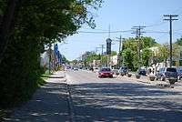
Major streets in St. Vital include St. Mary's Road, St. Anne's Road, Bishop Grandin Boulevard, Fermor Avenue (part of the Trans-Canada Highway), Nova Vista, Warde Ave., Beliveau Rd., Meadowood Ave., and Dunkirk Drive (and its southerly extension, Dakota Street).
Sports
The St. Vital area contains a number of community centres, including the St. Vital Centennial Arena and the Jonathan Toews Community Centre (formerly the Dakota Community Centre). The St. Vital Victorias are members of the Manitoba Major Junior Hockey League, while the Winnipeg Saints played in the Manitoba Junior Hockey League from 2000–2012.[11] Maple Grove Park is home to the St. Vital Mustangs Football Club and Manitoba's largest rugby complex.
| Team | Founded | League | Arena | Championships |
|---|---|---|---|---|
| St. Vital Victorias | 1975 | MMJHL | St. Vital Centennial Arena | 1 |
Education
Most public schools are operated by the Louis Riel School Division; the exceptions are two schools for francophones in south St. Vital operated by the Division Scolaire Franco-Manitobaine.[12] There are also two parochial schools administered jointly by the Roman Catholic Archdiocese of Saint Boniface and the Ukrainian Catholic Archeparchy of Winnipeg, and a number of private schools.[13]
Health care
The only major health care facility in St. Vital is St. Amant, located on River Road in the Minnetonka neighbourhood. It was originally a tuberculosis hospital, but was repurposed as a facility for developmentally challenged children in 1959. In 1974 it was renamed to honour Beatrice St. Amant.[14] The neighbouring suburb of Fort Richmond is home to the Victoria General Hospital and nearby St.Boniface is home to the province's second largest hospital, St. Boniface General Hospital (Winnipeg).[15]
Notable residents
- Todd MacCulloch, Former NBA player
- Gabrielle Roy, Author
- Nancy Allan, Politician
- Sara Orlesky, Sport's reporter
- Andrea Slobodian, Reporter
- Sami Jo Small, Women hockey player
- Jonathan Toews Winner of a ESPY Award for being the best hockey player of 2015
- Adam Smoluk: Actor, Screenwriter, and Director
- Nigel Dawes: Professional hockey player.
- Reid Carruthers: World Men's Curling Champion
- Laurie Hawn: Member of Parliament
- Nia Vardalos, actress in My Big Fat Greek Wedding
- Jim Agnew, Hockey player
- Clint Albright, Hockey player
- Gary Aldcorn, Hockey player
- Bill Allum, Hockey player
- Carter Ashton, Hockey player
- Doug Baldwin, Hockey player
- Cam Barker, Hockey player
- Andy Bathgate, Hockey player
- Ken Baumgartner, Hockey player
- Paul Baxter, Hockey player
- Gordie Bell, Hockey player
- Joe Bell, Hockey player
- Gary Bergman, Hockey player
- Garry Blaine, Hockey player
- Andy Blair , Hockey player
- Rick Blight, Hockey player
References
- 1 2 2006 Census returns - St. Vital. Accessed October 21, 2009.
- ↑ Ian Stewart, Just One Vote: Jim Walding's nomination to constitutional defeat, (Winnipeg: University of Manitoba Press), 2009, p. 18.
- ↑ William J. Fraser, "Bishop Grandin Remembered", Manitoba History Society, accessed 14 September 2009.
- ↑ Stewart, pp. 19-21.
- 1 2 History of St. Vital Fire Hall. Accessed October 8, 2009.
- ↑ Stewart, p. 21.
- ↑ Stewart, p. 20.
- ↑ Flood Scenes from 1950 from the City of Winnipeg. The first image is of a completely inundated St. Vital. Accessed 1 August 2009.
- ↑ Review of Historic Flood Data from the Red River Floodway Authority. Accessed 1 August 2009.
- ↑ "Refugees and pets crowding St. Vital Fire Hall". Life Magazine, May 1, 1950. Accessed August 1, 2009.
- ↑ http://www.winnipegfreepress.com/breakingnews/City-renames-community-centre-after-Jonathan-Toews-98203759.html
- ↑ Division Scolaire Franco-Manitobaine schools map. In French. Accessed October 8, 2009.
- ↑ Catholic Schools Commission. Archdiocese of St. Boniface. Accessed October 8, 2009.
- ↑ Biography of Beatrice St. Amant from the Province of Manitoba. Accessed October 8, 2009.
- ↑ History of St. Amant Centre. Accessed October 8, 2009.