St. Hedwig, Texas
| St. Hedwig, Texas | |
|---|---|
| Town | |
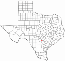 Location of St. Hedwig, Texas | |
 | |
| Coordinates: 29°25′28″N 98°12′52″W / 29.42444°N 98.21444°WCoordinates: 29°25′28″N 98°12′52″W / 29.42444°N 98.21444°W | |
| Country | United States |
| State | Texas |
| County | Bexar |
| Area | |
| • Total | 30.1 sq mi (77.9 km2) |
| • Land | 30.1 sq mi (77.9 km2) |
| • Water | 0.0 sq mi (0.0 km2) |
| Elevation | 577 ft (176 m) |
| Population (2010) | |
| • Total | 2,094 |
| • Density | 62.3/sq mi (24.1/km2) |
| Time zone | Central (CST) (UTC-6) |
| • Summer (DST) | CDT (UTC-5) |
| ZIP Code | 78152 |
| Area code(s) | 210, 726 (planned) |
| FIPS code | 48-64172[1] |
| GNIS feature ID | 1345901[2] |
| Website | http://sainthedwigcity.com/ |
St. Hedwig is a town in Bexar County, Texas, United States. The population was 2,094 at the 2010 census. It is part of the San Antonio Metropolitan Statistical Area.
History
The town was founded by John Demmer in 1852 when he moved to the area from his native Silesia. In 1856 four more Silesians immigrated to the area and built the site's first Catholic Church, Annunciation (under the Roman Catholic Archdiocese of San Antonio). In 1860 a post office called Cottage Hill opened, but was later renamed St. Hedwig after the patron saint of Silesia. By 1868 the community had built a stone church, and in 1897 the town boasted 200 families mainly from Poland and Germany.
Geography
St. Hedwig is located at 29°25′28″N 98°12′52″W / 29.42444°N 98.21444°W (29.424484, -98.214357).[3]
According to the United States Census Bureau, the town has a total area of 30.1 square miles (78 km2), all of it land.
Demographics
| Historical population | |||
|---|---|---|---|
| Census | Pop. | %± | |
| 1880 | 64 | — | |
| 1990 | 1,443 | — | |
| 2000 | 1,875 | 29.9% | |
| 2010 | 2,094 | 11.7% | |
| Est. 2015 | 2,358 | [4] | 12.6% |
| Largest ancestries (2000) | Percent |
|---|---|
| German | 34.2% |
| Polish | 28.9% |
| Irish | 11.5% |
| English | 4.7% |
| American | 4.6% |
| Czech | 2.3% |
As of the census[1] of 2000, there were 1,875 people, 653 households, and 543 families residing in the town. The population density was 62.3 people per square mile (24.1/km²). There were 687 housing units at an average density of 22.8 per square mile (8.8/km²). The racial makeup of the town was 91.95% White, 2.88% African American, 0.32% Native American, 0.21% Asian, 0.05% Pacific Islander, 2.67% from other races, and 1.92% from two or more races. Hispanic or Latino of any race were 10.35% of the population.
There were 653 households out of which 40.0% had children under the age of 18 living with them, 73.0% were married couples living together, 6.3% had a female householder with no husband present, and 16.7% were non-families. 13.6% of all households were made up of individuals and 7.5% had someone living alone who was 65 years of age or older. The average household size was 2.87 and the average family size was 3.17.
In the town the population was spread out with 27.2% under the age of 18, 6.1% from 18 to 24, 30.2% from 25 to 44, 25.9% from 45 to 64, and 10.5% who were 65 years of age or older. The median age was 38 years. For every 100 females there were 105.8 males. For every 100 females age 18 and over, there were 101.6 males.
The median income for a household in the town was $55,481, and the median income for a family was $58,603. Males had a median income of $34,615 versus $27,700 for females. The per capita income for the town was $19,477. About 4.1% of families and 6.7% of the population were below the poverty line, including 9.3% of those under age 18 and 11.4% of those age 65 or over.
References
- 1 2 "American FactFinder". United States Census Bureau. Retrieved 2008-01-31.
- ↑ "US Board on Geographic Names". United States Geological Survey. 2007-10-25. Retrieved 2008-01-31.
- ↑ "US Gazetteer files: 2010, 2000, and 1990". United States Census Bureau. 2011-02-12. Retrieved 2011-04-23.
- ↑ "Annual Estimates of the Resident Population for Incorporated Places: April 1, 2010 to July 1, 2015". Retrieved July 2, 2016.
- ↑ "Census of Population and Housing". Census.gov. Retrieved June 4, 2015.
External links
- St. Hedwig, Texas from the Handbook of Texas Online
Municipalities and communities of Bexar County, Texas, United States | ||
|---|---|---|
| Cities |  | |
| Towns | ||
| CDPs | ||
| Other unincorporated communities | ||
| Footnotes | ‡This populated place also has portions in an adjacent county or counties | |