St. Francis, Minnesota
| St. Francis, Minnesota | |
|---|---|
| City | |
 Location of the city of St. Francis within Anoka County, Minnesota | |
| Coordinates: 45°23′44″N 93°23′12″W / 45.39556°N 93.38667°WCoordinates: 45°23′44″N 93°23′12″W / 45.39556°N 93.38667°W | |
| Country | United States |
| State | Minnesota |
| County | Anoka |
| Area[1] | |
| • Total | 23.97 sq mi (62.08 km2) |
| • Land | 23.53 sq mi (60.94 km2) |
| • Water | 0.44 sq mi (1.14 km2) |
| Elevation | 919 ft (280 m) |
| Population (2010)[2] | |
| • Total | 7,218 |
| • Estimate (2012[3]) | 7,312 |
| • Density | 306.8/sq mi (118.5/km2) |
| Time zone | Central (CST) (UTC-6) |
| • Summer (DST) | CDT (UTC-5) |
| ZIP code | 55070 |
| Area code(s) | 763 |
| FIPS code | 27-56950 |
| GNIS feature ID | 0650579[4] |
| Website | www.stfrancismn.org |
St. Francis is a city in Anoka County, Minnesota, United States. The population was 7,218 at the 2010 census.[5]
Minnesota State Highway 47 serves as a main route in the city. Other routes include Ambassador Boulevard.
History
St. Francis was named after Francis of Assisi.[6]
Geography
According to the United States Census Bureau, the city has a total area of 23.97 square miles (62.08 km2), of which, 23.53 square miles (60.94 km2) is land and 0.44 square miles (1.14 km2) is water.[1] St. Francis is located in the northwest part of Anoka County.
Nearby places include Bethel, East Bethel, Oak Grove, Nowthen, Elk River, Zimmerman, Crown, and Isanti.
St. Francis is located 16 miles north of the city of Anoka. Lake George is nearby.
Demographics
| Historical population | |||
|---|---|---|---|
| Census | Pop. | %± | |
| 1970 | 897 | — | |
| 1980 | 1,184 | 32.0% | |
| 1990 | 2,538 | 114.4% | |
| 2000 | 4,910 | 93.5% | |
| 2010 | 7,218 | 47.0% | |
| Est. 2015 | 7,406 | [7] | 2.6% |
| U.S. Decennial Census[8] 2012 Estimate[9] | |||
As of 2000 the median income for a household in the city was $51,982, and the median income for a family was $52,193. Males had a median income of $40,585 versus $28,112 for females. The per capita income for the city was $19,957. About 3.0% of families and 4.8% of the population were below the poverty line, including 4.4% of those under age 18 and 5.0% of those age 65 or over.
2010 census
As of the census[2] of 2010, there were 7,218 people, 2,520 households, and 1,913 families residing in the city. The population density was 306.8 inhabitants per square mile (118.5/km2). There were 2,650 housing units at an average density of 112.6 per square mile (43.5/km2). The racial makeup of the city was 95.9% White, 0.6% African American, 0.4% Native American, 0.8% Asian, 0.2% from other races, and 2.0% from two or more races. Hispanic or Latino of any race were 1.4% of the population.
There were 2,520 households of which 46.7% had children under the age of 18 living with them, 55.6% were married couples living together, 13.8% had a female householder with no husband present, 6.5% had a male householder with no wife present, and 24.1% were non-families. 17.8% of all households were made up of individuals and 4% had someone living alone who was 65 years of age or older. The average household size was 2.86 and the average family size was 3.22.
The median age in the city was 31.5 years. 31.7% of residents were under the age of 18; 8.1% were between the ages of 18 and 24; 32.8% were from 25 to 44; 20.8% were from 45 to 64; and 6.5% were 65 years of age or older. The gender makeup of the city was 49.5% male and 50.5% female.
Organizations
- St. Francis is the current home of the Land of Lakes Choirboys.
Notable people
- Sean Sherk, mixed martial artist
- Kiana Eide, rhythmic gymnast
References
- 1 2 "US Gazetteer files 2010". United States Census Bureau. Retrieved 2012-11-13.
- 1 2 "American FactFinder". United States Census Bureau. Retrieved 2012-11-13.
- ↑ "Population Estimates". United States Census Bureau. Retrieved 2013-05-28.
- ↑ "US Board on Geographic Names". United States Geological Survey. 2007-10-25. Retrieved 2008-01-31.
- ↑ "2010 Census Redistricting Data (Public Law 94-171) Summary File". American FactFinder. U.S. Census Bureau, 2010 Census. Retrieved 23 April 2011.
- ↑ Upham, Warren (1920). Minnesota Geographic Names: Their Origin and Historic Significance. Minnesota Historical Society. p. 25.
- ↑ "Annual Estimates of the Resident Population for Incorporated Places: April 1, 2010 to July 1, 2015". Retrieved July 2, 2016.
- ↑ United States Census Bureau. "Census of Population and Housing". Retrieved August 14, 2013.
- ↑ "Annual Estimates of the Resident Population: April 1, 2010 to July 1, 2012". Retrieved August 14, 2013.
External links
Municipalities and communities of Anoka County, Minnesota, United States | ||
|---|---|---|
| Cities | 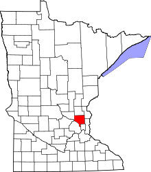 | |
| Township | ||
| CDP | ||
| Unincorporated community | ||
| Ghost town | ||
| Footnotes | ‡This populated place also has portions in an adjacent county or counties | |