Spruce Township, Bates County, Missouri
| Spruce Township | |
|---|---|
| Township | |
 Location in Bates County | |
| Coordinates: 38°20′48″N 94°07′27″W / 38.34667°N 94.12417°WCoordinates: 38°20′48″N 94°07′27″W / 38.34667°N 94.12417°W | |
| Country |
|
| State |
|
| County | Bates |
| Area | |
| • Total | 36.13 sq mi (93.56 km2) |
| • Land | 36.13 sq mi (93.56 km2) |
| • Water | 0 sq mi (0 km2) 0% |
| Elevation | 860 ft (262 m) |
| Population (2000) | |
| • Total | 288 |
| • Density | 8/sq mi (3.1/km2) |
| Time zone | CST (UTC-6) |
| • Summer (DST) | CDT (UTC-5) |
| ZIP codes | 64720, 64730, 64770, 64788 |
| GNIS feature ID | 0766308 |
Spruce Township is one of twenty-four townships in Bates County, Missouri, USA. As of the 2000 census, its population was 288.[1]
Geography
According to the United States Census Bureau, Spruce Township covers an area of 36.13 square miles (93.56 square kilometers).
Unincorporated towns
- Ballard at 38°21′41″N 94°08′36″W / 38.361409°N 94.143278°W
- Johnstown at 38°18′36″N 94°04′57″W / 38.310022°N 94.082444°W
(This list is based on USGS data and may include former settlements.)
Adjacent townships
- Mingo Township (north)
- White Oak Township, Henry County (northeast)
- Walker Township, Henry County (east)
- Deepwater Township, Henry County (southeast)
- Deepwater Township (south)
- Summit Township (southwest)
- Shawnee Township (west)
- Grand River Township (northwest)
Cemeteries
The township contains these three cemeteries: Antioch, Poage and Walnut Grove.
School districts
- Ballard R-II
Political districts
- Missouri's 4th congressional district
- State House District 120
- State Senate District 31
References
- United States Census Bureau 2008 TIGER/Line Shapefiles
- United States Board on Geographic Names (GNIS)
- United States National Atlas
External links
 |
Grand River Township | Mingo Township | White Oak Township, Henry County | |
| Shawnee Township | |
Walker Township, Henry County | ||
| ||||
| | ||||
| Summit Township | Deepwater Township | Deepwater Township, Henry County |
Municipalities and communities of Bates County, Missouri, United States | ||
|---|---|---|
| Cities | 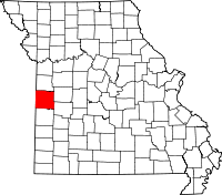 | |
| Villages | ||
| Townships | ||
| Unincorporated communities | ||
| Ghost towns | ||
| Footnotes | ‡This populated place also has portions in an adjacent county or counties | |
This article is issued from Wikipedia - version of the 12/20/2013. The text is available under the Creative Commons Attribution/Share Alike but additional terms may apply for the media files.