Spodnja Senarska
| Spodnja Senarska | |
|---|---|
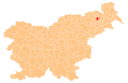
 Spodnja Senarska Location in Slovenia | |
| Coordinates: 46°33′17.99″N 15°53′16.44″E / 46.5549972°N 15.8879000°ECoordinates: 46°33′17.99″N 15°53′16.44″E / 46.5549972°N 15.8879000°E | |
| Country |
|
| Traditional region | Styria |
| Statistical region | Drava |
| Municipality | Sveta Trojica v Slovenskih Goricah |
| Area | |
| • Total | 3.26 km2 (1.26 sq mi) |
| Elevation | 230.7 m (756.9 ft) |
| Population (2002) | |
| • Total | 114 |
| [1] | |
Spodnja Senarska (pronounced [ˈspoːdnja sɛˈnaːɾska]) is a village in the Municipality of Sveta Trojica v Slovenskih Goricah in northeastern Slovenia. It lies on the edge of the Pesnica Valley. The area was part of the traditional region of Styria and is now included in the Drava Statistical Region.[2]
Archaeological evidence points to Roman-era settlement of the area with burial mounds and remains of other contemporary structures.[3]
References
- ↑ Statistical Office of the Republic of Slovenia
- ↑ Sveta Trojica municipal site
- ↑ Slovenian Ministry of Culture register of national heritage reference numbers ešd 1028, 1029 & 1057
External links
| Settlements | Administrative centre: Sveta Trojica v Slovenskih Goricah
|  |
|---|---|---|
This article is issued from Wikipedia - version of the 8/5/2016. The text is available under the Creative Commons Attribution/Share Alike but additional terms may apply for the media files.