Spiceland, Indiana
| Spiceland, Indiana | |
|---|---|
| Town | |
|
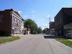
Spiceland Downtown | |
 Location of Spiceland in the state of Indiana | |
| Coordinates: 39°50′16″N 85°26′10″W / 39.83778°N 85.43611°WCoordinates: 39°50′16″N 85°26′10″W / 39.83778°N 85.43611°W | |
| Country | United States |
| State | Indiana |
| County | Henry |
| Township | Spiceland |
| Area[1] | |
| • Total | 0.50 sq mi (1.29 km2) |
| • Land | 0.50 sq mi (1.29 km2) |
| • Water | 0 sq mi (0 km2) |
| Elevation | 1,050 ft (320 m) |
| Population (2010)[2] | |
| • Total | 890 |
| • Estimate (2012[3]) | 876 |
| • Density | 1,780.0/sq mi (687.3/km2) |
| Time zone | Eastern (EST) (UTC-5) |
| • Summer (DST) | EDT (UTC-4) |
| ZIP code | 47385 |
| Area code(s) | 765 |
| FIPS code | 18-72008[4] |
| GNIS feature ID | 0443945[5] |
| Website | http://www.spicelandtown.com |
Spiceland is a town in Spiceland Township, Henry County, Indiana, United States. The population was 890 at the 2010 census.
History
Spiceland was platted in 1850.[6] The town was so named on account of spice bushes near the original town site.[7]
Geography

Spiceland is located at 39°50′16″N 85°26′10″W / 39.83778°N 85.43611°W (39.837743, -85.436089).[8]
According to the 2010 census, Spiceland has a total area of 0.5 square miles (1.29 km2), all land.[1]
Demographics
| Historical population | |||
|---|---|---|---|
| Census | Pop. | %± | |
| 1870 | 370 | — | |
| 1880 | 527 | 42.4% | |
| 1890 | 637 | 20.9% | |
| 1900 | 590 | −7.4% | |
| 1910 | 622 | 5.4% | |
| 1920 | 632 | 1.6% | |
| 1930 | 722 | 14.2% | |
| 1940 | 645 | −10.7% | |
| 1950 | 739 | 14.6% | |
| 1960 | 863 | 16.8% | |
| 1970 | 957 | 10.9% | |
| 1980 | 940 | −1.8% | |
| 1990 | 757 | −19.5% | |
| 2000 | 807 | 6.6% | |
| 2010 | 890 | 10.3% | |
| Est. 2015 | 868 | [9] | −2.5% |
2010 census
As of the census[2] of 2010, there were 890 people, 353 households, and 256 families residing in the town. The population density was 1,780.0 inhabitants per square mile (687.3/km2). There were 389 housing units at an average density of 778.0 per square mile (300.4/km2). The racial makeup of the town was 98.5% White, 0.1% African American, 0.2% Asian, 0.7% from other races, and 0.4% from two or more races. Hispanic or Latino of any race were 0.7% of the population.
There were 353 households of which 34.8% had children under the age of 18 living with them, 58.4% were married couples living together, 9.3% had a female householder with no husband present, 4.8% had a male householder with no wife present, and 27.5% were non-families. 24.9% of all households were made up of individuals and 13.3% had someone living alone who was 65 years of age or older. The average household size was 2.52 and the average family size was 2.99.
The median age in the town was 39.5 years. 26.9% of residents were under the age of 18; 5.9% were between the ages of 18 and 24; 23.6% were from 25 to 44; 27.1% were from 45 to 64; and 16.5% were 65 years of age or older. The gender makeup of the town was 49.0% male and 51.0% female.
2000 census
As of the census[4] of 2000, there were 807 people, 327 households, and 240 families residing in the town. The population density was 1,838.6 people per square mile (708.1/km²). There were 340 housing units at an average density of 774.6 per square mile (298.4/km²). The racial makeup of the town was 98.14% White, 0.12% African American, 0.25% Native American, 1.12% from other races, and 0.37% from two or more races. Hispanic or Latino of any race were 1.61% of the population.
There were 327 households, of which 30.3% had children under the age of 18 living with them, 64.2% were married couples living together, 7.6% had a female householder with no husband present, and 26.6% were non-families. 24.2% of all households were made up of individuals and 12.2% had someone living alone who was 65 years of age or older. The average household size was 2.47 and the average family size was 2.92.
In the town the population was spread out with 25.0% under the age of 18, 7.7% from 18 to 24, 30.7% from 25 to 44, 23.9% from 45 to 64, and 12.6% who were 65 years of age or older. The median age was 36 years. For every 100 females there were 93.1 males. For every 100 females age 18 and over, there were 88.5 males.
The median income for a household in the town was $45,875, and the median income for a family was $54,904. Males had a median income of $37,333 versus $28,393 for females. The per capita income for the town was $20,419. About 2.3% of families and 2.5% of the population were below the poverty line, including 3.1% of those under age 18 and 6.9% of those age 65 or over.

References
- 1 2 "G001 - Geographic Identifiers - 2010 Census Summary File 1". United States Census Bureau. Retrieved 2015-07-25.
- 1 2 "American FactFinder". United States Census Bureau. Retrieved 2012-12-11.
- ↑ "Population Estimates". United States Census Bureau. Retrieved 2013-06-25.
- 1 2 "American FactFinder". United States Census Bureau. Retrieved 2008-01-31.
- ↑ "US Board on Geographic Names". United States Geological Survey. 2007-10-25. Retrieved 2008-01-31.
- ↑ Hazzard, George (1906). Hazzard's History of Henry County, Indiana, 1822-1906. G. Hazzard, author and publisher. p. 963.
- ↑ Baker, Ronald L. (October 1995). From Needmore to Prosperity: Hoosier Place Names in Folklore and History. Indiana University Press. p. 308. ISBN 978-0-253-32866-3.
...is for the abundance of spicebush growing in this area.
- ↑ "US Gazetteer files: 2010, 2000, and 1990". United States Census Bureau. 2011-02-12. Retrieved 2011-04-23.
- ↑ "Annual Estimates of the Resident Population for Incorporated Places: April 1, 2010 to July 1, 2015". Retrieved July 2, 2016.
- ↑ "Census of Population and Housing". Census.gov. Retrieved June 4, 2015.
External links
Municipalities and communities of Henry County, Indiana, United States | ||
|---|---|---|
| City | ||
| Towns | ||
| Townships | ||
| Unincorporated communities | ||
| Footnotes | ‡This populated place also has portions in an adjacent county or counties | |