Spence, Australian Capital Territory
| Spence Canberra, Australian Capital Territory | |||||||||||||
|---|---|---|---|---|---|---|---|---|---|---|---|---|---|
 | |||||||||||||
| Population | 2,559 (2011 census)[1] | ||||||||||||
| • Density | 1,710/km2 (4,420/sq mi) | ||||||||||||
| Established | 1974 | ||||||||||||
| Postcode(s) | 2615 | ||||||||||||
| Area | 1.5 km2 (0.6 sq mi) | ||||||||||||
| District | Belconnen | ||||||||||||
| Territory electorate(s) | Ginninderra | ||||||||||||
| Federal Division(s) | Fenner | ||||||||||||
| |||||||||||||
Spence is a residential suburb in the Belconnen district of Canberra, located within the Australian Capital Territory, Australia. The suburb is named after William Spence (1846–1926), one of the founders of the Australian Workers' Union and later a member of the first Australian House of Representatives. It was gazetted on 2 November 1972. Streets are named after trade unionists.[2]
Location and features
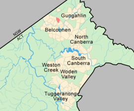
Spence is located adjacent to the suburbs of Fraser, Melba and Evatt. Nearby is a CSIRO property. The suburb is to the south of Owen Dixon Drive and Kuringa Drive and also bounded by Alpen Street and Copland Drive.
The local primary school, Spence Primary School, was established in 1977. It later merged with Melba Primary School to become Mount Rogers Community School—Spence Campus. The school closed at the end of 1998 due to a lack of enrolment. Students were encouraged to move to the Melba Campus. The former school buildings now house a number of community-based organisations including the Mount Rogers Community (Anglican) Church. A donation only cafe called "Coffee Corner" is run by the church.
Spence has a neighbourhood oval, bordering Clarey Crescent, which has been in great disrepair since the drought of 2002 / 2003. The other area of bush and open space is the water tower in the northwest of the suburb. The "tower" is built into a hill with only a small portion showing.
The local shopping centre has a butcher, hairdresser, baker, chemist and supermarket, along with a petrol station. The supermarket includes a coffee shop. Another local supermarket, known as the Spence/Evatt Shops, is located on Copland Drive. Next to it is the Tongan Community Centre, rebuilt in 2007 after it burned down earlier in that year. 2012 saw the closing of the supermarket, mechanics workshop and auto electrician replaced with a 7-Eleven outlet.
Political representation
For the purposes of Australian federal elections for the House of Representatives, Spence is in the Fenner.[3]
For the purposes of Australian Capital Territory elections for the ACT Legislative Assembly, Spence is in the Ginninderra electorate.[4]
Geology
Silurian age Hawkins Volcanics green-grey dacite and quartz andesite are in the center and west of Spence. A green grey dacitic porphyry intrusive rock with white feldspar crystals is in the southeast of the suburb. There is a Hawkins Volcanics shale lens patch in the south central part.[5]
References
- ↑ Australian Bureau of Statistics (31 October 2012). "Spence (State Suburb)". 2011 Census QuickStats. Retrieved 12 February 2014.
- ↑ "Suburb Name search results". ACT Environment and Sustainable Development. Retrieved 12 February 2014.
- ↑ "Profile of the electoral division of Fenner (ACT)". Current federal electoral divisions. Australian Electoral Commission. 8 February 2016. Retrieved 29 May 2016.
- ↑ "Electorates 2012 election". Electorates. ACT Electoral Commission. 5 July 2012. Retrieved 17 December 2013.
- ↑ Henderson G A M and Matveev G, Geology of Canberra, Queanbeyan and Environs 1:50000 1980.
Coordinates: 35°11′56″S 149°03′55″E / 35.19889°S 149.06528°E