Spelthorne
| Borough of Spelthorne | |
|---|---|
| Non-metropolitan district, Borough | |
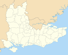
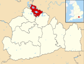 Spelthorne shown within Surrey | |
| Coordinates: 51°26′N 0°30′W / 51.433°N 0.500°WCoordinates: 51°26′N 0°30′W / 51.433°N 0.500°W | |
| Sovereign state | United Kingdom |
| Constituent country | England |
| Region | South East England |
| Non-metropolitan county | Surrey |
| Historic county | Middlesex |
| Status | Non-metropolitan district, Borough |
| Incorporated | 1 April 1974 |
| Admin HQ | Staines-upon-Thames |
| Government | |
| • Type | Non-metropolitan district council |
| • Body | Spelthorne Borough Council |
| • Leadership | Leader & Cabinet (Conservative) |
| • MPs | Kwasi Kwarteng |
| Area | |
| • Total | 19.75 sq mi (51.16 km2) |
| Area rank | 280th (of 326)[1] |
| Population (mid-2014 est.) | |
| • Total | 98,106 |
| • Rank | 242nd (of 326) |
| • Density | 5,000/sq mi (1,900/km2) |
| • Ethnicity |
91.8% White 3.8% S.Asian 1.3% Black 1.7% Mixed Race 1.3% Chinese or Other |
| Time zone | GMT (UTC0) |
| • Summer (DST) | BST (UTC+1) |
| ONS code |
43UH (ONS) E07000213 (GSS) |
| OS grid reference | TQ045715 |
| Website |
www |
Spelthorne is a local government district and borough in Surrey, England. It contains the towns and villages of Ashford, Laleham, Shepperton, Staines-upon-Thames, Stanwell and Sunbury-on-Thames.
Boroughs adjacent to Spelthorne are Runnymede and Elmbridge to the south in Surrey, Windsor and Maidenhead and Slough to the west in Berkshire, and Hillingdon, Hounslow and Richmond upon Thames to the north and east in Greater London.[2]
History
Spelthorne appears in Domesday Book of 1086 as Spelethorne, in Middlesex. Spelthorne was a hundred, where local landowners met about once a month. The Spelthorne hundred also covered Poyle, historically a hamlet in the village of Stanwell,[3] Hatton, East Bedfont, Feltham and Hanworth in the modern London Borough of Hounslow and Teddington (not in 1086 a manor) and Hampton (historically including Hampton Wick, Hampton Hill and Hampton Court) in the London Borough of Richmond upon Thames.[4]
Hundreds dwindled in power as the medieval period drew to a close and were largely sources of revenue for certain overlords by the Tudor period, underlying freeholds and rights over their commons frequently held or divided among royalty or peers in a particular hundred. Ecclesiastical parishes assumed responsibilities for upkeep of public places and roads and apprehending wrongdoers, appointing churchwardens and constables to administer their areas. The poor law unions assumed responsibility for indoor and outdoor relief, later including workhouses:
In 1875 Sanitary Districts were created covering England and Wales.[7]
In 1889 Middlesex County Council was elected and formed pursuant to the Local Government Act 1888 and principally administered the area until 1965.
Under the Local Government Act 1894 in the area of the current borough responsibilities such as planning, sanitation and surface water drainage were conferred on the new bodies Staines Urban, Sunbury Urban and Staines Rural districts.
The 20th century saw the construction of the Two Staines Reservoirs (1901), Queen Mary (1931), King George VI (1947), and the Wraysbury Reservoirs (1970) in what is today's borough.
In 1930 most of Staines Rural District merged into Staines Urban District, with the remainder given to West Drayton and Feltham Urban Districts.
In 1965 when the rest of Middlesex, except for Potters Bar Urban District, was absorbed into the new county of Greater London, Staines and Sunbury-on-Thames Urban Districts were transferred to Surrey.
From these the Borough of Spelthorne was formed on the abolition of the urban districts and rural districts nationally in 1974.
The borough ceded a small amount of land in 1995 when Poyle was transferred to the Borough of Slough, as it was the only settlement outside the M25 motorway. Spelthorne, like Potters Bar, remained inside the Metropolitan Police District, and was not transferred to Surrey Police until the boundary was realigned to Greater London in 2000.
Spelthorne also retains its historic links with Middlesex through the Church: it remains part of the Church of England Diocese of London and the Roman Catholic Archdiocese of Westminster, while the remainder of Surrey falls into the Anglican dioceses of Guildford and Southwark, and the Roman Catholic diocese of Arundel and Brighton.
Floods in 2014 caused internal damage to 891 (or 2.2%) of homes in Spelthorne due to record rainfall causing Thames flooding. This compared to internal damage to more than 30% of homes in the neighbouring settlement of Wraysbury in the borough of Windsor and Maidenhead.[8]
In August 2014 a campaign group of local business leaders called for the borough - along with others close to the capital - to be transferred from the county of Surrey to Greater London, however, the proposal was generally opposed by local representatives of each of these areas.[9]
Parks and lakes
The borough estimates it has 750 acres (300 ha) (3 km²) of parks, including, from Shepperton upstream the Thames Path.[10] Its sixteen main parks with recreational/sports facilities[11] are supplemented by various small greens and linear parks, such as by the River Thames and include the two largest parks which have substantial areas of flowering meadow with diverse and rare grasses, invertebrates and birds: Laleham Park and Sunbury Park.
The borough has five reservoirs, covering more than 15% of land, which apart from their main use of ensuring a stable and energy-efficient drinking water supply to London are bird reserves and in the case of the Queen Mary Reservoir, a sailing training centre.
Of recognised high importance to nature is Staines Moor, which alongside Sheepwalk Lake and wetlands, Shepperton are the sites of special scientific interest (SSSI).[12]
Other land use
A January 2005 enhanced basemap study by the Office for National Statistics managed to classify 50.8 square kilometres (19.6 sq mi), 99% of land in Spelthorne. This showed that in this borough 20.954 square kilometres (8.090 sq mi) was Greenspace (fields, verges, woods and parks) and 11.165 square kilometres (4.311 sq mi) was water. The remaining land uses were:[13]
| Domestic gardens | 8.495 square kilometres (3.280 sq mi) |
| Road | 3.919 square kilometres (1.513 sq mi) |
| Other land uses | 2.491 square kilometres (0.962 sq mi) |
| Domestic buildings | 2.403 square kilometres (0.928 sq mi) |
| Non-domestic buildings | 1.045 square kilometres (0.403 sq mi) |
| Path | 0.209 square kilometres (0.081 sq mi) |
| Rail | 0.134 square kilometres (0.052 sq mi) |
Politics
The 5 May 2011 election results produced 32 Conservative seats, 6 Liberal Democrat seats and one Independent. This result saw three seats change denomination and a net loss of two Liberal Democrat council seats to each of the other two groups.[14]
Elections are held every four years for the whole council, rather than third-of-council for election (for district and borough councils there is an approximately equal bias towards both methods).[14]
The last borough council elections took place in 2015.
Sport and leisure
The borough has two publicly sponsored leisure centres. Within the borders are two private fitness clubs also with pools, the Thames Club Staines, Pure Gym Staines, and Virgin Active Sunbury and two golf courses.
The three school-taught English sports of rugby, cricket and football are played at pitches widely. In rugby union, the London Irish Training Academy is in Sunbury-on-Thames and Staines Rugby Club play next to the Feltham-Sunbury border.
Spelthorne has three football clubs, which are semi- or non-professional as the top men's sides compete in the lower leagues:
| Club | Ground |
|---|---|
| Ashford Town (Middlesex) F.C | The Robert Parker Stadium, Short Lane, Stanwell |
| Spelthorne Sports F.C. | Spelthorne Sports Club, Ashford |
| Staines Town F.C. | Wheatsheaf Park, Staines-upon-Thames |
Spelthorne is also home to one of the county's major Archery Clubs, Spelthorne Archers.
Fishing is open to all, subject to obtaining a rod licence,[15] from the Thames Path National Trail and adjoining islands in Laleham and Staines as well as at lakes in Shepperton and Ashford. One rowing club is in the borough, at Laleham, with others nearby including Staines Boat Club across Staines Bridge from the town centre which organises a regatta to Penton Hook in July for racing shells. Sunbury Skiff and Punting Club is the newest of six nearby on the Thames, several of which incorporate dongola racing, dragon boat racing and canoeing and organises an August regatta with fireworks. In May the Staines 10k charity run takes place organised by two local running/'strolling' clubs and the Borough Council. Other sports venues hosting annual events in a range of sports are Kempton Park Racecourse and Staines Lammas Park.
Towns and villages
The stated proportion of land that is absorbed by domestic dwellings tends to be housing with gardens forming suburbs to London and otherwise has mid rise urban town centres with exceptional offices (in Staines-upon-Thames) and apartments (in Sunbury-on-Thames) which are high rise, including a minority of the social housing.
The non-urban parts, inclusive of the embanked water retaining reservoirs, are today for the most part Spelthorne's parks and lakes. The bulk of the rest is mostly narrow buffering land being arable farming, horse-grazing meadows and sheep grazing on the reservoir embankments and fringes with Green Belt legal status. Shopping is available in each of the towns and in the village of Shepperton but not in the other small villages which are connected by road and bus to the nearby towns. Kempton Park Racecourse and Shepperton Studios are in Spelthorne. Staines is the largest town and has local government and judicial buildings. Each of the towns has libraries and schools.
Current towns and villages
- Staines-upon-Thames
- Sunbury on Thames
- Shepperton
- Ashford
- Laleham[n 1]
- Stanwell[n 1]
- Stanwell Moor[n 2]
- Upper Halliford[n 3]
- Charlton[n 3]
- Littleton[n 4]
Subsumed hamlets or manors
- Kempton
- Astleham: see Littleton, above and Queen Mary Reservoir, above.
Twinning
See also
Notes and references
Notes
- 1 2 In Staines upon Thames post town. As with the first four places, these are ancient parishes, manors and were also in local services/improvements civil parishes from 1895 until 1974.[16]
- ↑ Former hamlet of Stanwell. In Staines upon Thames post town. Its verges, grazing and hay meadow parts have mostly become part of Staines Moor from which they have been indivisible since the 1820s when both were inclosed (privatised) from an area of common land alongside the River Colne and later transferred to the local authority.[3]
- 1 2 Former hamlet of Sunbury-on-Thames. In Shepperton post town.[17]
- ↑ Covers a small area as covered most of the Queen Mary Reservoir. Of sporadic use: half-rural, half-suburban streets with trees and verges. The streets adjoin other housing across the Ash in Shepperton Green; within Shepperton post town and this is the home of Shepperton Studios.[16]
References
- ↑ Office for National Statistics
- ↑ "Election Maps". Ordnance Survey. Retrieved 22 June 2015.
- 1 2 3 Susan Reynolds (Editor) (1962). "Stanwell: Introduction". A History of the County of Middlesex: Volume 3. Institute of Historical Research. Retrieved 4 July 2013.
- ↑ Domesday Map website with details of 13 manors in the Hundred of Spelthorne
- ↑ Samuel Lewis (publisher) (1848). "Teddington, St Mary". A Topographical Dictionary of England. Institute of Historical Research. Retrieved 4 July 2013.
- ↑ Samuel Lewis (publisher) (1848). "Hanworth, St George". A Topographical Dictionary of England. Institute of Historical Research. Retrieved 4 July 2013.
- ↑ Public Health Act 1875
- ↑ "No flood defence work for worst hit towns" Chris Caulfield. Surrey Advertiser/Surrey Herald newspaper group. 20 April 2014. Retrieved 2014-11-02
- ↑ "Calls for Surrey towns to be part of London". BBC News. 20 August 2014. Retrieved 8 December 2014
- ↑ Spelthorne BC Park and Open Spaces. Retrieved 2013-07-04
- ↑ Spelthorne BC Sports Facilities. Retrieved 2013-07-04
- ↑ SSSIs List and Management: Surrey Wildlife Trust.
- ↑ Land Use Statistics (Generalised Land Use Database) (2001 - 2005) Office for National Statistics. Retrieved 13 November 2014.
- 1 2 BBC News Vote 2011, Retrieved 2011-07-30
- ↑ When you need a licence www.gov.uk
- 1 2 William Page (Editor) (1911). "Ashford, Laleham, Littleton [and others outside of the borough]". A History of the County of Middlesex: Volume 2. Institute of Historical Research. Retrieved 4 November 2014.
- ↑ Susan Reynolds (Editor) (1962). "Shepperton, Staines, Stanwell, Sunbury [and others outside the borough]". A History of the County of Middlesex: Volume 3. Institute of Historical Research. Retrieved 4 November 2014.
- ↑ Twinning with Melun, Île de France and Grand Port, Mauritius
External links
| Towns, villages and localities | | ||||||||||
|---|---|---|---|---|---|---|---|---|---|---|---|
| Key parks | |||||||||||
| Large listed buildings |
| ||||||||||
| Education | |||||||||||
| Railway stations | |||||||||||
| Buildings and structures | |||||||||||
| Sport |
| ||||||||||
| Destroyed landmarks | |||||||||||