Spaulding, Oklahoma
| Spaulding, Oklahoma | |
|---|---|
| Town | |
 Location of Spaulding, Oklahoma | |
| Coordinates: 35°0′49″N 96°26′41″W / 35.01361°N 96.44472°WCoordinates: 35°0′49″N 96°26′41″W / 35.01361°N 96.44472°W | |
| Country | United States |
| State | Oklahoma |
| County | Hughes |
| Area | |
| • Total | 1.0 sq mi (2.6 km2) |
| • Land | 1.0 sq mi (2.6 km2) |
| • Water | 0.0 sq mi (0.0 km2) |
| Elevation | 814 ft (248 m) |
| Population (2000) | |
| • Total | 62 |
| • Density | 61.8/sq mi (23.8/km2) |
| Time zone | Central (CST) (UTC-6) |
| • Summer (DST) | CDT (UTC-5) |
| FIPS code | 40-69000[1] |
| GNIS feature ID | 1098340[2] |
Spaulding is a town in Hughes County, Oklahoma, United States. The population was 62 at the 2000 census. The town was founded by Homer B. Spaulding in 1902 during a dispute with the Ozark and Cherokee Central railway company.
The founding of Spaulding
The Daily Ardmoreite newspaper (August 12, 1902)
Muskogee, Oklahoma, Aug 11. - The people in this section of the country are interested in the outcome of a struggle which came to light today between Mayor Homer B. Spaulding of the city of Muskogee and associates and the officials and promoters of the Ozark and Cherokee Central railway, a new line running from Fayetteville, Arkansas, via Muskogee and Okmulgee, to Shawnee, Oklahoma. About midway between Muskogee and Okmulgee and twenty miles from either for several miles tributary thereto, the Ozark and Cherokee Central traverses a fine section of country, The Ozark and Cherokee Central promoters planned to build their pet town in this locality and name it Boynton, after the chief engineer of the road, and the two principal streets Seaman and Kenefick, after the president of the road and the contractor who is constructing the road, respectively.
Upon an investigation it was found that Mayor Spaulding, who is one of the most extensive cattlemen in the Southwest, member of the Democratic national committee for Indian Territory, mayor of Muskogee, whole sale, retail merchant, and cotton oil mill president, had, as was thought a five year lease on every foot of ground miles in the immediate locality. Mr. Spaulding came with a proposition to relinquish to the railroad promoters as much ground as was needed, with exclusive townsite privileges, for the sum of $5,000. The railroad people took thirty days option, with privilege of accepting or rejecting as they might see proper. In the meantime they began a second investigation, and found 160 acres of ground upon which Mr. Spaulding did not have a lease. Which they were enabled to secure for a nominal sum, which they decided to secure, declining Mr. Spaulding’s proposition.
Mayor Spaulding has too much combativeness in him to submit to this kind of treatment, and he has moved down the line one mile and has begun the erection of what he says will shortly be the metropolis of the Southwest, to be known as Spaulding.
Geography
Spaulding is located at 35°0′49″N 96°26′41″W / 35.01361°N 96.44472°W (35.013476, -96.444737).[3]
According to the United States Census Bureau, the town has a total area of 1.0 square mile (2.6 km2), all of it land.
Demographics
| Historical population | |||
|---|---|---|---|
| Census | Pop. | %± | |
| 2000 | 137 | — | |
| 2010 | 178 | 29.9% | |
| Est. 2015 | 173 | [4] | −2.8% |
As of the census[1] of 2000, there were 62 people, 24 households, and 18 families residing in the town. The population density was 61.8 people per square mile (23.9/km²). There were 30 housing units at an average density of 29.9 per square mile (11.6/km²). The racial makeup of the town was 82.26% White, 9.68% Native American, and 8.06% from two or more races.
There were 24 households out of which 25.0% had children under the age of 18 living with them, 62.5% were married couples living together, 12.5% had a female householder with no husband present, and 25.0% were non-families. 25.0% of all households were made up of individuals and 20.8% had someone living alone who was 65 years of age or older. The average household size was 2.58 and the average family size was 3.11.
In the town the population was spread out with 27.4% under the age of 18, 3.2% from 18 to 24, 24.2% from 25 to 44, 25.8% from 45 to 64, and 19.4% who were 65 years of age or older. The median age was 38 years. For every 100 females there were 82.4 males. For every 100 females age 18 and over, there were 80.0 males.
The median income for a household in the town was $22,188, and the median income for a family was $23,125. Males had a median income of $21,250 versus $11,250 for females. The per capita income for the town was $13,900. There were 11.8% of families and 25.5% of the population living below the poverty line, including 60.0% of under eighteens and 13.3% of those over 64.
References
- 1 2 "American FactFinder". United States Census Bureau. Retrieved 2008-01-31.
- ↑ "US Board on Geographic Names". United States Geological Survey. 2007-10-25. Retrieved 2008-01-31.
- ↑ "US Gazetteer files: 2010, 2000, and 1990". United States Census Bureau. 2011-02-12. Retrieved 2011-04-23.
- ↑ "Annual Estimates of the Resident Population for Incorporated Places: April 1, 2010 to July 1, 2015". Retrieved July 2, 2016.
- ↑ "Census of Population and Housing". Census.gov. Retrieved June 4, 2015.
Municipalities and communities of Hughes County, Oklahoma, United States | ||
|---|---|---|
| Cities | 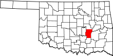 | |
| Towns | ||
| Unincorporated communities |
| |
| Footnotes | ‡This populated place also has portions in an adjacent county or counties | |