Spaubeek
| Spaubeek Sjpaubik / Sjpawbik | |
|---|---|
| Village | |
| Coordinates: 50°56′16″N 5°50′29″E / 50.93778°N 5.84139°E | |
| Country | Netherlands |
| Province | Limburg |
| Municipality | Beek |
| Population (2007) | 3,650 |
Spaubeek is a village in the Dutch province of Limburg. It is located in the municipality of Beek, about 3 km south of the town of Geleen.[1] Spaubeek was a separate municipality until 1982, when it was merged with Beek.[2]
Jansgeleen Castle
The history of Spaubeek was closely connected to that of the Jansgeleen Castle, nowadays called Sint Jansgeleen. This castle, built as House Spaubeek at a bench in the small Geleen river in the 13th century, was the first seat of the former County of Geleen in the 16th century. It got its name Heer Jansgelene after one of the former owners, Lord Jan Rode van Opsinnich in the 15th century, but was later erroneously renamed as Sint Jansgeleen after St. John the Baptist.
The castle, already in a bad shape at the end of the 19th century, and further damaged by the mine galleries of the nearby big Maurits mine at Geleen in the 1920s, was finally demolished in the 1930s. Only the buildings of the water mill (Jansmolen, hence Sint Jansmolen) and the forecourt (16th century) have remained, now both provincial monuments.[3]
References
- ↑ ANWB Topografische Atlas Nederland, Topografische Dienst and ANWB, 2005.
- ↑ Ad van der Meer and Onno Boonstra, Repertorium van Nederlandse gemeenten, KNAW, 2006.
- ↑ M.J.H.A. Schrijnemakers 1985: Sint Jansgeleen. Kasteel, hoeve en molens, [Series 'Wat Baek ós bud', 9], Beek-L: Drukkerij Econoom / Heemkunde-vereniging Beek-L..
People from Spaubeek
- Dennis Dengering, football player
- Robin Piso, musician
External links
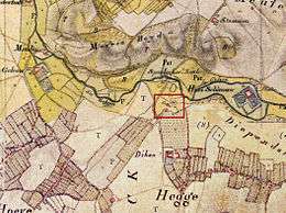
- J. Kuyper, Gemeente Atlas van Nederland, 1865-1870, "Spaubeek". Map of the former municipality, around 1868.
Coordinates: 50°56′N 5°51′E / 50.933°N 5.850°E