Spanaway, Washington
| Spanaway, Washington | |
|---|---|
| CDP | |
 Location of Spanaway, Washington | |
| Coordinates: 47°05′52″N 122°25′26″W / 47.09778°N 122.42389°WCoordinates: 47°05′52″N 122°25′26″W / 47.09778°N 122.42389°W | |
| Country | United States |
| State | Washington |
| County | Pierce |
| Area | |
| • Total | 8.7 sq mi (22.5 km2) |
| • Land | 8.3 sq mi (21.6 km2) |
| • Water | 0.4 sq mi (1.0 km2) |
| Elevation | 381 ft (116 m) |
| Population (2010) | |
| • Total | 27,227 |
| • Density | 2,592.0/sq mi (1,000.8/km2) |
| Time zone | Pacific (PST) (UTC-8) |
| • Summer (DST) | PDT (UTC-7) |
| ZIP code | 98387 |
| Area code | 253 |
| FIPS code | 53-66255[1] |
| GNIS feature ID | 1512680[2] |
Spanaway is a census-designated place (CDP) in Pierce County, Washington, United States. The population was 27,227 at the 2010 census. Spanaway is an unincorporated area near Tacoma, and is often identified together with the more urban, less wealthy Parkland.
Spanaway's main business thoroughfare is Pacific Avenue South, which is a north-south road that coincides with State Route 7 through the Spanaway area.
The song "The Needle Has Landed" from Neko Case's CD Fox Confessor Brings the Flood mentions Spanaway in passing. Tacoma alternative pop/rock band Seaweed also released an album entitled Spanaway. Long Island, New York band The Movielife also has a song called "Spanaway".
History
Etymology: The Hudson's Bay Company, headquartered at Fort Nisqually, had control of this region until 1863. Company maps and journals show the company's subsidiary, the Pugets Sound Agricultural Company, raised cattle, grain, and sheep at "Spanueh Station" on the south and east shores of "Spanueh Lake." Spanueh is the Hudson Bay Company's spelling of the native Lushootseed spadue, which means "dug roots" referring to an area where camas and other edible roots can be found. Lushootseed underwent a loss of nasal consonants in the 1800s, so "Spanueh" simply transcribes an older pronunciation of what is now "Spadue".[3]
The first white settler to take a donation claim by the lake, Henry de la Bushalier, tried to rename the lake after himself. That faded away with his death one year later. In 1890 the area was renamed "Lake Park" as a planned community by the Lake Park Land, Railway and Improvement Company, which bought all the nearby land east of the lake and built a rail line to its "recreation mecca" on the shore of "Spanaway Lake." When Mount Rainier National Park was established in 1899, tourists would take the train to its terminus in Lake Park and from there make the two-day journey to Mount Rainier, making Spanaway the original "gateway" to Mount Rainier. The journey was made by stagecoach, with an overnight stop in Eatonville; the route was in operation as early as 1893.[4]
Although the U.S. Board on Geographic Names recognized the community of "Lake Park" in 1897, it had to very belatedly reverse its decision in 1970 to accept common usage: Spanaway (Spanueh).
Geography
According to the United States Census Bureau, the CDP has a total area of 8.7 square miles (22.6 km²), of which, 8.3 square miles (21.6 km²) of it is land and 0.4 square miles (1.0 km²) of it (4.25%) is water.
Surrounding communities
 |
Lakewood | Parkland | Puyallup | |
| McChord Air Force Base | |
Frederickson | ||
| ||||
| | ||||
| Fort Lewis | Elk Plain | Graham |
Demographics
| Historical population | |||
|---|---|---|---|
| Census | Pop. | %± | |
| 1970 | 5,768 | — | |
| 1980 | 8,868 | 53.7% | |
| 1990 | 15,001 | 69.2% | |
| 2000 | 21,588 | 43.9% | |
| 2010 | 27,227 | 26.1% | |
As of the census[1] of 2000, there were 21,588 people, 7,659 households, and 5,820 families residing in the CDP. The population density was 2,592.0 people per square mile (1,000.6/km²). There were 7,963 housing units at an average density of 956.1/sq mi (369.1/km²). The racial makeup of the CDP was 71.13% White, 9.11% African American, 1.61% Native American, 6.34% Asian American, 2.12% Pacific Islander, 2.15% from other races, and 7.55% from two or more races.
There were 7,659 households out of which 40.4% had children under the age of 18 living with them, 57.1% were married couples living together, 13.6% had a female householder with no husband present, and 24.0% were non-families. 18.2% of all households were made up of individuals and 4.8% had someone living alone who was 65 years of age or older. The average household size was 2.82 and the average family size was 3.17.
In the CDP the age distribution of the population shows 30.0% under the age of 18, 8.4% from 18 to 24, 32.7% from 25 to 44, 21.5% from 45 to 64, and 7.3% who were 65 years of age or older. The median age was 33 years. For every 100 females there were 99.3 males. For every 100 females age 18 and over, there were 96.2 males.
The median income for a household in the CDP was $46,210, and the median income for a family was $50,076. Males had a median income of $35,525 versus $26,758 for females. The per capita income for the CDP was $17,928. About 7.8% of families and 10.8% of the population were below the poverty line, including 15.5% of those under age 18 and 7.3% of those age 65 or over.
Notable residents
- Mike Blowers, MLB baseball player
- Jerry Cantrell, Alice In Chains guitarist
- Derrike Cope, NASCAR driver
- Jo Koy, stand-up comedian
- Rick Story, Ultimate Fighting Championship fighter
Notable sites
Sites in Spanaway
- Spanaway Airport
- Shady Acres Airport
- Spanaway Park
- Spanaway Lake
- Spanaway Historical Society
- Prairie House Museum
- Lake Spanaway Golf Course
- Classic Golf Club
- Spanaway Park Shopping Center
- Spanaway Village Shopping Center
- Sunbird Shopping Center
- LeMay Family Collection Foundation
Sites near Spanaway
- Sprinker Recreation Center & Ice Arena
- Parkland/Spanaway Public Library
- McChord Air Force Base/Joint Base Lewis-McChord
- Pacific Lutheran University
- Harold E. LeMay America's Car Museum
Education
Public schools in Spanaway are part of the Bethel School District.
- Elementary schools:
- Camas Prairie Elementary School
- Elk Plain School of Choice Elementary School
- Evergreen Elementary School
- Pioneer Valley Elementary School
- Shining Mountain Elementary School
- Spanaway Elementary School
- Thompson Elementary School
- Junior high schools:
- Bethel Junior High School
- Cedarcrest Junior High School
- Liberty Junior High School
- Spanaway Junior High School
- Cougar Mountain Middle School
- High schools:
- Private school:
- Bethel Baptist Christian School (grades K4-12)
- Nearby colleges:
References
- 1 2 "American FactFinder". United States Census Bureau. Retrieved 2008-01-31.
- ↑ "US Board on Geographic Names". United States Geological Survey. 2007-10-25. Retrieved 2008-01-31.
- ↑ Czaykowska-Higgins, Ewa; Kinkade, Marvin Dale, eds. (June 1998). Salish Languages and Linguistics: Theoretical and Descriptive Perspectives. Trends in Linguistics: Studies and Monographs 107. Berlin: Mouton de Gruyter. p. 53. ISBN 9783110154924. Lay summary (Spring 2000).
- ↑ http://earlyeatonvillewa.blogspot.com/p/settlement-of-eatonville-prior-to.html Early Eatonville
External links
- Celebrate! Spanaway, website for all things Spanaway
- Spanaway Water Company
Municipalities and communities of Pierce County, Washington, United States | ||
|---|---|---|
| Cities | 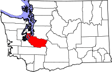 | |
| Towns | ||
| CDPs |
| |
| Other unincorporated communities | ||
| Indian reservation | ||
| Military bases | ||
| Ghost towns | ||
| Footnotes | ‡This populated place also has portions in an adjacent county or counties | |