Southeast Township, Orange County, Indiana
| Southeast Township | |
|---|---|
| Township | |
|
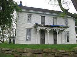
An I-house at Valeene | |
 Location in Orange County | |
| Coordinates: 38°26′40″N 86°22′59″W / 38.44444°N 86.38306°WCoordinates: 38°26′40″N 86°22′59″W / 38.44444°N 86.38306°W | |
| Country |
|
| State |
|
| County | Orange |
| Government | |
| • Type | Indiana township |
| Area | |
| • Total | 53.33 sq mi (138.1 km2) |
| • Land | 53.21 sq mi (137.8 km2) |
| • Water | 0.12 sq mi (0.3 km2) 0.23% |
| Elevation | 656 ft (200 m) |
| Population (2010) | |
| • Total | 1,603 |
| • Density | 30.1/sq mi (11.6/km2) |
| ZIP codes | 47125, 47140, 47452, 47454 |
| GNIS feature ID | 0453856 |
Southeast Township is one of ten townships in Orange County, Indiana, United States. As of the 2010 census, its population was 1,603 and it contained 717 housing units.[1]
History
Southeast Township was named from its position in the southeastern corner of Orange County.[2]
Geography
According to the 2010 census, the township has a total area of 53.33 square miles (138.1 km2), of which 53.21 square miles (137.8 km2) (or 99.77%) is land and 0.12 square miles (0.31 km2) (or 0.23%) is water.[1]
Unincorporated towns
- Bacon at 38°24′38″N 86°26′00″W / 38.410614°N 86.433317°W
- Pearsontown at 38°25′15″N 86°23′30″W / 38.420892°N 86.39165°W
- Pine Valley at 38°28′35″N 86°27′01″W / 38.476446°N 86.450264°W
- Rego at 38°29′06″N 86°19′04″W / 38.485058°N 86.317760°W
- Valeene at 38°26′20″N 86°23′50″W / 38.438947°N 86.397206°W
(This list is based on USGS data and may include former settlements.)
Cemeteries
The township contains Little Africa Cemetery.
Major highways
School districts
- Paoli Community School Corporation
Political districts
- Indiana's 9th congressional district
- State House District 62
- State Senate District 44
References
- "Southeast Township, Orange County, Indiana". Geographic Names Information System. United States Geological Survey. Retrieved 2009-10-17.
- United States Census Bureau 2008 TIGER/Line Shapefiles
- IndianaMap
- 1 2 "Population, Housing Units, Area, and Density: 2010 - County -- County Subdivision and Place -- 2010 Census Summary File 1". United States Census. Retrieved 2013-05-10.
- ↑ History of Lawrence, Orange, and Washington Counties, Indiana: From the Earliest Time to the Present. Higginson Book Company. 1884. p. 402.
External links
- Indiana Township Association
- United Township Association of Indiana
- City-Data.com page for Southeast Township

Municipalities and communities of Orange County, Indiana, United States | ||
|---|---|---|
| Towns | ||
| Townships | ||
| Unincorporated communities |
| |
| Footnotes | ‡This populated place also has portions in an adjacent county or counties | |
This article is issued from Wikipedia - version of the 10/20/2016. The text is available under the Creative Commons Attribution/Share Alike but additional terms may apply for the media files.