Southampton Township, New Jersey
| Southampton Township, New Jersey | |
|---|---|
| Township | |
| Township of Southampton | |
|
Bishop-Irick Farmstead in Vincentown | |
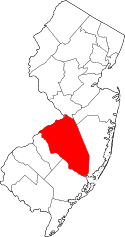
 Southampton Township highlighted in Burlington County. Inset map: Burlington County highlighted in the State of New Jersey. | |
 Census Bureau map of Southampton Township, New Jersey | |
| Coordinates: 39°54′58″N 74°43′04″W / 39.916236°N 74.717766°WCoordinates: 39°54′58″N 74°43′04″W / 39.916236°N 74.717766°W[1][2] | |
| Country |
|
| State |
|
| County | Burlington |
| Incorporated | March 10, 1845 as Coaxen Township |
| Renamed | April 1, 1845 as Southampton Township |
| Government[3] | |
| • Type | Township |
| • Body | Township Committee |
| • Mayor | James F. Young, Sr. (term ends December 31, 2016)[4][5] |
| • Administrator / Clerk | Kathleen D. Hoffman[6] |
| Area[1] | |
| • Total | 44.224 sq mi (114.538 km2) |
| • Land | 43.668 sq mi (113.099 km2) |
| • Water | 0.556 sq mi (1.439 km2) 1.26% |
| Area rank |
44th of 566 in state 7th of 40 in county[1] |
| Elevation[7] | 36 ft (11 m) |
| Population (2010 Census)[8][9][10] | |
| • Total | 10,464 |
| • Estimate (2015)[11] | 10,337 |
| • Rank |
234th of 566 in state 14th of 40 in county[12] |
| • Density | 239.6/sq mi (92.5/km2) |
| • Density rank |
493rd of 566 in state 34th of 40 in county[12] |
| Time zone | Eastern (EST) (UTC-5) |
| • Summer (DST) | Eastern (EDT) (UTC-4) |
| ZIP code | 08088[13] |
| Area code(s) | 609 exchanges: 268, 801, 859[14] |
| FIPS code | 3400568610[1][15][16] |
| GNIS feature ID | 0882090[1][17] |
| Website |
www |
.JPG)
Southampton Township is a township in Burlington County, New Jersey, United States. As of the 2010 United States Census, the township's population was 10,464[8][9][10] reflecting an increase of 76 (+0.7%) from the 10,388 counted in the 2000 Census, which had in turn increased by 186 (+1.8%) from the 10,202 counted in the 1990 Census.[18]
What is now Southampton was originally incorporated as Coaxen Township by an act of the New Jersey Legislature on March 10, 1845, from portions of Northampton Township (now known as Mount Holly Township). The name lasted for about three weeks when it was renamed Southampton Township on April 1, 1845. Portions of the township were taken to form Pemberton Township (March 10, 1846), Shamong Township (February 19, 1852), Lumberton Township (March 14, 1860), Woodland Township (March 7, 1866) and Tabernacle Township (March 22, 1901).[19]
Geography
According to the United States Census Bureau, Southampton Township had a total area of 44.224 square miles (114.538 km2), including 43.668 square miles (113.099 km2) of land and 0.556 square miles (1.439 km2) of water (1.26%).[1][2] The township is located within the New Jersey Pine Barrens.[20]
Leisuretowne (2010 Census population of 3,582) is an unincorporated community and census-designated place (CDP) located within Southampton Township.[21][22] Vincentown is an unincorporated area and ZIP code 08088 within portions of the township, while other unincorporated communities, localities and place names located partially or completely within the township include Beaverville, Buddtown, Burrs Mill, Chairville, Crescent Heights, Ewansville, Ewingville, Hampton Lakes, Medford Park, Oak Shade, Red Lion, Retreat and Sandtown.[23]
The township borders Eastampton Township, Lumberton Township, Medford Township, Pemberton Township, Tabernacle Township and Woodland Township.[24]
The township is one of 56 South Jersey municipalities that are included within the New Jersey Pinelands National Reserve, a protected natural area of unique ecology covering 1,100,000 acres (450,000 ha), that has been classified as a United States Biosphere Reserve and established by Congress in 1978 as the nation's first National Reserve.[25] Part of the township is included in the state-designated Pinelands Area, which includes portions of Burlington County, along with areas in Atlantic, Camden, Cape May, Cumberland, Gloucester and Ocean counties.[26]
Climate
| Month | Jan | Feb | Mar | Apr | May | Jun | Jul | Aug | Sep | Oct | Nov | Dec |
|---|---|---|---|---|---|---|---|---|---|---|---|---|
| High | 42 F | 45 F | 54 F | 65 F | 75 F | 83 F | 87 F | 86 F | 79 F | 69 F | 57 F | 46 F |
| Avg | 36 F | 36 F | 44 F | 54 F | 60 F | 74 F | 77 F | 72 F | 68 F | 54 F | 44 F | 38 F |
| Low | 22 F | 24 F | 31 F | 39 F | 49 F | 58 F | 63 F | 61 F | 54 F | 43 F | 35 F | 27 F |
Demographics
| Historical population | |||
|---|---|---|---|
| Census | Pop. | %± | |
| 1850 | 3,545 | * | — |
| 1860 | 2,558 | * | −27.8% |
| 1870 | 2,374 | * | −7.2% |
| 1880 | 2,269 | −4.4% | |
| 1890 | 1,849 | −18.5% | |
| 1900 | 1,904 | * | 3.0% |
| 1910 | 1,778 | −6.6% | |
| 1920 | 1,641 | −7.7% | |
| 1930 | 1,637 | −0.2% | |
| 1940 | 1,813 | 10.8% | |
| 1950 | 2,341 | 29.1% | |
| 1960 | 3,166 | 35.2% | |
| 1970 | 4,982 | 57.4% | |
| 1980 | 8,808 | 76.8% | |
| 1990 | 10,202 | 15.8% | |
| 2000 | 10,388 | 1.8% | |
| 2010 | 10,464 | 0.7% | |
| Est. 2015 | 10,337 | [11][27] | −1.2% |
| Population sources:1850-2000[28] 1850-1920[29] 1850-1870[30] 1850[31] 1870[32] 1880-1890[33] 1890-1910[34] 1910-1930[35] 1930-1990[36] 2000[37][38] 2010[8][9][10] * = Lost territory in previous decade.[19] | |||
Census 2010
The 2010 United States Census counted 10,464 people, 4,746 households, and 3,042 families residing in the township. The population density was 239.6 per square mile (92.5/km2). The township contained 5,024 housing units at an average density of 115.1 per square mile (44.4/km2). The racial makeup of the township was 94.50% (9,888) White, 2.21% (231) Black or African American, 0.11% (12) Native American, 1.33% (139) Asian, 0.01% (1) Pacific Islander, 0.49% (51) from other races, and 1.36% (142) from two or more races. Hispanics or Latinos of any race were 2.15% (225) of the population.[8]
Out of a total of 4,746 households, 16.7% had children under the age of 18 living with them, 52.6% were married couples living together, 7.8% had a female householder with no husband present, and 35.9% were non-families. 32.3% of all households were made up of individuals, and 22.9% had someone living alone who was 65 years of age or older. The average household size was 2.20 and the average family size was 2.77.[8]
In the township, 15.6% of the population were under the age of 18, 5.7% from 18 to 24, 15.9% from 25 to 44, 30.8% from 45 to 64, and 32.0% who were 65 years of age or older. The median age was 53.9 years. For every 100 females the census counted 88.0 males, but for 100 females at least 18 years old, it was 85.5 males.[8]
The Census Bureau's 2006-2010 American Community Survey showed that (in 2010 inflation-adjusted dollars) median household income was $51,713 (with a margin of error of +/- $3,072) and the median family income was $73,598 (+/- $11,729). Males had a median income of $57,500 (+/- $8,015) versus $39,472 (+/- $4,560) for females. The per capita income for the borough was $34,493 (+/- $1,869). About 3.1% of families and 5.2% of the population were below the poverty line, including 6.1% of those under age 18 and 8.4% of those age 65 or over.[39]
Census 2000
As of the 2000 United States Census[15] there were 10,388 people, 4,574 households, and 3,046 families residing in the township. The population density was 235.9 people per square mile (91.1/km²). There were 4,751 housing units at an average density of 107.9 per square mile (41.7/km²). The racial makeup of the township was 97.09% White, 1.20% African American, 0.28% Native American, 0.63% Asian, 0.30% from other races, and 0.50% from two or more races. Hispanic or Latino of any race were 1.29% of the population.[37][38]
There were 4,574 households out of which 19.8% had children under the age of 18 living with them, 57.2% were married couples living together, 6.8% had a female householder with no husband present, and 33.4% were non-families. 29.9% of all households were made up of individuals and 21.3% had someone living alone who was 65 years of age or older. The average household size was 2.26 and the average family size was 2.79.[37]
In the township the population was spread out with 17.8% under the age of 18, 4.8% from 18 to 24, 21.2% from 25 to 44, 24.5% from 45 to 64, and 31.7% who were 65 years of age or older. The median age was 50 years. For every 100 females there were 87.8 males. For every 100 females age 18 and over, there were 85.2 males.[37]
The median income for a household in the township was $44,419, and the median income for a family was $57,419. Males had a median income of $45,785 versus $30,134 for females. The per capita income for the township was $26,977. About 2.6% of families and 3.9% of the population were below the poverty line, including 4.8% of those under age 18 and 2.5% of those age 65 or over.[37]
Government
Local government
Southampton Township is governed under the Township form of government. The five-member Township Committee is elected directly by the voters at-large in partisan elections to serve three-year terms of office on a staggered basis, with either one or two seats coming up for election each year as part of the November general election in a three-year cycle.[3][40] At an annual reorganization meeting, the Township Committee selects one of its members to serve as Mayor for the year.
As of 2016, members of the Southampton Township Committee are Mayor James F. Young, Sr. (R, term on committee ends December 31, 2017; term as mayor ends 2016), Ronald J. Heston (R, 2018), Bill Raftery (R, 2018), Elizabeth H. Rossell (R, 2016) and Latham Tiver (R, 2016).[4][41][42][43][44][45]
Federal, state and county representation
Southampton Township is located in the 3rd Congressional District[46] and is part of New Jersey's 8th state legislative district.[9][47][48]
New Jersey's 3rd Congressional District is represented by Tom MacArthur (R, Toms River).[49] New Jersey is represented in the United States Senate by Cory Booker (D, Newark, term ends 2021)[50] and Bob Menendez (D, Paramus, 2019).[51][52]
For the 2016–2017 session (Senate, General Assembly), the 8th Legislative District of the New Jersey Legislature is represented in the State Senate by Dawn Marie Addiego (R, Evesham Township) and in the General Assembly by Maria Rodriguez-Gregg (R, Evesham Township) and Joe Howarth (R, Evesham Township).[53] The Governor of New Jersey is Chris Christie (R, Mendham Township).[54] The Lieutenant Governor of New Jersey is Kim Guadagno (R, Monmouth Beach).[55]
Burlington County is governed by a Board of chosen freeholders, whose five members are elected at-large in partisan elections to three-year terms of office on a staggered basis, with either one or two seats coming up for election each year.[56] The board chooses a director and deputy director from among its members at an annual reorganization meeting held in January.[56] As of 2015, Burlington County's Freeholders are Director Mary Ann O'Brien (R, Medford Township, 2017; Director of Administration and Human Services),[57] Deputy Director Bruce Garganio (R, Florence Township, 2017; Director of Public Works and Health),[58] Aimee Belgard (D, Edgewater Park Township, 2015; Director of Hospital, Medical Services and Education)[59] Joseph Donnelly (R, Cinnaminson Township, 2016; Director of Public Safety, Natural Resources, and Education)[60] and Joanne Schwartz (D, Southampton Township, 2015; Director of Health and Corrections).[61][56] Constitutional officers are County Clerk Tim Tyler,[62] Sheriff Jean E. Stanfield[63] and Surrogate George T. Kotch.[64]
Politics
As of March 23, 2011, there were a total of 7,558 registered voters in Southampton Township, of which 1,879 (24.9% vs. 33.3% countywide) were registered as Democrats, 2,929 (38.8% vs. 23.9%) were registered as Republicans and 2,747 (36.3% vs. 42.8%) were registered as Unaffiliated. There were 3 voters registered to other parties.[65] Among the township's 2010 Census population, 72.2% (vs. 61.7% in Burlington County) were registered to vote, including 85.6% of those ages 18 and over (vs. 80.3% countywide).[65][66]
In the 2012 presidential election, Republican Mitt Romney received 3,166 votes here (54.5% vs. 40.2% countywide), ahead of Democrat Barack Obama with 2,547 votes (43.8% vs. 58.1%) and other candidates with 54 votes (0.9% vs. 1.0%), among the 5,814 ballots cast by the township's 7,758 registered voters, for a turnout of 74.9% (vs. 74.5% in Burlington County).[67][68] In the 2008 presidential election, Republican John McCain received 3,317 votes here (53.2% vs. 39.9% countywide), ahead of Democrat Barack Obama with 2,791 votes (44.8% vs. 58.4%) and other candidates with 75 votes (1.2% vs. 1.0%), among the 6,233 ballots cast by the township's 7,815 registered voters, for a turnout of 79.8% (vs. 80.0% in Burlington County).[69] In the 2004 presidential election, Republican George W. Bush received 3,359 votes here (55.3% vs. 46.0% countywide), ahead of Democrat John Kerry with 2,613 votes (43.0% vs. 52.9%) and other candidates with 56 votes (0.9% vs. 0.8%), among the 6,077 ballots cast by the township's 7,712 registered voters, for a turnout of 78.8% (vs. 78.8% in the whole county).[70]
In the 2013 gubernatorial election, Republican Chris Christie received 2,998 votes here (77.2% vs. 61.4% countywide), ahead of Democrat Barbara Buono with 762 votes (19.6% vs. 35.8%) and other candidates with 54 votes (1.4% vs. 1.2%), among the 3,883 ballots cast by the township's 7,765 registered voters, yielding a 50.0% turnout (vs. 44.5% in the county).[71][72] In the 2009 gubernatorial election, Republican Chris Christie received 2,500 votes here (58.0% vs. 47.7% countywide), ahead of Democrat Jon Corzine with 1,556 votes (36.1% vs. 44.5%), Independent Chris Daggett with 180 votes (4.2% vs. 4.8%) and other candidates with 34 votes (0.8% vs. 1.2%), among the 4,307 ballots cast by the township's 7,733 registered voters, yielding a 55.7% turnout (vs. 44.9% in the county).[73]
Education
The Southampton Township Schools serve public school students in Kindergarten through eighth grade. As of the 2011-12 school year, the district's three schools had an enrollment of 780 students and 70.0 classroom teachers (on an FTE basis), for a student–teacher ratio of 11.14:1.[74] Schools in the district (with 2011-12 enrollment data from the National Center for Education Statistics[75]) are Southampton School #1[76] (K-2, 244 students), Southampton School #2[77] (3-5, 254 students) and Southampton School #3[78] (6-8, 282 students).[79][80]
Public school students from Southampton Township in ninth through twelfth grades attend Seneca High School, which also serves students in ninth through twelfth grade from Shamong Township, Tabernacle Township and Woodland Township.[81] The school is part of the Lenape Regional High School District, which also serves students from Evesham Township, Medford Lakes, Medford Township and Mount Laurel Township at Shawnee High School.[82][83] As of the 2013-14 school year, the high school had an enrollment of 1,249 students and 119.8 classroom teachers (on an FTE basis), for a student–teacher ratio of 10.4:1.[84]
Students from Southampton Township, and from all of Burlington County, are eligible to attend the Burlington County Institute of Technology, a countywide public school district that serves the vocational and technical education needs of students at the high school and post-secondary level at its campuses in Medford and Westampton Township.[85]
Transportation
Roads and highways
As of May 2010, the township had a total of 112.19 miles (180.55 km) of roadways, of which 74.37 miles (119.69 km) were maintained by the municipality, 19.38 miles (31.19 km) by Burlington County and 18.44 miles (29.68 km) by the New Jersey Department of Transportation.[86]
Public transportation
New Jersey Transit provides bus service in the township on the 317 route between Asbury Park and Philadelphia.[87][88]
Wineries
Notable people
People who were born in, residents of, or otherwise closely associated with Southampton Township include:
- Albert Cooper (1904-1993), soccer goalkeeper who earned two cap with the U.S. national team in 1928.[89]
- Samuel A. Dobbins (1814–1905), represented New Jersey's 2nd congressional district in the United States House of Representatives from 1873-1877.[90]
- Brad Ecklund (1922–2010), center who played five seasons in the NFL.[91]
- Job H. Lippincott (1842–1900), United States Attorney for the District of New Jersey and Associate Justice of the New Jersey Supreme Court from 1893-1900.[92]
References
- 1 2 3 4 5 6 2010 Census Gazetteer Files: New Jersey County Subdivisions, United States Census Bureau. Accessed May 21, 2015.
- 1 2 US Gazetteer files: 2010, 2000, and 1990, United States Census Bureau. Accessed September 4, 2014.
- 1 2 2012 New Jersey Legislative District Data Book, Rutgers University Edward J. Bloustein School of Planning and Public Policy, March 2013, p. 43.
- 1 2 Mayor & Committee, Southampton Township. Accessed June 22, 2016.
- ↑ 2016 New Jersey Mayors Directory, New Jersey Department of Community Affairs. Accessed June 14, 2016.
- ↑ Clerk & Administration, Southampton Township. Accessed June 22, 2016.
- ↑ U.S. Geological Survey Geographic Names Information System: Township of Southampton, Geographic Names Information System. Accessed March 14, 2013.
- 1 2 3 4 5 6 DP-1 - Profile of General Population and Housing Characteristics: 2010 for Southampton township, Burlington County, New Jersey, United States Census Bureau. Accessed August 30, 2012.
- 1 2 3 4 Municipalities Grouped by 2011-2020 Legislative Districts, New Jersey Department of State, p. 5. Accessed January 6, 2013.
- 1 2 3 Profile of General Demographic Characteristics: 2010 for Southampton township, New Jersey Department of Labor and Workforce Development. Accessed August 30, 2012.
- 1 2 PEPANNRES - Annual Estimates of the Resident Population: April 1, 2010 to July 1, 2015 - 2015 Population Estimates for New Jersey municipalities, United States Census Bureau. Accessed May 22, 2016.
- 1 2 GCT-PH1 Population, Housing Units, Area, and Density: 2010 - State -- County Subdivision from the 2010 Census Summary File 1 for New Jersey, United States Census Bureau. Accessed August 9, 2013.
- ↑ Look Up a ZIP Code for Southampton, NJ, United States Postal Service. Accessed August 30, 2012.
- ↑ Area Code Lookup - NPA NXX for Southampton, NJ, Area-Codes.com. Accessed December 29, 2014.
- 1 2 American FactFinder, United States Census Bureau. Accessed September 4, 2014.
- ↑ A Cure for the Common Codes: New Jersey, Missouri Census Data Center. Accessed August 30, 2012.
- ↑ US Board on Geographic Names, United States Geological Survey. Accessed September 4, 2014.
- ↑ Table 7. Population for the Counties and Municipalities in New Jersey: 1990, 2000 and 2010, New Jersey Department of Labor and Workforce Development, February 2011. Accessed August 30, 2012.
- 1 2 Snyder, John P. The Story of New Jersey's Civil Boundaries: 1606-1968, Bureau of Geology and Topography; Trenton, New Jersey; 1969. p. 99. Accessed October 25, 2012.
- ↑ New Jersey Pinelands, United States Fish and Wildlife Service. Accessed August 30, 2012.
- ↑ DP-1 - Profile of General Population and Housing Characteristics: 2010 Demographic Profile Data for Leisuretowne CDP, New Jersey, United States Census Bureau. Accessed August 31, 2012.
- ↑ GCT-PH1 - Population, Housing Units, Area, and Density: 2010 - County -- County Subdivision and Place from the 2010 Census Summary File 1 for Burlington County, New Jersey, United States Census Bureau. Accessed August 31, 2012.
- ↑ Locality Names, State of New Jersey. Accessed December 1, 2013.
- ↑ Areas touching Southampton Township, MapIt. Accessed December 29, 2014.
- ↑ The Pinelands National Reserve, New Jersey Pinelands Commission. Accessed December 1, 2013.
- ↑ Pinelands Municipalities, New Jersey Pinelands Commission, April 2003. Accessed December 1, 2013.
- ↑ Census Estimates for New Jersey April 1, 2010 to July 1, 2015, United States Census Bureau. Accessed May 22, 2016.
- ↑ Barnett, Bob. Population Data for Burlington County Municipalities, 1800 - 2000, WestJersey.org, January 6, 2011. Accessed August 30, 2012.
- ↑ Compendium of censuses 1726-1905: together with the tabulated returns of 1905, New Jersey Department of State, 1906. Accessed July 29, 2013.
- ↑ Raum, John O. The History of New Jersey: From Its Earliest Settlement to the Present Time, Volume 1, p. 265, J. E. Potter and company, 1877. Accessed July 29, 2013. "Southampton contained a population in 1850 of 3,545; in 1860, 2,558; and in 1870, 2,374."
- ↑ Debow, James Dunwoody Brownson. The Seventh Census of the United States: 1850, p. 137. R. Armstrong, 1853. Accessed July 9, 2013.
- ↑ Staff. A compendium of the ninth census, 1870, p. 259. United States Census Bureau, 1872. Accessed July 9, 2013.
- ↑ Porter, Robert Percival. Preliminary Results as Contained in the Eleventh Census Bulletins: Volume III - 51 to 75, p. 97. United States Census Bureau, 1890. Accessed July 29, 2013.
- ↑ Thirteenth Census of the United States, 1910: Population by Counties and Minor Civil Divisions, 1910, 1900, 1890, United States Census Bureau, p. 335. Accessed August 30, 2012.
- ↑ Fifteenth Census of the United States : 1930 - Population Volume I, United States Census Bureau, p. 714. Accessed August 30, 2012.
- ↑ Table 6. New Jersey Resident Population by Municipality: 1930 - 1990, New Jersey Department of Labor and Workforce Development. Accessed June 28, 2015.
- 1 2 3 4 5 Census 2000 Profiles of Demographic / Social / Economic / Housing Characteristics for Southampton township, Burlington County, New Jersey, United States Census Bureau. Accessed August 30, 2012.
- 1 2 DP-1: Profile of General Demographic Characteristics: 2000 - Census 2000 Summary File 1 (SF 1) 100-Percent Data for Southampton township, Burlington County, New Jersey, United States Census Bureau. Accessed August 30, 2012.
- ↑ DP03: Selected Economic Characteristics from the 2006-2010 American Community Survey 5-Year Estimates for Southampton township, Burlington County, New Jersey, United States Census Bureau. Accessed August 30, 2012.
- ↑ "Forms of Municipal Government in New Jersey", p. 7. Rutgers University Center for Government Studies. Accessed June 3, 2015.
- ↑ 2016 Municipal User Friendly Budget, Southampton Township. Accessed June 22, 2016.
- ↑ A Guide to Burlington County - 2015, Burlington County, New Jersey. Accessed June 20, 2016.
- ↑ November 3, 2015 Summary Report Burlington County Official Results / Recounts Appended, Burlington County, New Jersey, November 25, 2015. Accessed June 20, 2016.
- ↑ November 4, 2014 Summary Report Burlington County Official Recounted Results, Burlington County, New Jersey, December 22, 2014. Accessed June 13, 2015.
- ↑ November 5, 2013 Summary Report Burlington County Official Results, Burlington County, New Jersey, December 18, 2013. Accessed November 16, 2014.
- ↑ Plan Components Report, New Jersey Redistricting Commission, December 23, 2011. Accessed January 6, 2013.
- ↑ 2016 New Jersey Citizen's Guide to Government, p. 64, New Jersey League of Women Voters. Accessed July 20, 2016.
- ↑ Districts by Number for 2011-2020, New Jersey Legislature. Accessed January 6, 2013.
- ↑ Tom MacArthur Biography, United States House of Representatives. Accessed January 7, 2015.
- ↑ About Cory Booker, United States Senate. Accessed January 26, 2015. "He now owns a home and lives in Newark's Central Ward community."
- ↑ Biography of Bob Menendez, United States Senate, January 26, 2015. "He currently lives in Paramus and has two children, Alicia and Robert."
- ↑ Senators of the 114th Congress from New Jersey. United States Senate. Accessed January 26, 2015. "Booker, Cory A. - (D - NJ) Class II; Menendez, Robert - (D - NJ) Class I"
- ↑ Legislative Roster 2016-2017 Session, New Jersey Legislature. Accessed January 17, 2016.
- ↑ "About the Governor". State of New Jersey. Retrieved 2010-01-21.
- ↑ "About the Lieutenant Governor". State of New Jersey. Retrieved 2010-01-21.
- 1 2 3 Staff. Board of Chosen Freeholders, Burlington County, New Jersey. Accessed May 12, 2015.
- ↑ Mary Ann O'Brien, Burlington County, New Jersey. Accessed May 12, 2015.
- ↑ Bruce Garganio, Burlington County, New Jersey. Accessed May 12, 2015.
- ↑ Aimee Belgard, Burlington County, New Jersey. Accessed August 4, 2014.
- ↑ Joseph B. Donnelly, Burlington County, New Jersey. Accessed May 12, 2015.
- ↑ Joanne Schwartz, Burlington County, New Jersey. Accessed May 12, 2015.
- ↑ County Clerk, Burlington County. Accessed May 12, 2015.
- ↑ Sheriff's Department, Burlington County. Accessed May 12, 2015.
- ↑ Surrogate, Burlington County. Accessed May 12, 2015.
- 1 2 Voter Registration Summary - Burlington, New Jersey Department of State Division of Elections, March 23, 2011. Accessed December 28, 2014.
- ↑ GCT-P7: Selected Age Groups: 2010 - State -- County Subdivision; 2010 Census Summary File 1 for New Jersey, United States Census Bureau. Accessed December 28, 2014.
- ↑ Presidential November 6, 2012 General Election Results - Burlington County, New Jersey Department of State Division of Elections, March 15, 2013. Accessed December 28, 2014.
- ↑ Number of Registered Voters and Ballots Cast November 6, 2012 General Election Results - Burlington County, New Jersey Department of State Division of Elections, March 15, 2013. Accessed December 28, 2014.
- ↑ 2008 Presidential General Election Results: Burlington County, New Jersey Department of State Division of Elections, December 23, 2008. Accessed December 28, 2014.
- ↑ 2004 Presidential Election: Burlington County, New Jersey Department of State Division of Elections, December 13, 2004. Accessed December 28, 2014.
- ↑ 2013 Governor: Burlington County, New Jersey Department of State Division of Elections, January 29, 2014. Accessed December 28, 2014.
- ↑ Number of Registered Voters and Ballots Cast November 5, 2013 General Election Results : Burlington County, New Jersey Department of State Division of Elections, January 29, 2014. Accessed December 28, 2014.
- ↑ 2009 Governor: Burlington County, New Jersey Department of State Division of Elections, December 31, 2009. Accessed December 28, 2014.
- ↑ District information for Southampton Township School District, National Center for Education Statistics. Accessed November 16, 2014.
- ↑ School Data for the Southampton Township Schools, National Center for Education Statistics. Accessed November 16, 2014.
- ↑ Southampton School #1, Southampton Township Schools. Accessed November 16, 2014.
- ↑ Southampton School #2, Southampton Township Schools. Accessed November 16, 2014.
- ↑ Southampton School #3, Southampton Township Schools. Accessed November 16, 2014.
- ↑ Schools, Southampton Township Schools. Accessed November 16, 2014.
- ↑ New Jersey School Directory for the Southampton Township Schools, New Jersey Department of Education. Accessed November 16, 2014.
- ↑ Seneca High School 2015 Report Card Narrative, New Jersey Department of Education. Accessed June 2, 2016. "ATTENDANCE AREA: Shamong, Southampton, Tabernacle and Woodland Townships"
- ↑ Lenape Regional High School District 2015 Report Card Narrative, New Jersey Department of Education. Accessed May 28, 2016. "The Lenape Regional High School District (LRHSD) serves the eight municipalities of Evesham, Medford, Mount Laurel, Shamong, Southampton, Tabernacle and Woodland Townships and Medford Lakes Borough."
- ↑ Staff. "Regional School Districts", Burlington County Times, April 26, 2015. Accessed May 28, 2016. "LENAPE REGIONAL Serves: Evesham, Medford, Medford Lakes, Mount Laurel, Shamong, Southampton, Tabernacle, Woodland"
- ↑ School Data for Seneca High School, National Center for Education Statistics. Accessed June 2, 2016.
- ↑ Why Choose BCIT?, Burlington County Institute of Technology. Accessed December 1, 2013.
- ↑ Burlington County Mileage by Municipality and Jurisdiction, New Jersey Department of Transportation, May 2010. Accessed December 1, 2013.
- ↑ Burlington County Bus/Rail Connections, New Jersey Transit, backed up by the Internet Archive as of January 28, 2010. Accessed December 1, 2013.
- ↑ South Jersey Transit Guide, Cross County Connection, as of April 1, 2010. Accessed December 1, 2013.
- ↑ Albert Cooper, SR/Olympic Sports. Accessed October 8, 2015.
- ↑ Samuel Atkinson Dobbins, Biographical Directory of the United States Congress. Accessed February 28, 2011.
- ↑ Vargas, Claudia. "Brad Ecklund, former NFL player, coach", The Philadelphia Inquirer, February 10, 2010. Accessed February 28, 2011. "Brad Ecklund, 87, of Vincentown, a former NCAA and NFL football player who coached the Eagles' offensive line in the 1970s, died Saturday of congestive heart failure at Samaritan Hospice in Mount Holly."
- ↑ Fitzgerald, Thomas F. Manual of the Legislature of New Jersey 1900, p. 291. T. F. Fitzgerald, 1900. Accessed July 18, 2016. "JOB H. LIPPINCOTT, Jersey City. Justice Lippincott was born near Mount Holly, N.J., November 12th, 1842. He was reared on his father's farm at Vincentown, N.J., and received a common-school education."
External links
| Wikimedia Commons has media related to Southampton Township, New Jersey. |
- Southampton Township website
- Southampton Township Schools
- Southampton Township Schools's 2014–15 School Report Card from the New Jersey Department of Education
- Vincent Fire Company
- Data for the Southampton Township Schools, National Center for Education Statistics
- Lenape Regional High School District