South Coast railway line, Queensland
| South Coast Line | |||||||||||||||||||||||||||||||||||||||||||||||||||||||||||||||||||||||||||||||||||||||||||||||||||||||||||||||||||||||||||||||||||||||||||||||||||||||||||||||||||||||||||||||||||||||||||||||||||||||||||||||||||||||||||||||||||||
|---|---|---|---|---|---|---|---|---|---|---|---|---|---|---|---|---|---|---|---|---|---|---|---|---|---|---|---|---|---|---|---|---|---|---|---|---|---|---|---|---|---|---|---|---|---|---|---|---|---|---|---|---|---|---|---|---|---|---|---|---|---|---|---|---|---|---|---|---|---|---|---|---|---|---|---|---|---|---|---|---|---|---|---|---|---|---|---|---|---|---|---|---|---|---|---|---|---|---|---|---|---|---|---|---|---|---|---|---|---|---|---|---|---|---|---|---|---|---|---|---|---|---|---|---|---|---|---|---|---|---|---|---|---|---|---|---|---|---|---|---|---|---|---|---|---|---|---|---|---|---|---|---|---|---|---|---|---|---|---|---|---|---|---|---|---|---|---|---|---|---|---|---|---|---|---|---|---|---|---|---|---|---|---|---|---|---|---|---|---|---|---|---|---|---|---|---|---|---|---|---|---|---|---|---|---|---|---|---|---|---|---|---|---|---|---|---|---|---|---|---|---|---|---|---|---|---|---|---|---|
|
Train at Tweed Heads in 1940 | |||||||||||||||||||||||||||||||||||||||||||||||||||||||||||||||||||||||||||||||||||||||||||||||||||||||||||||||||||||||||||||||||||||||||||||||||||||||||||||||||||||||||||||||||||||||||||||||||||||||||||||||||||||||||||||||||||||
| Operation | |||||||||||||||||||||||||||||||||||||||||||||||||||||||||||||||||||||||||||||||||||||||||||||||||||||||||||||||||||||||||||||||||||||||||||||||||||||||||||||||||||||||||||||||||||||||||||||||||||||||||||||||||||||||||||||||||||||
| Opened |
25 January 1889 (to Southport) 10 August 1903 (to Tweed Heads) | ||||||||||||||||||||||||||||||||||||||||||||||||||||||||||||||||||||||||||||||||||||||||||||||||||||||||||||||||||||||||||||||||||||||||||||||||||||||||||||||||||||||||||||||||||||||||||||||||||||||||||||||||||||||||||||||||||||
| Closed |
1 July 1961 (to Tweed Heads) 30 June 1964 (to Southport) | ||||||||||||||||||||||||||||||||||||||||||||||||||||||||||||||||||||||||||||||||||||||||||||||||||||||||||||||||||||||||||||||||||||||||||||||||||||||||||||||||||||||||||||||||||||||||||||||||||||||||||||||||||||||||||||||||||||
| Owner | Queensland Railways | ||||||||||||||||||||||||||||||||||||||||||||||||||||||||||||||||||||||||||||||||||||||||||||||||||||||||||||||||||||||||||||||||||||||||||||||||||||||||||||||||||||||||||||||||||||||||||||||||||||||||||||||||||||||||||||||||||||
| Operator(s) | Queensland Railways | ||||||||||||||||||||||||||||||||||||||||||||||||||||||||||||||||||||||||||||||||||||||||||||||||||||||||||||||||||||||||||||||||||||||||||||||||||||||||||||||||||||||||||||||||||||||||||||||||||||||||||||||||||||||||||||||||||||
| Technical | |||||||||||||||||||||||||||||||||||||||||||||||||||||||||||||||||||||||||||||||||||||||||||||||||||||||||||||||||||||||||||||||||||||||||||||||||||||||||||||||||||||||||||||||||||||||||||||||||||||||||||||||||||||||||||||||||||||
| Line length | 73 kilometres | ||||||||||||||||||||||||||||||||||||||||||||||||||||||||||||||||||||||||||||||||||||||||||||||||||||||||||||||||||||||||||||||||||||||||||||||||||||||||||||||||||||||||||||||||||||||||||||||||||||||||||||||||||||||||||||||||||||
| Track gauge | 3 ft 6 in (1,067 mm) | ||||||||||||||||||||||||||||||||||||||||||||||||||||||||||||||||||||||||||||||||||||||||||||||||||||||||||||||||||||||||||||||||||||||||||||||||||||||||||||||||||||||||||||||||||||||||||||||||||||||||||||||||||||||||||||||||||||
| |||||||||||||||||||||||||||||||||||||||||||||||||||||||||||||||||||||||||||||||||||||||||||||||||||||||||||||||||||||||||||||||||||||||||||||||||||||||||||||||||||||||||||||||||||||||||||||||||||||||||||||||||||||||||||||||||||||

The South Coast railway line was an Australian railway from Brisbane, the capital city of Queensland, to the Gold Coast. It operated from 1889 to 1964. The Gold Coast railway line re-opened in 1996 along a modified alignment in the north and a new route south.
History
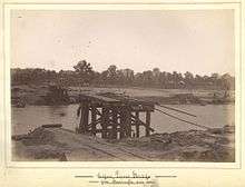
The Beenleigh railway line opened in 1885[1] before being extended 26 miles (42 km) to Southport in 1889.[2] The firm of J. W. Sutton and Company of Kangaroo Point in Brisbane provided materials and aided in bridge construction for the railway line.[3] A branch line running 22 miles (35 km) from Southport Junction (later renamed Ernest Junction) to Tweed Heads opened on 10 August 1903.[4]
It had been hoped that the New South Wales Government would extend its Casino to Murwillumbah line a further 30 kilometres from Murwillumbah to Tweed Heads, but this did not occur due to cost of resuming the land and the expenses associated with the tunnel and bridge that would be required.[5]
Due to the increasing popularity of the motor car, and political interests in road transport, the Tweed Heads branch closed on 1 July 1961, followed by the Beenleigh to Southport line on 30 June 1964.
Route
The initial South Coast line officially opened on 24 January 1889 [6] and included stops at Yatala, Stapylton, Ormeau, Pimpama, Coomera, 39 Mile Platform (Oxenford), Helensvale, Coombabah, Ernest Junction and Southport. It included a number of cuts, river crossings, long grades and a tunnel [7] at, Ernest Junction, that remains in situ. The second branch of the South Coast line, known as the Nerang-Tweed Heads extension, [8] opened in 1903 [9] and stretched from Ernest Junction to the Queensland-New South Wales border. Stops included Benowa, Molendinar, Nerang, [10] Worongary, Mudgeeraba, Reedy Creek, West Burleigh, Elanora, Currumbin, Tugun, Bilinga, Kirra, Coolangatta and Tweed Heads. The present day Pacific Motorway largely follows the route the railway between Yatala and Currumbin. Stewart Street between Currumbin and Tugun, the Gold Coast Highway between Tugun and Kirra, Coolangatta Road between Kirra and Coolangatta, and Griffith Street in Coolangatta/Tweed Heads are built on the former railway reservation.
Services
Passenger trains ran from South Brisbane to Southport with connecting trains from Ernest Junction or Southport to Tweed Heads. Picnic and excursion trains ran through from South Brisbane to Tweed Heads on Sundays.
From opening until the 1950s, services were operated exclusively by PB15 class locomotives, the largest locomotive permitted to cross the Logan River. Diesel rail cars operated some passenger services from the 1950s until closure.
Remains
The Beenleigh railway line is still in use. The track bed between Ernest Junction and Southport, and between Tugun and Coolangatta, is still visible. The railway bridge over Currumbin Creek was converted to a footbridge. Short sections of the route at Currumbin and Coolangatta have been reused as a bicycle paths. The Southport tunnel still exists, but the West Burleigh tunnel does not; it was demolished to make way for the Pacific Motorway.
Parts of modern-day Griffith and Wright Streets in Coolangatta and Tweed Heads are built on the former railway reservation.
Replacement
The Gold Coast railway line on a new alignment opened from Beenleigh to Helensvale in 1996, Nerang in 1997, Robina in 1998 and Varsity Lakes in 2009.[11]
See also
References
- ↑ History of Mt Gravatt Our Brisbane
- ↑ The Southport Railway Brisbane Courier 25 January 1889 page 6
- ↑ "Kangaroo Point: Iron Ships and Bridges". The Brisbane Courier (Qld. : 1864 - 1933). Qld.: National Library of Australia. 24 May 1930. p. 22. Retrieved 24 January 2016.
- ↑ Visitors from New South Wales The Brisbane Courier 11 August 1903 page 5
- ↑ Tweed Heads Railway Extension The Brisbane Courier 29 May 1903 page 5
- ↑ "THE SOUTHPORT RAILWAY.". The Brisbane Courier. XLV, (9,682). Queensland, Australia. 25 January 1889. p. 6. Retrieved 9 May 2016 – via National Library of Australia.
- ↑ "SOUTHPORT RAILWAY". South Coast Bulletin. 8, (430). Queensland, Australia. 21 August 1936. p. 6. Retrieved 9 May 2016 – via National Library of Australia.
- ↑ "OPENING OF NERANG RAILWAY.". Queensland Times, Ipswich Herald And General Advertiser. XLIV, (6642). Queensland, Australia. 27 August 1903. p. 2. Retrieved 9 May 2016 – via National Library of Australia.
- ↑ "VISITORS FROM NEW SOUTH WALES.". The Brisbane Courier. LX, (14,220). Queensland, Australia. 11 August 1903. p. 5. Retrieved 9 May 2016 – via National Library of Australia.
- ↑ "OPENING OF NERANG RAILWAY.". Queensland Times, Ipswich Herald And General Advertiser. XLIV, (6642). Queensland, Australia. 27 August 1903. p. 2. Retrieved 9 May 2016 – via National Library of Australia.
- ↑ Robina-Varsity Lakes rail extension state's most expensive The Courier-Mail 14 December 2009
Bibliography
- Alan Arundell (2011). The South Coast Railway: A history of Growth and Transport on the Gold Coast. Water Street Productions. ISBN 0646555286.
- John Kerr and John Armstrong (1978). Destination Sth Brisbane : an illustrated history of the southside railways of Brisbane. Australian Railway Historical Society.
External links
 Media related to South Coast railway line, Queensland at Wikimedia Commons
- 1925 map of the Queensland railway system
| |||||||
| |||||||
|